List of crossings of the Hackensack River
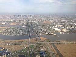
The Hackensack River courses southward for approximately 50 miles (80 km)[6] through Rockland County in New York and Bergen and Hudson counties in northeastern New Jersey, forming the border of the latter two for part of its length. Its source, as identified by the U.S. Geological Survey (Hydrological Code Unit 02030103901),[7] is in New City, New York. The river empties into Newark Bay between Kearny Point (South Kearny) and Droyer's Point (Jersey City).
At the outset of the colonial era the river's watershed was home to Lenape groups now known as the Rumachenanck (or Haverstraw), Tappan, and Hackensack, the latter exonym taken from an encampment near the confluence of the tributary Overpeck Creek.[8] European settlement began in the mid 17th century as part of New Netherland when the region was called Achter Kol, meaning "rear pass" or "behind the ridge", to describe the valleys west of the Hudson Palisades which afforded passage to trapping grounds in the northern hinterlands. It was settled by Bergen Dutch who established regular water crossings at Douwe's Ferry[9] and Little Ferry.[10] The first bridge crossing of the Hackensack was at Demarest Landing (now Old Bridge Road), built in 1724, which was replaced by that at New Bridge Landing in 1745.[11] The first railroad crossing was completed by the NJRR in 1834, and was soon followed by many others. By the early 1900s conflicts between rail and maritime traffic led to calls for changes in regulations giving priority to trains.[12]
At one time, Van Buskirk Island, created in 1804, was the head of navigation, but diminished freshwater flow in the Hackensack has been altered by construction of dams,[13] namely the Oradell (1923), the DeForest (1952), and the Tappan (1972).[14] The river is now tidally influenced to the island.[15] The Hackensack has only been channelized to Milepoint 3.5 at the Riverbend in Hudson County.[13][16] The accumulation of silt has diminished the depth, and thus navigability, of the Lower Hackensack.[17] which at one time was a major waterway for towboats and river barges in the Port of New York and New Jersey.[18]
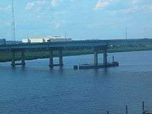
Since 1999, the bridge at Milepoint 16.3 is the most upstream bridge required by the Code of Federal Regulations to open on request,[19] though no requests have made since 1994.[20] The Lower Hackensack remains partially in use for commercial maritime traffic, notably for coal deliveries to the Hudson Generating Station.[21] and sewage sludge for treatment at a facility on the bay.[22] Downstream of the power plant, vehicular moveable bridges (at MP 1.8 and MP 3.1) are required at all times to open on demand.[23] and rail crossings to open on 1-hour notice.[19] As of 2012 there were plans to replace the Wittpenn Bridge, a vehicular bridge at MP 3.1, with a new vertical lift bridge[24] and the Portal Bridge, a rail swing bridge at MP 5.0, with a through arch bridge.[25]
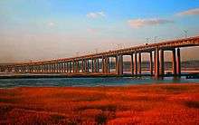
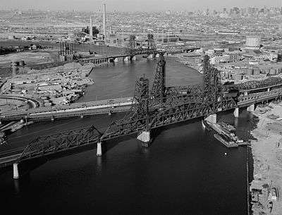
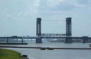
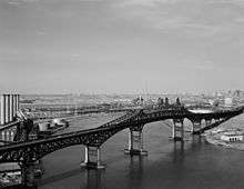
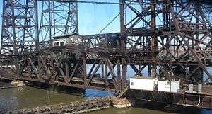
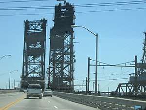
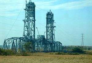
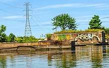
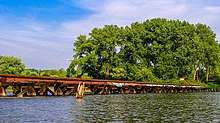
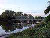
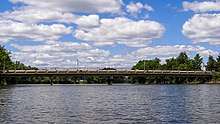
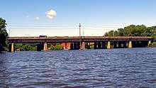
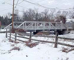
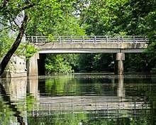
Crossings
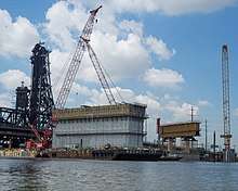
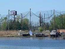
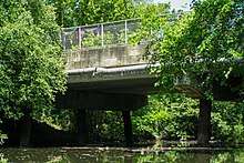
_01.JPG)
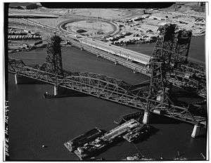
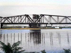
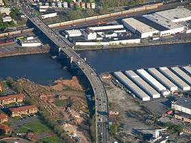
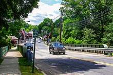
.tiff.png)

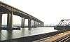


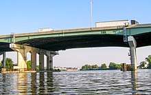
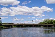
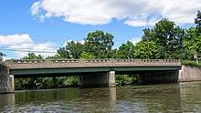
.tif.png)
Abbreviations
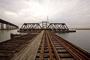
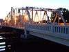
%2C_in_June_1974_(555767).jpg)
- CNJ=Central Railroad of New Jersey
- CR=County Road, County Route
- CSXT=CSX Transportation
- DL&W=Delaware, Lackawanna and Western Railroad
- Erie=Erie Railroad
- H&M=Hudson and Manhattan Railroad
- MNCR=Metro-North Railroad
- MP=mile point
- NYC=New York Central Railroad
- NJDOT=New Jersey Department of Transportation
- NJT=New Jersey Transit
- NYS&W=New York, Susquehanna and Western Railway
- NS=Norfolk Southern Railway
- PATH=Port Authority Trans-Hudson
- PRR=Pennsylvania Railroad
- PS=Public Service Railway
- USGS=United States Geological Survey
See also
- New Milford Plant of the Hackensack Water Company
- Overpeck Creek
- Hackensack RiverWalk
- Geography of New York–New Jersey Harbor Estuary
- Timeline of Jersey City area railroads
- List of bridges, tunnels, and cuts in Hudson County, New Jersey
- List of crossings of the Lower Passaic River
- List of crossings of the Upper Passaic River
- List of NJ Transit moveable bridges
- List of fixed crossings of the North River (Hudson River)

References
- ↑ "Bridges are man-made marvels of the Hackensack River". North Jersey.com. July 15, 2010. Retrieved 2012-11-07.
- ↑ "Hackensack River". The Travels of Tug 44. www.tug44.org. Retrieved 2012-11-07.
- ↑ Wang, Dayi; Lynne M. Baumann; Feraidoon Kashani (October 2002). Movable Versus Fixed - Wittpenn Bridge Replacement (PDF) (Report). Heavy Movable Structures.
- ↑ Modica, Glenn. "The Hackensack River Vertical Lift Bridges Historic District" (PDF). Richard Grubb Associates. Retrieved 20 January 2016.
- 1 2 "New Jersey and National Registers of Historic Places - Hudson County". New Jersey Department of Environmental Protection - Historic Preservation Office. Retrieved 2016-01-19.
- ↑ "The Hackensack River: A True Come-Back Story". Haceknsack Riverkeeper. Retrieved 2012-10-30.
- ↑ Jeffs, Ed (April 2005). "A History of Lake Lucille & Vicinity". Retrieved 2012-11-01.
- ↑ Wright, Kevin. "The Indigenous Population of Bergen County". Bergen County Historical Society. Retrieved 2012-11-01.
- ↑ McKelvey, Bill. "Chronology: Transportation Milestones Around the CRR of NJ Jersey City Terminal (now Liberty State Park) and the NJ / NY Port Area". Liberty Historic Railway. Retrieved 2012-11-01.
- ↑ Snow, Violet (October 2, 2011). "Little Ferry 'tries to improve living' for residents". The Record (Bergen County). Retrieved 2012-10-10.
- ↑ Howitt, Naomi; Howitt, george (1976), Musket, Anchor, and Plow: The Story of River Edge, 1677-1976, Arno Press, ISBN 0405098596
- ↑ "Drawbridges and Railroad Operation" (PDF), The New York Times, May 1, 1903, retrieved 2012-10-31
- 1 2 Marshall, Stephen (December 2004). "The Meadowlands Before the Commission: Three Centuries of Human Use and Alteration of the Newark and Hackensack Meadows". 2 (1). Urban Habitats.
Dredging of the Hackensack River began in the 1900s, when the corps dug a 12-foot-deep channel. The current Hackensack River channel is 32 feet deep for the first 3 miles, 25 feet deep for the next ¼ mile, and 15 feet deep for an additional ½ mile. The channel varies between 800 and 200 feet in width
- ↑ Newark Bay/Hackensack River/Passaic River Study Area Report (PDF). Hudson-Raritan Estuary Environmental Restoration Feasibility (Report). United States Army Corps of Engineers. June 2004. Archived from the original (PDF) on 2010-07-31. Retrieved 2012-10-21.
- ↑ "Ecology Along the Hackensack River" (PDF). Hackensack Water Works. Rutgers University School of Environmental and Biological Sciences Center for Urban Sustainability. August 2012. Retrieved 2012-11-01.
- ↑ Newark Bay, Hackensack and Passaic Rivers – Hackensack River, New Jersey (PDF). Report of Channel Conditions 100 to 400 Feet Wide (ER 1130-2-306) (Report). April 18, 2011. Retrieved 2012-10-21.
- ↑ Army Corps of Engineers. "Meadowlands Environmental Site Investigation Compilation". New Jersey Meadowlands Commission. Retrieved 2012-11-01.
- ↑ Olsen, Kevin K. (2008), A Great Conveniency: A Maritime History of the Passaic River, Hackensack River, and Newark Bay, American History Imprints, ISBN 9780975366776
- 1 2 "117.723 Hackensack River", Title 33: Navigation and Navigable Waters Part 117—Drawbridge Operations Regulations, US Government Printing Office, October 20, 2012, retrieved 2012-10-20
- ↑ Cichowksi, John (June 20, 2010), "Historic Bridge Getting Face-lift", The Record, retrieved 2012-10-20
- ↑ Sheenan, Bill (Winter 2006). "The Truth About Traffic On the River". At the Helm: A Word from Captain Bill. Hackensack Riverkeeper. Retrieved 2012-11-01.
- ↑ Maag, Christopher (February 21, 2015). "When Bergen County sludge meets rusty Amtrak bridge, both sides lose". The Record.
- ↑ "Drawbridge Schedules". NJDOT. April 12, 2012. Retrieved 2012-11-05.
- ↑ "Overview". Route 7 Wittpenn Bridge. NJDOT. August 5, 2011. Retrieved 2012-11-06.
- ↑ "Portal Bridge Capacity Enhancement Project" (Press release). NJDOT. Retrieved 2012-11-01.
- ↑ "U.S. Route 1-9 Truck straight line diagram" (PDF). NJDOT. Retrieved 2016-12-21.
- ↑ 33CFR117.723(c)
- ↑ https://bridgehunter.com/nj/bergen/bh73369/
- ↑ bridgesnyc: Midtown Bridge (Hackensack and Bogota)
- ↑ "Elm Street Bridge". Bridgehunter.com. Retrieved 22 September 2017.
- ↑ Ryall, M. J.; Parke, J. E. Harding, G. A. R. (14 December 2013). "Bridge Management: Inspection, Maintenance, Assessment and Repair". Springer. ISBN 9781489972323.
Sources
- Olsen, Kevin K. (2008), A Great Conveniency: A Maritime History of the Passaic River, Hackensack River, and Newark Bay, American History Imprints, ISBN 9780975366776
- Richman, Steven M. (2005), The Bridges of New Jersey, Rutgers University Press, p. 135, ISBN 0813535107
- "Bridgesnyc".
- "Drawbridge Schedules". NJDOT. April 12, 2012.
- jag9889. "Hackensack River Bridges". Flickr. Retrieved 2015-09-17.
- "Historic Bridge Survey (1991-1994)". NJDOT. 2001.
- "Masonry and Metal: The Historic Bridges of Bergen County, New Jersey" (PDF). Richard Grubb and Associates. 2008. Archived from the original (PDF) on July 10, 2012. Retrieved 2012-08-21.
This publication lists the wrong date for the swing bridge at New Bridge Landing. Correct date built is February 4, 1889.
- "National Bridge Inventory Database".
- Report of the Assembly Committee Appointed to Inquire into the Condition of the Bridges over the Passaic and Hackensack Rivers in the Counties of Union, Essex, Hudson (Report). Trenton: New Jersey Assembly. 1865.
- "117.723 Hackensack River", Title 33: Navigation and Navigable Waters Part 117—Drawbridge Operations Regulations, US Government Printing Office, October 20, 2012
Bridges of the Newark Bay | |
|---|---|