| Crossing |
Image |
Carries |
Location |
Coordinates |
|
|
Cape May–Lewes Ferry
(Delaware Bay) |
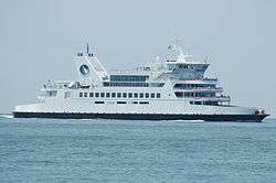 |
 US 9 US 9 |
Lewes and Cape May |
38°53′32″N 75°02′38″W / 38.89222°N 75.04389°W / 38.89222; -75.04389 (Cape May-Lewes Ferry)
Zoom out if map is blank. |
| Forts Ferry Crossing (April–September) |
 |
|
Fort DuPont State Park, Delaware and Fort Mott, New Jersey |
|
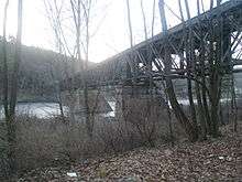
| Exelon Transmission Line |
|
|
Cedar Creek, Delaware and Salem, New Jersey |
39°36′43″N 75°35′20″W / 39.612°N 75.589°W / 39.612; -75.589 (Pepco transmission line) |
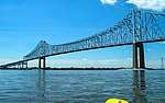
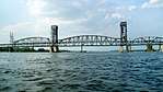
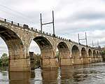
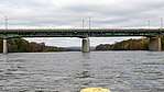
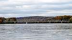
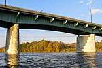
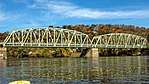
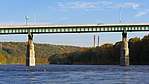
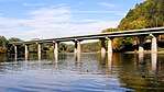
| Delaware Memorial Bridge (toll) - Twin Span |
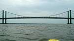 |
  I‑295 / US 40 I‑295 / US 40 |
New Castle and Deepwater |
39°41′20″N 75°31′09″W / 39.68889°N 75.51917°W / 39.68889; -75.51917 (Delaware Memorial Bridge) |
|
|
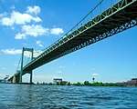
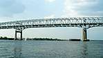
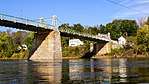
| Commodore Barry Bridge (toll) |
 |
  US 322 / CR 536 US 322 / CR 536 |
Chester and Bridgeport |
39°49′40″N 75°22′17″W / 39.82778°N 75.37139°W / 39.82778; -75.37139 (Commodore Barry Bridge) |
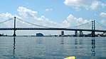
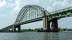
| Walt Whitman Bridge (toll) |
 |
 I-76 I-76 |
Philadelphia and Gloucester City |
39°54′19″N 75°07′47″W / 39.90528°N 75.12972°W / 39.90528; -75.12972 (Walt Whitman Bridge) |
| RiverLink Ferry (summer) |
 |
|
Philadelphia and Camden |
|
| Skylink Aerial Tram (Partially Built) |
|
|
|
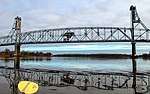
| Benjamin Franklin Bridge (toll) |
 |
  I‑676 / US 30 I‑676 / US 30
PATCO Speedline |
39°57′10″N 75°08′05″W / 39.95278°N 75.13472°W / 39.95278; -75.13472 (Benjamin Franklin Bridge) |
| Delair Bridge |
 |
CSAO Delair Branch
NJ Transit Atlantic City Line
Former NJ Transit ACES |
Philadelphia and Pennsauken |
39°58′57″N 75°04′08″W / 39.98250°N 75.06889°W / 39.98250; -75.06889 (Delair Bridge) |
| Betsy Ross Bridge (toll) |
 |
 Route 90 Route 90 |
39°59′05″N 75°03′58″W / 39.98472°N 75.06611°W / 39.98472; -75.06611 (Betsy Ross Bridge) |
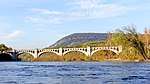
| Tacony-Palmyra Bridge (toll) |
 |
 PA 73 PA 73
 Route 73 Route 73 |
Philadelphia and Palmyra |
40°00′45″N 75°02′36″W / 40.01250°N 75.04333°W / 40.01250; -75.04333 (Tacony-Palmyra Bridge) |
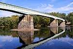
| Burlington-Bristol Bridge (toll) |
 |
 PA 413 PA 413
 Route 413 Route 413 |
Bristol Township and Burlington |
40°04′53″N 74°52′10″W / 40.08139°N 74.86944°W / 40.08139; -74.86944 (Burlington-Bristol Bridge) |
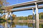
| Delaware River – Turnpike Toll Bridge |
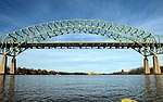 |
 Pennsylvania Turnpike Pennsylvania Turnpike
 New Jersey Turnpike Ext. New Jersey Turnpike Ext.
 I-95 I-95 |
Bristol Township and Burlington Township |
40°07′02″N 74°49′49″W / 40.11722°N 74.83028°W / 40.11722; -74.83028 (Delaware River-Turnpike toll bridge) |
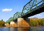
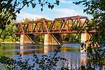
| Morrisville-Trenton Railroad Bridge |
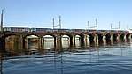 |
Stone Arch Railroad Bridge, ex Pennsylvania Railroad, now owned by Amtrak Northeast Corridor
SEPTA Trenton Line
Former NJ Transit ACES
NJ Transit Morrisville Yard access |
Morrisville and Trenton |
40°12′30″N 74°46′02″W / 40.2082°N 74.7672°W / 40.2082; -74.7672 (Morrisville-Trenton Railroad Bridge) |
| Trenton-Morrisville Toll Bridge |
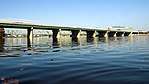 |
 US 1 US 1 |
40°12′33″N 74°46′04″W / 40.2092°N 74.7677°W / 40.2092; -74.7677 (Trenton-Morrisville Toll Bridge) |
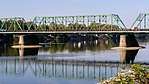
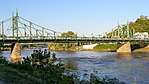
| Lower Trenton Bridge (free) |
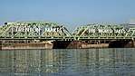 |
US 1 BUS |
40°12′38″N 74°46′06″W / 40.2105°N 74.7683°W / 40.2105; -74.7683 (Lower Trenton Bridge) |
| Calhoun Street Bridge (free) |
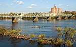 |
|
40°13′12″N 74°46′40″W / 40.22001°N 74.77787°W / 40.22001; -74.77787 (Calhoun Street Bridge) |
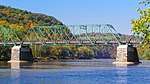
| Yardley-Ewing Railroad Bridge, ex Reading Railroad |
 |
CSX Trenton Subdivision
SEPTA West Trenton Line |
Yardley and Ewing Township |
40°14′30″N 74°49′27″W / 40.2417°N 74.8241°W / 40.2417; -74.8241 (Yardley-Ewing Railroad Bridge) |
Yardley-Wilburtha Bridge
(destroyed by flood in 1955, temporarily rebuilt until torn down completely in 1961, replaced by I-95 Scudder Falls Bridge) |
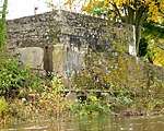 Abutment Remains |
|
40°14′46″N 74°50′08″W / 40.246°N 74.8356°W / 40.246; -74.8356 (Yardley-Wilburtha Bridge) |
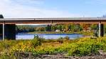
| Scudder Falls Bridge (free)
(Soon to be Toll) |
 |
I-295 |
Lower Makefield Township and Ewing Township |
40°15′31″N 74°50′50″W / 40.25861°N 74.84722°W / 40.25861; -74.84722 (Scudder Falls Bridge) |
| Washington Crossing Bridge (free) |
 |
|
Upper Makesfield Township and Hopewell Township |
40°17′43″N 74°52′5″W / 40.29528°N 74.86806°W / 40.29528; -74.86806 (Washington Crossing Bridge) |
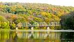
| New Hope-Lambertville Bridge (free) |
 |
 PA 179 PA 179
 Route 179 Route 179 |
New Hope and Lambertville |
40°21′53″N 74°56′53″W / 40.36472°N 74.94806°W / 40.36472; -74.94806 (New Hope-Lambertville Bridge) |
| New Hope-Lambertville Toll Bridge |
 |
 US 202 US 202 |
Solebury Township and Delaware Township |
40°22′45″N 74°57′19″W / 40.37917°N 74.95528°W / 40.37917; -74.95528 (New Hope-Lambertville toll bridge) |
| Centre Bridge-Stockton Bridge (free) |
 |
 PA 263 PA 263 |
Centre Bridge, and Stockton. |
40°24′11″N 74°58′46″W / 40.40306°N 74.97944°W / 40.40306; -74.97944 (Centre Bridge-Stockton Bridge) |
| Lumberville-Raven Rock Bridge |
 |
(formerly a road bridge, closed in 1944 to auto traffic, rebuilt as a pedestrian crossing in 1947) |
Lumberville and Raven Rock |
40°24′28″N 75°02′14″W / 40.4078°N 75.0373°W / 40.4078; -75.0373 (Lumberville-Raven Rock Bridge) |
Point Pleasant-Byram Bridge
(destroyed by flood in 1955) |
|
|
Point Pleasant and Byram |
40°25′23″N 75°03′40″W / 40.423°N 75.061°W / 40.423; -75.061 (Point Pleasant-Byram Bridge) |
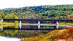
| Uhlerstown–Frenchtown Bridge (free) |
 |
 Route 12 Route 12 |
Tinicum Township and Frenchtown |
40°31′34″N 75°03′54″W / 40.5262°N 75.0651°W / 40.5262; -75.0651 (Uhlerstown–Frenchtown Bridge) |
| Upper Black Eddy-Milford Bridge (free) |
 |
|
Upper Black Eddy and Milford |
40°33′59″N 75°05′55″W / 40.5664°N 75.0986°W / 40.5664; -75.0986 (Upper Black Eddy-Milford Bridge) |
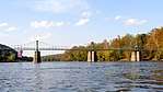
| Riegelsville Bridge (free) |
 |
Delaware Road |
Riegelsville and Pohatcong Township |
40°35′39″N 75°11′27″W / 40.59422°N 75.19077°W / 40.59422; -75.19077 (Riegelsville Bridge) |
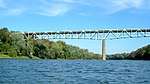
| Interstate 78 Toll Bridge |
 |
 I‑78 I‑78 |
Williams Twp and Phillipsburg |
40°40′20″N 75°10′40″W / 40.6721°N 75.1778°W / 40.6721; -75.1778 (Interstate 78 Toll Bridge) |
| Lehigh Valley Railroad, Delaware River Bridge |
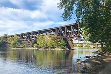 |
Lehigh Valley Railroad |
Easton and Phillipsburg |
40°41′15″N 75°12′08″W / 40.687566°N 75.202298°W / 40.687566; -75.202298 (Lehigh Valley Railroad Bridge (abandoned)) |
| Central Railroad of New Jersey Bridge |
 |
Central Railroad of New Jersey |
40°41′16″N 75°12′09″W / 40.687784°N 75.202403°W / 40.687784; -75.202403 (Central Railroad of New Jersey Bridge) |
| Lehigh and Hudson River Railway Bridge |
 |
Lehigh and Hudson River Railway |
40°41′20″N 75°12′12″W / 40.688958°N 75.203299°W / 40.688958; -75.203299 (Lehigh and Hudson River Railway Bridge) |
| Northampton Street Bridge (free) |
 |
|
40°41′30″N 75°12′14″W / 40.691545°N 75.204004°W / 40.691545; -75.204004 (Northampton Street Bridge) |
| Easton-Phillipsburg Toll Bridge |
 |
 US 22 US 22 |
40°41′40″N 75°12′13″W / 40.6945°N 75.2036°W / 40.6945; -75.2036 (Easton-Phillipsburg Toll Bridge) |
| Riverton-Belvidere Bridge (free) |
 |
|
Riverton and Belvidere |
40°41′40″N 75°12′13″W / 40.6945°N 75.2036°W / 40.6945; -75.2036 (Riverton-Belvidere Bridge) |
| Darlington's Bridge at Delaware Station (demolished) |
|
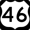 US 46 US 46 |
Portland and Delaware |
40°53′58″N 75°04′29″W / 40.89947°N 75.07480°W / 40.89947; -75.07480 (Delaware Bridge (demolished)) |
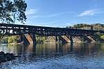
| Delaware, Lackawanna and Western Railroad Bridge (abandoned) |
 |
DL&W Railroad |
Mount Bethel and Delaware |
40°53′59″N 75°04′30″W / 40.899838°N 75.074937°W / 40.899838; -75.074937 (Delaware, Lackawanna and Western Railroad Bridge (abandoned)) |
| Portland-Columbia Toll Bridge |
 |
 Route 94 Route 94 |
Portland and Columbia |
40°55′18″N 75°05′30″W / 40.9216°N 75.0917°W / 40.9216; -75.0917 (Portland-Columbia Toll Bridge) |
| Portland-Columbia Pedestrian Bridge |
 |
Pedestrian |
40°55′27″N 75°05′44″W / 40.92415°N 75.09554°W / 40.92415; -75.09554 (Portland-Columbia Pedestrian Bridge) |
| Delaware River Viaduct (Lackawanna Cut-Off) |
 |
Rail |
Upper Mt Bethel Township and Columbia |
40°56′15″N 75°06′21″W / 40.9376°N 75.1057°W / 40.9376; -75.1057 (Delaware River Viaduct) |
| Delaware Water Gap Toll Bridge |
 |
 I‑80 I‑80 |
Delaware Water Gap and Hardwick Township |
40°58′37″N 75°08′07″W / 40.9770°N 75.1354°W / 40.9770; -75.1354 (Delaware Water Gap Toll Bridge) |
| Dingman's Ferry Bridge (toll) |
 |
 SR 2019 SR 2019
 CR 560 CR 560 |
Delaware Township and
Sandyston Township |
41°13′12″N 74°51′33″W / 41.2201°N 74.8593°W / 41.2201; -74.8593 (Dingman's Ferry Bridge) |
| Milford-Montague Toll Bridge |
 |
 US 206 US 206 |
Milford and Montague Township |
41°18′26″N 74°48′01″W / 41.3071°N 74.8002°W / 41.3071; -74.8002 (Milford-Montague Toll Bridge) |
|
|
| Interstate 84 Bridge (Free) |
|
 I-84 I-84 |
Matamoras and Port Jervis |
41°21′28″N 74°41′43″W / 41.357818°N 74.695372°W / 41.357818; -74.695372 (Interstate 84 Bridge) |
| Mid-Delaware Bridge (Pike Street) |
 |
  US 6 / US 209 US 6 / US 209 |
Matamoras and Port Jervis |
41°22′18″N 74°41′52″W / 41.37167°N 74.69778°W / 41.37167; -74.69778 (Mid-Delaware Bridge (Pike Street)) |
| Pond Eddy Bridge |
 |
CR 41 |
Pond Eddy, New York, Pond Eddy, Pennsylvania |
41°26′21″N 74°49′13″W / 41.439167°N 74.820278°W / 41.439167; -74.820278 (Pond Eddy Bridge) |
| Barryville–Shohola Bridge |
 |
 PA 434 PA 434
 NY 55 NY 55 |
Shohola Township and Barryville |
41°28′33″N 74°54′46″W / 41.4758°N 74.9128°W / 41.4758; -74.9128 (Barryville–Shohola Bridge) |
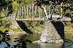
| Roebling's Delaware Aqueduct |
 |
CR 168 |
Lackawaxen and Minisink Ford |
41°28′57″N 74°59′04″W / 41.482571°N 74.9844105°W / 41.482571; -74.9844105 (Roebling's Delaware Aqueduct) |
| Narrowsburg–Darbytown Bridge |
|
 PA 652 PA 652
 NY 52 NY 52 |
Darbytown and Narrowsburg |
41°36′35″N 75°03′43″W / 41.609715°N 75.061855°W / 41.609715; -75.061855 (Narrowsburg–Darbytown Bridge) |
| Skinners Falls-Milanville Bridge |
|
|
|
|
| Cochecton–Damascus Bridge |
|
 PA 371 PA 371 |
Damascus Twp. and Cochecton |
41°42′17″N 75°04′01″W / 41.70485°N 75.06699°W / 41.70485; -75.06699 (Cochecton–Damascus Bridge) |
| Callicoon Bridge |
|
|
Damascus Twp. and Callicoon |
41°45′55″N 75°03′38″W / 41.76528°N 75.06056°W / 41.76528; -75.06056 (Callicoon Bridge) |
| Little Equinunk Bridge (Kellams Bridge) |
|
|
Stacker and Hankins |
41°49′24″N 75°06′49″W / 41.823333°N 75.113611°W / 41.823333; -75.113611 (Kellams Bridge) |
| Lordville-Equinunk Bridge |
|
|
Equinunk and Lordville |
41°52′04″N 75°12′50″W / 41.867779°N 75.21388°W / 41.867779; -75.21388 (Lordville-Equinunk Bridge) |