
Current districts of Mecklenburg-Vorpommern, including capitals
In the German state of Mecklenburg-Western Pomerania (German: Mecklenburg-Vorpommern) there are 84 officially recognised towns and cities.
In addition there are the two district-free cities of Rostock and Schwerin.
District capitals
There are 6 district capitals in the state of Mecklenburg-Vorpommern:
Table
You can sort the table by clicking one of the upper columns.
| City/Town |
Coat of Arms |
District |
first mentioned |
Town privileges |
Area in km2 |
Population at December 31, 2013[1] |
Image |
|---|
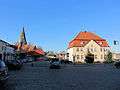
| Altentreptow |
 |
Mecklenburgische Seenplatte |
1245 |
1245 |
52,83 |
5308 |
 |
| Anklam |
 |
Vorpommern-Greifswald |
1243 |
1264 |
56,57 |
12521 |
 |
| Bad Doberan |
 |
Rostock |
1177 |
1879 |
32,74 |
12290 |
 |
| Bad Sülze |
 |
Vorpommern-Rügen |
1243 |
1257[2] |
26,37 |
1743 |
 |
| Barth |
 |
Vorpommern-Rügen |
1255 |
1255 |
40,83 |
8643 |
 |
| Bergen auf Rügen |
 |
Vorpommern-Rügen |
1314 |
1613 |
51,42 |
13555 |
 |
| Boizenburg/Elbe |
 |
Ludwigslust-Parchim |
1158 |
1267 |
47,26 |
10630 |
 |
| Brüel |
 |
Ludwigslust-Parchim |
1222 |
1340[3] |
27,30 |
2571 |
 |
| Burg Stargard |
 |
Mecklenburgische Seenplatte |
1244 |
1259[4] |
61,68 |
5398 |
 |
| Bützow |
 |
Rostock |
1171 |
1236 |
39,70 |
7852 |
 |
| Crivitz |
 |
Ludwigslust-Parchim |
1302 |
1302 |
75,48 |
4872 |
 |
| Dargun |
 |
Mecklenburgische Seenplatte |
1172 |
1938 |
117,15 |
4410 |
 |
| Dassow |
 |
Nordwestmecklenburg |
1219 |
1938 |
66,54 |
4077 |
 |
| Demmin |
 |
Mecklenburgische Seenplatte |
1070 |
1236[5] |
81,56 |
10865 |
 |
| Dömitz |
 |
Ludwigslust-Parchim |
1235 |
1259 |
60,38 |
3049 |
 |
| Eggesin |
 |
Vorpommern-Greifswald |
1216 |
1966 |
88,01 |
4745 |
 |
| Franzburg |
 |
Vorpommern-Rügen |
1231 |
1587 |
15,19 |
1394 |
 |
| Friedland |
 |
Mecklenburgische Seenplatte |
1244 |
1244 |
97,64 |
6514 |
 |
| Gadebusch |
 |
Nordwestmecklenburg |
1194 |
1225 |
47,65 |
5481 |
 |
| Garz/Rügen |
 |
Vorpommern-Rügen |
1207 |
1319 |
65,44 |
2201 |
 |
| Gnoien |
 |
Rostock |
1257 |
1290 |
41,08 |
2928 |
 |
| Goldberg |
_COA.svg.png) |
Ludwigslust-Parchim |
1227 |
1248 |
64,85 |
3550 |
 |
| Grabow |
 |
Ludwigslust-Parchim |
1186 |
1252 |
47,68 |
5701 |
 |
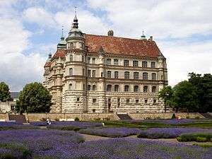
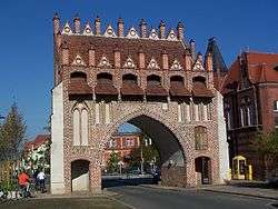
| Greifswald |
 |
Vorpommern-Greifswald |
1241 |
1250 |
50,50 |
58886 |
 |
| Grevesmühlen |
 |
Nordwestmecklenburg |
1226 |
1261 |
52,32 |
10410 |
 |
| Grimmen |
 |
Vorpommern-Rügen |
1267 |
1287 |
50,29 |
9733 |
 |
| Güstrow |
 |
Rostock |
1222 |
1228 |
70,86 |
29429 |
 |
| Gützkow |
 |
Vorpommern-Greifswald |
1301 |
1353 |
42,68 |
3021 |
 |
| Hagenow |
 |
Ludwigslust-Parchim |
1190[6] |
1754 |
67,44 |
11968 |
 |
| Jarmen |
 |
Vorpommern-Greifswald |
1269 |
1720 |
30,64 |
2948 |
 |
| Klütz |
 |
Nordwestmecklenburg |
1188 |
1938 |
44,12 |
3133 |
 |
| Krakow am See |
 |
Rostock |
1298 |
1467 |
87,07 |
3472 |
 |
| Kröpelin |
 |
Rostock |
1177 |
1249 |
67,26 |
4780 |
 |
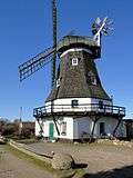
| Kühlungsborn |
 |
Rostock |
1938[7] |
1938 |
16,16 |
7961 |
 |
| Laage |
 |
Rostock |
1216 |
1336 |
81,27 |
5457 |
 |
| Lassan |
 |
Vorpommern-Greifswald |
1136 |
1274 |
27,98 |
1532 |
 |
| Loitz |
 |
Vorpommern-Greifswald |
1242 |
1242 |
89,53 |
4276 |
 |
| Lübtheen |
 |
Ludwigslust-Parchim |
1363 |
1938 |
119,69 |
4789 |
 |
| Lübz |
 |
Ludwigslust-Parchim |
1308 |
1456[8] |
49,12 |
6134 |
 |
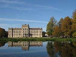
| Ludwigslust |
 |
Ludwigslust-Parchim |
1754 |
1876 |
78,30 |
12267 |
 |
| Malchin |
 |
Mecklenburgische Seenplatte |
1236 |
1236 |
94,50 |
7346 |
 |
| Malchow |
 |
Mecklenburgische Seenplatte |
1147 |
1235 |
44,60 |
6619 |
 |
| Marlow |
 |
Vorpommern-Rügen |
1210 |
1459 |
139,81 |
4577 |
 |
| Mirow |
 |
Mecklenburgische Seenplatte |
1226 |
1919 |
84,08 |
3955 |
 |
| Neubrandenburg |
 |
Mecklenburgische Seenplatte |
1248 |
1248 |
85,65 |
64259 |
 |
| Neubukow |
 |
Rostock |
1260 |
1435 |
24,99 |
3903 |
 |
| Neukalen |
 |
Mecklenburgische Seenplatte |
1174[9] |
1253[10] |
46,84 |
1749 |
 |
| Neukloster |
 |
Nordwestmecklenburg |
1219 |
1938 |
27,49 |
3928 |
 |
| Neustadt-Glewe |
 |
Ludwigslust-Parchim |
1248 |
1248 |
93,91 |
6890 |
 |
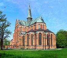
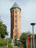
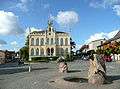
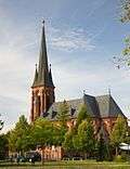
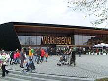
| Neustrelitz |
 |
Mecklenburgische Seenplatte |
1278 |
1733 |
138,15 |
20135 |
_Front.jpg) |
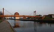
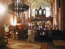
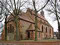
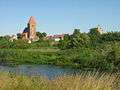
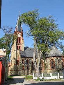
| Parchim |
 |
Ludwigslust-Parchim |
1170 |
1226 |
106,61 |
18074 |
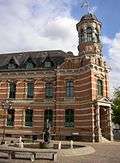 |
| Pasewalk |
 |
Vorpommern-Greifswald |
1121 |
1251[11] |
54,99 |
10281 |
 |
| Penkun |
 |
Vorpommern-Greifswald |
1240 |
1269 |
78,63 |
1806 |
 |
| Penzlin |
 |
Mecklenburgische Seenplatte |
1170 |
1263 |
115,47 |
4177 |
 |
| Plau am See |
 |
Ludwigslust-Parchim |
1235 |
1226 |
115,99 |
6013 |
 |
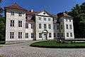
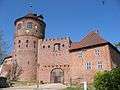
| Putbus |
 |
Vorpommern-Rügen |
1810 |
1810 |
66,60 |
4396 |
_3.JPG) |
| Rehna |
 |
Nordwestmecklenburg |
1230 |
1791 |
22,52 |
3497 |
 |
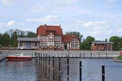
| Rerik |
 |
Rostock |
1238[12] |
1938[13] |
33,45 |
2161 |
 |
| Ribnitz-Damgarten |
 |
Vorpommern-Rügen |
1950 |
1950 |
122,20 |
15197 |
 |
| Richtenberg |
 |
Vorpommern-Rügen |
1231 |
1297 |
15,63 |
1295 |
 |
| Röbel/Müritz |
 |
Mecklenburgische Seenplatte |
1226 |
1261 |
30,17 |
5109 |
 |
| Rostock |
 |
Kreisfreie Stadt |
1161 |
1218 |
181,44 |
208409 |
 |
| Sassnitz |
 |
Vorpommern-Rügen |
1906[14] |
1957 |
46,45 |
9435 |
 |
| Schönberg |
 |
Nordwestmecklenburg |
1219 |
1822 |
38,09 |
4409 |
 |
| Schwaan |
 |
Rostock |
1276 |
1276 |
38,28 |
5029 |
 |
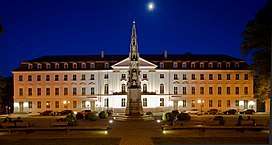
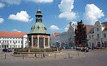
| Schwerin (state capital) |
 |
Kreisfreie Stadt |
1018[15] |
1160 |
130,46 |
95797 |
 |
| Stavenhagen |
 |
Mecklenburgische Seenplatte |
1230 |
1264 |
40,84 |
5766 |
 |
| Sternberg |
 |
Ludwigslust-Parchim |
1248 |
1248 |
67,67 |
4222 |
 |
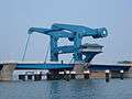
| Stralsund |
 |
Vorpommern-Rügen |
1234 |
1234 |
38,97 |
59517 |
%2C_by_Klugschnacker_in_Wikipedia_(9).JPG) |
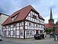
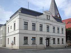
| Strasburg (Uckermark) |
.svg.png) |
Vorpommern-Greifswald |
1250[16] |
1250[17] |
86,83 |
4829 |
 |
| Tessin |
 |
Rostock |
1121 |
1343 |
24,52 |
3880 |
 |
| Teterow |
 |
Rostock |
1215[18] |
1272[19] |
47,17 |
8508 |
 |
| Torgelow |
 |
Vorpommern-Greifswald |
1281 |
1945 |
49,46 |
9250 |
 |
| Tribsees |
 |
Vorpommern-Rügen |
1136 |
1285 |
54,75 |
2647 |
 |
| Ueckermünde |
 |
Vorpommern-Greifswald |
1178 |
1260 |
84,69 |
8668 |
 |
| Usedom |
 |
Vorpommern-Greifswald |
1128 |
1298 |
38,57 |
1776 |
 |
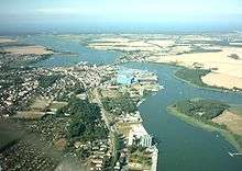
| Waren (Müritz) |
_COA.svg.png) |
Mecklenburgische Seenplatte |
1260[20] |
1260[21] |
158,39 |
21210 |
 |
| Warin |
 |
Nordwestmecklenburg |
1178 |
1306 |
44,26 |
3242 |
 |
| Wesenberg |
 |
Mecklenburgische Seenplatte |
1252 |
1252 |
89,43 |
3024 |
 |
| Wismar |
 |
Nordwestmecklenburg |
1147 |
1226 |
41,36 |
42906 |
 |
| Wittenburg |
 |
Ludwigslust-Parchim |
1154 |
1230 |
46,25 |
6306 |
 |
| Woldegk |
 |
Mecklenburgische Seenplatte |
1236[22] |
1298 |
103,70 |
4310 |
 |
| Wolgast |
 |
Vorpommern-Greifswald |
1123 |
1257 |
61,52 |
12084 |
 |
| Zarrentin am Schaalsee |
 |
Ludwigslust-Parchim |
1139 |
1938 |
91,89 |
5198 |
 |
|
Sources
- ↑ MV Stats: Census results
- ↑ Town privileges between 1255 and 1260
- ↑ 1377 according to other sources
- ↑ 1259 is the date for the town of Stargard; the "Burg" area with the castle was incorporated in 1929, the town renamed to Burg Stargard.
- ↑ Town privileges given between 1236 and 1249
- ↑ Town privileges given between 1190 and 1195
- ↑ Fusion of the former villages/seaside resorts of Fulgen, Brunshaupten and Arendsee
- ↑ exact date not really clear, town privileges received definitely until 1506
- ↑ Altkalen
- ↑ 1281 new foundation 10 km further south
- ↑ unsettled date, definite town privileges at 1276
- ↑ for the village of Alt Gaarz
- ↑ for renaming of Alt Gaarz to Rerik
- ↑ merging of the fishing villages Saßnitz and Crampas
- ↑ around 1018
- ↑ around 1250
- ↑ around 1250
- ↑ Construction of the church started
- ↑ probably in 1235 already, unclear
- ↑ between 1260 and 1270
- ↑ between 1260 and 1270
- ↑ between 1236 and 1250