Wittenburg
| Wittenburg | ||
|---|---|---|
| ||
 Wittenburg Location of Wittenburg within Ludwigslust-Parchim district  | ||
| Coordinates: 53°30′N 11°04′E / 53.500°N 11.067°ECoordinates: 53°30′N 11°04′E / 53.500°N 11.067°E | ||
| Country | Germany | |
| State | Mecklenburg-Vorpommern | |
| District | Ludwigslust-Parchim | |
| Municipal assoc. | Wittenburg | |
| Founded | 1230 | |
| Government | ||
| • Mayor | Dr. Margret Seemann (SPD) | |
| Area | ||
| • Total | 80.00 km2 (30.89 sq mi) | |
| Elevation | 40 m (130 ft) | |
| Population (2017-12-31)[1] | ||
| • Total | 6,306 | |
| • Density | 79/km2 (200/sq mi) | |
| Time zone | CET/CEST (UTC+1/+2) | |
| Postal codes | 19243 | |
| Dialling codes | 038852 | |
| Vehicle registration | LWL, LUP | |
| Website | www.wittenburg.de | |


Town hall of Wittenburg
Wittenburg is a town in the district Ludwigslust-Parchim in Mecklenburg-Vorpommern, Germany. Population 6,092, area 80.0 km².
Wittenburg has been the seat of the Amt of Wittenburg since January 2004. It is in the west of Mecklenburg-Vorpommern and lies on the little river Motel.
The settlements of Helm, Klein Wolde, Wölzow, Lehsen, Körchow and Ziggelmark are part of Wittenburg. Wittenburg was first mentioned in 1154 and gained town privileges in 1230.
Number of inhabitants
| Year | Inhabitants |
|---|---|
| 1496 | 500-600 |
| 1644 | only 100 (Thirty years war) |
| 1857 | 3.100 |
| 1920 | 3.359 |
| 1989 | 6.000 |
| 2000 | 5.161 |
| 2006 | 4.924 |
| 2015 | 6.385 |
Gallery
 St. Bartholomew's church
 Tower of town wall
 „Amtsbergturm“
 Town wall
 Timber framing
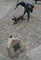 Sculpture on market square
 River Motel
References
External links
- Official website (German)
| Authority control |
|---|
This article is issued from
Wikipedia.
The text is licensed under Creative Commons - Attribution - Sharealike.
Additional terms may apply for the media files.