List of attractions and landmarks in Calgary

The city of Calgary is located in Alberta, Canada and has over 1 million inhabitants. Tourism is an important part of the economy.

List of attractions

The following is a list of attractions and landmarks in or near Calgary, Alberta, Canada.

Downtown

Address Type Remarks Image
Arts Commons 205 8 Avenue S.E
51°02′43″N 114°03′37″W / 51.04528°N 114.06028°W / 51.04528; -114.06028 (EPCOR Centre)
Arts venuePerforming arts, home of Calgary Philharmonic Orchestra
Burns Building 237 8 Ave SE
51°02′45″N 114°03′31″W / 51.04583°N 114.05861°W / 51.04583; -114.05861 (Calgary Burns Building)
BuildingHistoric site built by Pat Burns in 1913
Calgary Tower 101 9 Ave SW
51°02′40.0″N 114°03′48.7″W / 51.044444°N 114.063528°W / 51.044444; -114.063528 (Calgary Tower)
TowerObservation tower
Chinese Cultural Centre 197 1 St SW
51°03′06″N 114°03′56″W / 51.05167°N 114.06556°W / 51.05167; -114.06556 (Chinese Cultural Centre)
MuseumLargest facility of its kind in North America
City Hall 800 Macleod Trail SE
51°02′42″N 114°03′26″W / 51.04500°N 114.05722°W / 51.04500; -114.05722 (City Hall)
BuildingMunicipal building, and Historic City Hall
Devonian Gardens 409 8 Ave SW
51°02′45.6″N 114°04′23.4″W / 51.046000°N 114.073167°W / 51.046000; -114.073167 (Devonian Gardens)
Urban parkBotanical garden with seasonal exhibitions
Dragon City Mall 100 3 Ave SE
51°03′02.2″N 114°03′43.6″W / 51.050611°N 114.062111°W / 51.050611; -114.062111 (Dragon City Mall)
Shopping mallAsian themed
Fairmont Palliser Hotel 133 9 Ave SW
51°02′40″N 114°03′55″W / 51.04444°N 114.06528°W / 51.04444; -114.06528 (Fairmont Palliser)
HotelOne of Canada's grand railway hotels
Fort Calgary 750 9 Ave SE
51°02′42.5″N 114°02′44.8″W / 51.045139°N 114.045778°W / 51.045139; -114.045778 (Fort Calgary)
MuseumHistoric Site
Glenbow Museum 130 9 Ave SE
51°02′41″N 114°03′39″W / 51.04472°N 114.06083°W / 51.04472; -114.06083 (Glenbow Museum)
MuseumWestern Canada's largest museum
Shaw Millennium Park 800 11 St SW
51°02′46″N 114°05′30″W / 51.04611°N 114.09167°W / 51.04611; -114.09167 (Millennium Park)
Urban parkSkatepark
National Music Centre 134 11 Ave SE
51°02′33″N 114°03′39″W / 51.04250°N 114.06083°W / 51.04250; -114.06083 (Cantos Foundation)
MuseumOver 2,000 rare instruments and artifacts along with the Canadian Music Hall of Fame and Canadian Country Music Hall of Fame Collections.
Olympic Plaza 801 Macleod Trail SE
51°02′45″N 114°03′31″W / 51.04583°N 114.05861°W / 51.04583; -114.05861 (Olympic Plaza)
Urban parkNamed for the 1988 Winter Olympics, site of open air festivals
Prince's Island Park 100 2 St SW
51°03′18″N 114°04′03″W / 51.05500°N 114.06750°W / 51.05500; -114.06750 (Prince's Island)
Urban parkHosts open air festivals
Stephen Avenue 8 Ave SW
51°02′44″N 114°03′56″W / 51.04556°N 114.06556°W / 51.04556; -114.06556 (Stephen Ave)
StreetHeritage buildings
Telus Convention Centre 120 9 Ave SE
51°02′43″N 114°03′39″W / 51.04528°N 114.06083°W / 51.04528; -114.06083 (Telus Convention Centre)
Convention centre
The Bow 124 7th Ave SE
51°02′52″N 114°03′44″W / 51.04778°N 114.06222°W / 51.04778; -114.06222 (The Bow)
SkyscraperTallest building in Canada outside of Toronto
Plus 15 Downtown CalgarySkywaySkywalk network

Northwest

Address Type Remarks Image
Confederation Park 24 Ave & 14 St NW
51°04′36″N 114°05′04″W / 51.07667°N 114.08444°W / 51.07667; -114.08444 (Confederation Park)
Urban parkSite of Lions Club Christmas Light Display
Foothills Stadium 2825 24 Ave NW
51°4′24.37″N 114°7′14.29″W / 51.0734361°N 114.1206361°W / 51.0734361; -114.1206361 (Foothills Stadium)
Sports venueBaseball stadium
Kensington Kensington Rd NW
51°03′09″N 114°05′41″W / 51.05250°N 114.09472°W / 51.05250; -114.09472 (Kensington)
StreetBusiness Revitalisation Zone, shopping and restaurants, heritage buildings
Market Mall 3625 Shaganappi Trail NW
51°05′05″N 114°09′22″W / 51.08472°N 114.15611°W / 51.08472; -114.15611 (Market Mall)
Shopping mallOne of the largest malls (by area) in Calgary
Parkdale Parkdale Boulevard
51°03′32″N 114°08′19″W / 51.05889°N 114.13861°W / 51.05889; -114.13861 (Parkdale)
Public artParkdale Plaza
McMahon Stadium 1817 Crowchild Trail NW
51°4′13.18″N 114°7′17.00″W / 51.0703278°N 114.1213889°W / 51.0703278; -114.1213889 (McMahon Stadium)
Sports venueCanadian football stadium, home of the Calgary Stampeders (CFL)
Baker Park 1817 Crowchild Trail NW
51°05′50″N 114°12′56″W / 51.09722°N 114.21556°W / 51.09722; -114.21556 (Baker Park)
Urban parkMost popular Calgary park for outdoor wedding. River observation point.
Nose Hill Park 14 St, Shaganappi Trail, John Laurie Blvd NW
51°07′N 114°07′W / 51.117°N 114.117°W / 51.117; -114.117 (Nose Hill Park)
Urban parkOne of the largest municipal parks in Canada
Olympic Oval 111 University Gate NW
51°04′37″N 114°08′08″W / 51.07694°N 114.13556°W / 51.07694; -114.13556 (Olympic Oval)
Sports venueSpeed skating oval, home of the Calgary Inferno CWHL hockey team
Southern Alberta Jubilee Auditorium 1415 14 Ave NW
51°03′45″N 114°05′35″W / 51.06250°N 114.09306°W / 51.06250; -114.09306 (Jubilee Auditorium)
Music venuePerforming arts, culture and community facility, home of Calgary Opera
University of Calgary 2500 University Dr NW
51°04′39″N 114°07′59″W / 51.07750°N 114.13306°W / 51.07750; -114.13306 (U of C)
UniversityPublic university

Northeast

Address Type Remarks Image
Baitun Nur 4353 54 Avenue NE
51°06′06″N 113°58′19″W / 51.101743°N 113.972039°W / 51.101743; -113.972039 (Baitun Nur)
Mosque Largest mosque in Canada
The Hangar Flight Museum 4629 McCall Way NE
51°05′39″N 114°00′47″W / 51.09417°N 114.01306°W / 51.09417; -114.01306 (Aerospace Museum)
MuseumHistory of aviation and space technology of western Canada
YYC Calgary International Airport 2000 Airport Rd NE
51°06′50″N 114°01′13″W / 51.11389°N 114.02028°W / 51.11389; -114.02028 (Calgary Airport)
AirportInternational airport, part of the National Airports System
Calgary Zoo 1300 Zoo Rd NE
51°02′45″N 114°02′00″W / 51.04583°N 114.03333°W / 51.04583; -114.03333 (Calgary Zoo)
ZooSecond largest zoo in Canada
Marlborough Mall 433 Marlborough Way NE
51°03′17″N 113°58′42″W / 51.05472°N 113.97833°W / 51.05472; -113.97833 (Marlborough Mall)
Shopping mallOpened in 1972
Sunridge Mall 2525 36 St NE
51°04′28″N 113°59′09″W / 51.07444°N 113.98583°W / 51.07444; -113.98583 (Sunridge Mall)
Shopping mallOpened in 1981
Telus Spark 220 St. George's Drive NE
51°02′52″N 114°05′19″W / 51.04778°N 114.08861°W / 51.04778; -114.08861 (Telus Spark)
MuseumInteractive exhibits, multimedia presentations, educational demonstrations

Southwest

Address Type Remarks Image
Battalion Park Signal Hill Ctr SW
51°01′13″N 114°10′17″W / 51.02028°N 114.17139°W / 51.02028; -114.17139 (Battalion Park)
Urban parkFormerly known as Camp Sarcee
Canada Olympic Park 88 Canada Olympic Rd NW
51°04′47″N 114°11′57″W / 51.07972°N 114.19917°W / 51.07972; -114.19917 (Canada Olympic Park)
Ski resort1988 Winter Olympics venue now used for Recreation and Athletic training
Canada's Sports Hall of Fame 169 Canada Olympic Road NW
51°04′57″N 114°13′16″W / 51.08250°N 114.22111°W / 51.08250; -114.22111 (Canada's Sports Hall of Fame)
MuseumThe main national hall of fame for sports in general
Chinook Centre 6455 Macleod Trail SW
50°59′54″N 114°04′26″W / 50.99833°N 114.07389°W / 50.99833; -114.07389 (Chinook Centre)
Shopping mallOpened in 1960
Edworthy Park Edworthy St SW
51°03′41″N 114°09′23″W / 51.06139°N 114.15639°W / 51.06139; -114.15639 (Edworthy Park)
Urban parkLocated along the Bow River
Fish Creek Park SW Calgary
50°55′40″N 114°07′42″W / 50.92778°N 114.12833°W / 50.92778; -114.12833 (Fish Creek)
Provincial parkOne of the largest urban parks in North America
Glenmore Reservoir 14th St & Glenmore Trail SW
50°58′53″N 114°06′50″W / 50.98139°N 114.11389°W / 50.98139; -114.11389 (Glenmore Reservoir)
LakeManmade reservoir on the Elbow River
Heritage Park Heritage Dr & 14th St SW
50°59′07″N 114°06′30″W / 50.98528°N 114.10833°W / 50.98528; -114.10833 (Heritage Park)
MuseumHistorical Village
Marda Loop 33rd Avenue SW
51°01′26″N 114°06′47″W / 51.02389°N 114.11306°W / 51.02389; -114.11306 (Marda Loop)
StreetShopping, Business Revitalization Zone
Spruce Meadows Highway 22X (Spruce Meadows Trail)
50°53′06″N 114°06′02″W / 50.88500°N 114.10056°W / 50.88500; -114.10056 (Spruce Meadows)
VenueEquestrian facility
Repsol Sport Centre 2225 Macleod Trail SW
51°02′04″N 114°03′48″W / 51.03444°N 114.06333°W / 51.03444; -114.06333 (Talisman Centre)
VenueMulti-sports complex
The Military Museums 1820 - 24 Street SW
4520 Crowchild Trail SW
51°00′52″N 114°06′57″W / 51.01444°N 114.11583°W / 51.01444; -114.11583 (Military Museums)
MuseumComprises the Naval Museum of Alberta,the Air Force Museum of Alberta, Library and Archives
17th Avenue 17 Ave SW
51°02′16″N 114°04′54″W / 51.03778°N 114.08167°W / 51.03778; -114.08167 (17th Avenue)
StreetShopping and entertainment, site of Red Mile

Southeast

Address Type Remarks Image
Stampede Grounds 1410 Olympic Way SE
51°02′01″N 114°03′14″W / 51.03361°N 114.05389°W / 51.03361; -114.05389 (Stampede)
VenueFair and Exhibition grounds
Fish Creek Provincial Park South Calgary
50°54′12″N 114°01′11″W / 50.90333°N 114.01972°W / 50.90333; -114.01972 (Fish Creek Park)
Provincial parkOne of the largest urban parks in North America
Inglewood 9 Ave SE
51°02′34″N 114°02′22″W / 51.04278°N 114.03944°W / 51.04278; -114.03944 (Inglewood)
StreetHeritage buildings[1]
International Avenue 17 Ave SE (Highway 1A)
51°02′16″N 113°58′54″W / 51.03778°N 113.98167°W / 51.03778; -113.98167 (International Ave)
StreetBusiness Revitalization Zone,[2] cultural diverse neighbourhood, site of GlobalFest
Max Bell Centre 1001 Barlow Trail SE
51°02′32″N 114°00′13″W / 51.04222°N 114.00361°W / 51.04222; -114.00361 (Max Bell Centre)
Sports venueIce hockey arena
Scotiabank Saddledome 555 Saddledome Rise SE
51°02′15″N 114°03′07″W / 51.03750°N 114.05194°W / 51.03750; -114.05194 (Saddledome)
VenueIce hockey arena, home of the Calgary Flames (NHL), performing arts
Sikome Lake Bow Bottom Trail SE
50°53′58″N 114°00′56″W / 50.89944°N 114.01556°W / 50.89944; -114.01556 (Sikome Lake)
LakeMan-made lake, public beach
Southcentre Mall 100 Anderson Rd SE
50°56′30″N 114°04′05″W / 50.94167°N 114.06806°W / 50.94167; -114.06806 (Southcentre Mall)
Shopping mallOpened in 1974

See also

References

  1. Inglewood Main Street Archived 2007-02-27 at the Wayback Machine. - Alberta Heritage
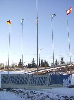
  2. Business Revitalization Zone - International Avenue
This article is issued from Wikipedia. The text is licensed under Creative Commons - Attribution - Sharealike. Additional terms may apply for the media files.