Ukraine Wetlands of International Importance
| Name[1] |
Oblast |
Area (km²) |
Designated |
Description |
Image |
|---|
| Bakota Bay[2] | Khmelnytsky
48°35′N 26°56′E / 48.583°N 26.933°E / 48.583; 26.933 (Bakota Bay) | 15.9 | 29 July 2004 | part of National Park "Podilski Tovtry", Dniester valley | |
| Berda River mouth, Berdiansk Spit and Berdiansk Bay[3] | Zaporizhia
46°44′N 36°48′E / 46.733°N 36.800°E / 46.733; 36.800 (Berda River mouth) | 18 | | Sea of Azov near Berdyansk | |
| Bilosaraisk Bay, Bilosaraisk Spit[4] | Donetsk
46°54′N 37°20′E / 46.900°N 37.333°E / 46.900; 37.333 (Bilosaraisk Bay) | 20 | | Sea of Azov near Yalta, Donetsk Oblast | |
| Great Chapli Depression[5] | Kherson
46°29′N 33°51′E / 46.483°N 33.850°E / 46.483; 33.850 (Great Chapli Depression) | 23.59 | | part of Askania-Nova Reserve | |
| Cheremske Mire | Volyn Oblast | 328 | | |  |
| Chilia branch (Kilia) | Odessa | 328 | | Danube Delta at Bystroye Channel | 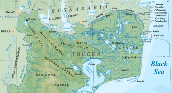 |
| Desna River floodplains | Sumy
52°19′N 33°23′E / 52.317°N 33.383°E / 52.317; 33.383 (Desna River floodplains) | 42.7 | | | |
| Dnieper River Delta | Kherson | 260 | | | |
| Dnieper-Orli floodplains | Dnipropetrovsk | 25.6 | | | |
| Northern area of the Dniester Liman | Odessa | 200 | | | |
| Land of Dniester-Turunchuk | Odessa | 760 | | | |
| Karadag rocky shore habitat | Crimea | 2.24 | | | |
| Karkanit and Dzharylhach bays | Kherson, Crimea
46°00′N 33°5′E / 46.000°N 33.083°E / 46.000; 33.083 (Karkinit and Dzharylgat Bays) | 870 | 23 November 1995 | The Karkinit Bay is a bay of the Black Sea that separates the southwestern Crimean Peninsula from mainland Ukraine. |  |
| Lake Kartal | Odessa | 5 | | | |
| Cape Kazantyp rocky shore habitat | Crimea
45°28′N 35°51′E / 45.467°N 35.850°E / 45.467; 35.850 (Cape Kazantyp) | 2.51 | 29 July 2004 | A headland located in the northeastern part of the Crimean peninsula. | 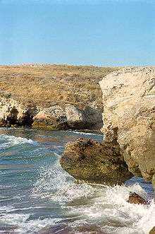 |
| Kremenchuk Floodplains | Poltava Oblast | | | | |
| Kryva Bay and Kryva Spit | Donetsk | 14 | | | |
| Kuhurluy | Odessa | 65 | | | |
| Molochnyi Estuary | Zaporizhia | 224 | | |  |
| Obitochna Spit | Zaporizhia | 20 | | | |
| Cape Opuk nearshore habitat | Crimea
45°01′N 36°12′E / 45.017°N 36.200°E / 45.017; 36.200 (Cape Opuk) | 7.75 | | | |
| Perebrody Peat Bogs | Rivne | 127.18 | | | |
| Polissya Marshes | Zhytomyr | 21.45 | | | |
| Prypiat River floodplains | Volyn | 120 | | | |
| Sasyk Lagoon | Odessa | 210 | | |  |
| Shahany-Alibei-Burnas lakes system | Odessa | 190 | | | |
| Shatsk Lakes | Volyn | 328.5 | | | |
| Lower Smotrych River | Khmelnytsky | 14.8 | | | |
| Stokhid River floodplains | Volyn | 100 | | | |
| Lake Synevyr | Zakarpattia | 0.29 | | | 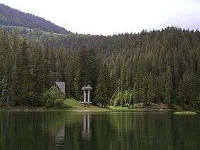 |
| Central Syvash | Kherson, Crimea
46°07′N 34°15′E / 46.117°N 34.250°E / 46.117; 34.250 (Central Syvash) | 800 | | | |
| Eastern Syvash | Kherson, Crimea | 1,650 | | | |
| Tendra Bay | Kherson | 380 | | | |
| Tylihul Estuary | Odessa, Mykolaiv | 260 | | | 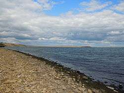 |
| Yahorlyk Bay[6] | Kherson, Mykolaiv | 340 | | separated from Dnieper-Bug Estuary by Kinburn Peninsula | |
External links
Wetlands of Ukraine |
|---|
| Ramsar sites | |
|---|
| Recent (2013) addition |
- Syra Pohonia
- Sim Mayakiv Floodplains
- Somyne Fen
- Velyki and Mali Kuchuhury Archipelago
- Bile Ozero/Koza-Berezyna Fen
|
|---|
| Potential wetlands |
- Druzhba Cave
- Dniester River
- Narcissus (Daffodil) Valley
- Prut Headwaters
- Pohorilets Headwaters
- Nadsyannia Raised Bog
- Burshtyn Reservoir
- Atak-Borzhava Wetlands
- Kleban-Byk
- Kakhovka Reservoir
- Bilenko-Rozumovski Floodplains
- Siversky Donets Floodplains
- Sula Bay
|
|---|
|