List of mountain ranges of Oregon

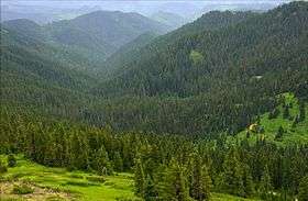
The Calapooya Mountains in Lane County
Mount Thielsen in the Cascade Range in southern Oregon
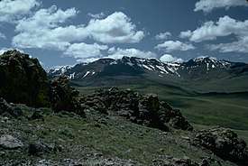
The Pueblo Mountains south of Fields
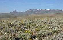
Trout Creek Mountains, Southeastern Oregon
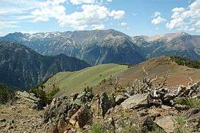
The Wallowa Mountains in northeastern Oregon

There are at least 50 named mountain ranges in the U.S. state of Oregon. Many of these ranges extend into the neighboring states of California, Idaho, Nevada, and Washington. Elevations and coordinates are from the U.S. Geological Survey, Geographic Names Information System, unless otherwise indicated.

range county elevation coordinate GNIS citation
ft m
Aldrich MountainsGrant County, Oregon6,214 1,89444°18′55″N 119°18′29″W / 44.31528°N 119.30806°W / 44.31528; -119.30806 (Aldrich Mountains)[1]
Bilk Creek MountainsHarney County, Oregon5,535 1,68741°40′28″N 118°19′25″W / 41.67444°N 118.32361°W / 41.67444; -118.32361 (Bilk Creek Mountains)[2]
Black HillsLake County, Oregon5,111 1,55843°10′10″N 120°40′48″W / 43.16944°N 120.68000°W / 43.16944; -120.68000 (Black Hills)[3]
Blue MountainsUnion County, Oregon9,108 2,77645°30′00″N 118°00′05″W / 45.50000°N 118.00139°W / 45.50000; -118.00139 (Blue Mountains)[4]
Buck MountainCrook County, Oregon5,213 1,58943°42′52″N 119°48′44″W / 43.71444°N 119.81222°W / 43.71444; -119.81222 (Buck Mountain)[5]
Calapooya MountainsDouglas County, Oregon3,996 1,21843°29′59″N 122°30′04″W / 43.49972°N 122.50111°W / 43.49972; -122.50111 (Calapooya Mountains)[6]
Canby MountainsKlamath County, Oregon4,938 1,50542°31′29″N 121°49′29″W / 42.52472°N 121.82472°W / 42.52472; -121.82472 (Canby Mountains)[7]
Cardwell HillsBenton County, Oregon1,952 59544°38′34″N 123°22′24″W / 44.64278°N 123.37333°W / 44.64278; -123.37333 (Cardwell Hills)[8]
Cascade Range or The Cascades or Oregon CascadesMarion County, Oregon14,409 4,39246°51′10″N 121°45′37″W / 46.85278°N 121.76028°W / 46.85278; -121.76028 (Cascade Range)[9]
Chehalem MountainsYamhill County, Oregon1,325 40445°22′34″N 123°02′14″W / 45.37611°N 123.03722°W / 45.37611; -123.03722 (Chehalem Mountains)[10]
Coast Ranges
Coburg HillsLane County, Oregon1,299 39644°10′23″N 122°55′29″W / 44.17306°N 122.92472°W / 44.17306; -122.92472 (Coburg Hills)[11]
Coleman HillsLake County, Oregon5,102 1,55542°47′50″N 120°04′54″W / 42.79722°N 120.08167°W / 42.79722; -120.08167 (Coleman Hills)[12]
Connley HillsLake County, Oregon5,269 1,60643°15′29″N 121°00′34″W / 43.25806°N 121.00944°W / 43.25806; -121.00944 (Connley Hills)[13]
Cottonwood MountainMalheur County, Oregon6,476 1,97444°10′07″N 117°39′44″W / 44.16861°N 117.66222°W / 44.16861; -117.66222 (Cottonwood Mountain)[14]
Coyote HillsBaker County, Oregon3,671 1,11944°55′15″N 117°54′04″W / 44.92083°N 117.90111°W / 44.92083; -117.90111 (Coyote Hills)[15]
Crooked Creek RangeMalheur County, Oregon4,206 1,28242°34′00″N 118°02′38″W / 42.56667°N 118.04389°W / 42.56667; -118.04389 (Crooked Creek Range)[16]
Crowcamp HillsHarney County, Oregon5,617 1,71243°31′30″N 118°30′09″W / 43.52500°N 118.50250°W / 43.52500; -118.50250 (Crowcamp Hills)[17]
Elkhorn MountainsBaker County, Oregon9,108 2,77644°52′20″N 118°11′34″W / 44.87222°N 118.19278°W / 44.87222; -118.19278 (Elkhorn Mountains)[18]
Eola HillsYamhill County, Oregon833 25445°04′31″N 123°07′25″W / 45.07528°N 123.12361°W / 45.07528; -123.12361 (Eola Hills)[19]
Farley HillsBaker County, Oregon4,022 1,22644°57′55″N 117°48′14″W / 44.96528°N 117.80389°W / 44.96528; -117.80389 (Farley Hills)[20]
Gage RangeWheeler County, Oregon2,723 83044°34′52″N 120°16′23″W / 44.58111°N 120.27306°W / 44.58111; -120.27306 (Gage Range)[21]
Grampian HillsKlamath County, Oregon6,037 1,84042°16′45″N 122°05′04″W / 42.27917°N 122.08444°W / 42.27917; -122.08444 (Grampian Hills)[22]
Grassy RangeJackson County, Oregon5,157 1,57242°53′19″N 122°41′04″W / 42.88861°N 122.68444°W / 42.88861; -122.68444 (Grassy Range)[23]
Greenhorn MountainsGrant County, Oregon8,100 2,50044°42′50″N 118°33′39″W / 44.71389°N 118.56083°W / 44.71389; -118.56083 (Greenhorn Mountains)[24]
Hagerhorst MountainsKlamath County, Oregon6,781 2,06742°28′30″N 120°55′04″W / 42.47500°N 120.91778°W / 42.47500; -120.91778 (Hagerhorst Mountains)[25]
Horse RangeJosephine County, Oregon2,001 61042°39′36″N 123°41′34″W / 42.66000°N 123.69278°W / 42.66000; -123.69278 (Horse Range)[26]
Hot Spring HillsMalheur County, Oregon4,744 1,44642°04′50″N 117°45′07″W / 42.08056°N 117.75194°W / 42.08056; -117.75194 (Hot Spring Hills)[27]
Klamath MountainsSiskiyou County, California4,416 1,34642°00′00″N 123°20′04″W / 42.00000°N 123.33444°W / 42.00000; -123.33444 (Klamath Mountains)[28]
Maury MountainsCrook County, Oregon6,050 1,84044°01′58″N 120°25′06″W / 44.03278°N 120.41833°W / 44.03278; -120.41833 (Maury Mountains)[29]
Mosquito MountainWashoe County, Nevada6,421 1,95741°54′03″N 119°48′24″W / 41.90083°N 119.80667°W / 41.90083; -119.80667 (Mosquito Mountain)[30]
Mutton MountainsWasco County, Oregon4,091 1,24744°56′51″N 121°10′36″W / 44.94750°N 121.17667°W / 44.94750; -121.17667 (Mutton Mountains)[31]
Ochoco MountainsCrook County, Oregon5,489 1,67344°26′35″N 120°23′37″W / 44.44306°N 120.39361°W / 44.44306; -120.39361 (Ochoco Mountains)[32]
Oregon Canyon MountainsMalheur County, Oregon6,437 1,96242°10′00″N 117°57′34″W / 42.16667°N 117.95944°W / 42.16667; -117.95944 (Oregon Canyon Mountains)[33]
Owyhee MountainsOwyhee County, Idaho8,386 2,55642°58′51″N 116°39′31″W / 42.98083°N 116.65861°W / 42.98083; -116.65861 (Owyhee Mountains)[34]
Paulina MountainsDeschutes County, Oregon7,969 2,42943°41′21″N 121°15′17″W / 43.68917°N 121.25472°W / 43.68917; -121.25472 (Paulina Mountains)[35]
Pueblo MountainsHarney County, Oregon6,716 2,04742°06′15″N 118°43′28″W / 42.10417°N 118.72444°W / 42.10417; -118.72444 (Pueblo Mountains)[36]
Red Hills of DundeeYamhill County, Oregon820 25045°17′08″N 123°03′07″W / 45.28556°N 123.05194°W / 45.28556; -123.05194 (Red Hills of Dundee)[37]
Rogue River RangeJackson County, Oregon2,405 73342°45′52″N 122°40′04″W / 42.76444°N 122.66778°W / 42.76444; -122.66778 (Rogue River Range)[38]
Sage Hen HillsHumboldt County, Nevada6,073 1,85141°57′14″N 119°16′02″W / 41.95389°N 119.26722°W / 41.95389; -119.26722 (Sage Hen Hills)[39]
Salem HillsMarion County, Oregon823 25144°50′35″N 123°04′06″W / 44.84306°N 123.06833°W / 44.84306; -123.06833 (Salem Hills)[40]
Sand HillsHarney County, Oregon4,183 1,27542°01′30″N 118°35′14″W / 42.02500°N 118.58722°W / 42.02500; -118.58722 (Sand Hills)[41]
Sheepshead MountainsMalheur County, Oregon5,590 1,70042°53′37″N 118°08′42″W / 42.89361°N 118.14500°W / 42.89361; -118.14500 (Sheepshead Mountains)[42]
Siskiyou MountainsJackson County, Oregon7,536 2,297[43]41°49′59″N 123°40′04″W / 41.83306°N 123.66778°W / 41.83306; -123.66778 (Siskiyou Mountains)[44]
Strawberry RangeGrant County, Oregon9,042 2,756[45]44°18′30″N 118°35′04″W / 44.30833°N 118.58444°W / 44.30833; -118.58444 (Strawberry Range)[46]
Trout Creek Mountains (southern boundary of Alvord Basin)Harney County, Oregon7,060 2,15042°06′00″N 118°17′34″W / 42.10000°N 118.29278°W / 42.10000; -118.29278 (Trout Creek Mountains)[47]
Virtue HillsBaker County, Oregon4,692 1,43044°44′40″N 117°42′49″W / 44.74444°N 117.71361°W / 44.74444; -117.71361 (Virtue Hills)[48]
Wallowa MountainsWallowa County, Oregon9,838 2,99945°12′00″N 117°19′04″W / 45.20000°N 117.31778°W / 45.20000; -117.31778 (Wallowa Mountains)[49]
Whiskey HillsLake County, Oregon5,515 1,68142°58′50″N 120°30′09″W / 42.98056°N 120.50250°W / 42.98056; -120.50250 (Whiskey Hills)[50]
White Horse MountainsHarney County, Oregon4,616 1,40742°13′00″N 118°30′05″W / 42.21667°N 118.50139°W / 42.21667; -118.50139 (White Horse Mountains)[51]

See also

Notes

  1. "Aldrich Mountains". Geographic Names Information System. United States Geological Survey.
  2. "Bilk Creek Mountains". Geographic Names Information System. United States Geological Survey.
  3. "Black Hills". Geographic Names Information System. United States Geological Survey.
  4. "Blue Mountains". Geographic Names Information System. United States Geological Survey.
  5. "Buck Mountain". Geographic Names Information System. United States Geological Survey.
  6. "Calapooya Mountains". Geographic Names Information System. United States Geological Survey.
  7. "Canby Mountains". Geographic Names Information System. United States Geological Survey.
  8. "Cardwell Hills". Geographic Names Information System. United States Geological Survey.
  9. "Cascade Range". Geographic Names Information System. United States Geological Survey.
  10. "Chehalem Mountains". Geographic Names Information System. United States Geological Survey.
  11. "Coburg Hills". Geographic Names Information System. United States Geological Survey.
  12. "Coleman Hills". Geographic Names Information System. United States Geological Survey.
  13. "Connley Hills". Geographic Names Information System. United States Geological Survey.
  14. "Cottonwood Mountain". Geographic Names Information System. United States Geological Survey.
  15. "Coyote Hills". Geographic Names Information System. United States Geological Survey.
  16. "Crooked Creek Range". Geographic Names Information System. United States Geological Survey.
  17. "Crowcamp Hills". Geographic Names Information System. United States Geological Survey.
  18. "Elkhorn Mountains". Geographic Names Information System. United States Geological Survey.
  19. "Eola Hills". Geographic Names Information System. United States Geological Survey.
  20. "Farley Hills". Geographic Names Information System. United States Geological Survey.
  21. "Gage Range". Geographic Names Information System. United States Geological Survey.
  22. "Grampian Hills". Geographic Names Information System. United States Geological Survey.
  23. "Grassy Range". Geographic Names Information System. United States Geological Survey.
  24. "Greenhorn Mountains". Geographic Names Information System. United States Geological Survey.
  25. "Hagerhorst Mountains". Geographic Names Information System. United States Geological Survey.
  26. "Horse Range". Geographic Names Information System. United States Geological Survey.
  27. "Hot Spring Hills". Geographic Names Information System. United States Geological Survey.
  28. "Klamath Mountains". Geographic Names Information System. United States Geological Survey.
  29. "Maury Mountains". Geographic Names Information System. United States Geological Survey.
  30. "Mosquito Mountain". Geographic Names Information System. United States Geological Survey.
  31. "Mutton Mountains". Geographic Names Information System. United States Geological Survey.
  32. "Ochoco Mountains". Geographic Names Information System. United States Geological Survey.
  33. "Oregon Canyon Mountains". Geographic Names Information System. United States Geological Survey.
  34. "Owyhee Mountains". Geographic Names Information System. United States Geological Survey.
  35. "Paulina Mountains". Geographic Names Information System. United States Geological Survey.
  36. "Pueblo Mountains". Geographic Names Information System. United States Geological Survey.
  37. "Red Hills of Dundee". Geographic Names Information System. United States Geological Survey.
  38. "Rogue River Range". Geographic Names Information System. United States Geological Survey.
  39. "Sage Hen Hills". Geographic Names Information System. United States Geological Survey.
  40. "Salem Hills". Geographic Names Information System. United States Geological Survey.
  41. "Sand Hills". Geographic Names Information System. United States Geological Survey.
  42. "Sheepshead Mountains". Geographic Names Information System. United States Geological Survey.
  43. "Mt Ashland". NGS data sheet. U.S. National Geodetic Survey. Retrieved January 12, 2014.
  44. "Siskiyou Mountains". Geographic Names Information System. United States Geological Survey.
  45. "Strawberry". NGS data sheet. U.S. National Geodetic Survey. Retrieved January 12, 2014.
  46. "Strawberry Range". Geographic Names Information System. United States Geological Survey.
  47. "Trout Creek Mountains". Geographic Names Information System. United States Geological Survey.
  48. "Virtue Hills". Geographic Names Information System. United States Geological Survey.
  49. "Wallowa Mountains". Geographic Names Information System. United States Geological Survey.
  50. "Whiskey Hills". Geographic Names Information System. United States Geological Survey.
  51. "White Horse Mountains". Geographic Names Information System. United States Geological Survey.
This article is issued from Wikipedia. The text is licensed under Creative Commons - Attribution - Sharealike. Additional terms may apply for the media files.