Eola Hills
| Eola Hills | |
|---|---|
 Eola Hills | |
| Highest point | |
| Elevation | 1,170 ft (360 m) [1] |
| Geography | |
| Country | United States |
| State | Oregon |
| District | Yamhill County |
| Range coordinates | 45°4′31.425″N 123°7′25.362″W / 45.07539583°N 123.12371167°WCoordinates: 45°4′31.425″N 123°7′25.362″W / 45.07539583°N 123.12371167°W |
| Topo map | USGS Mission Bottom |

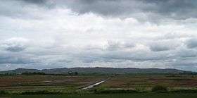
The Eola Hills are a range of hills northwest of Salem, Oregon, United States.[2] They stretch from the community of Eola about 10 miles (16 km) north to Yamhill County.
They are divided from the Salem Hills by the Willamette River at Eola.
See also
- Eola-Amity Hills AVA
- Bethel Heights Vineyard, one of the first vineyards planted on the Eola Hills
References
- ↑ "Eola Hills". ListsOfJohn.com. Retrieved 2012-11-18.
- 1 2 "Eola Hills". Geographic Names Information System. United States Geological Survey.
This article is issued from
Wikipedia.
The text is licensed under Creative Commons - Attribution - Sharealike.
Additional terms may apply for the media files.