Grade I listed buildings in Berkshire
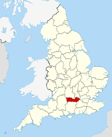
Berkshire shown within England
There are approximately 372,905 listed buildings in England and 2.5% of these are Grade I.[1] This page is a list of these buildings in the county of Berkshire, ordered by building name within place name within district.
Bracknell Forest
| Name | Location | Type | Completed [note 1] | Date designated | Grid ref.[note 2] Geo-coordinates |
Entry number [note 3] | Image |
|---|---|---|---|---|---|---|---|
| Grotto in the Grounds of Ascot Place to South of House at West end of lake | Winkfield | Grotto | c. 1750 | 20 December 1972 | SU9131171181 51°25′56″N 0°41′16″W / 51.432284°N 0.687869°W |
1390475 | 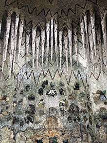 |
Reading
| Name | Location | Type | Completed [note 1] | Date designated | Grid ref.[note 2] Geo-coordinates |
Entry number [note 3] | Image |
|---|---|---|---|---|---|---|---|
| Abbey Gate | The Forbury, Reading | Abbey gatehouse | 12th century to 14th century | 22 March 1957 | SU7188273556 51°27′23″N 0°58′01″W / 51.456429°N 0.966821°W |
1155691 |  |
| St Laurence's Church and churchyard | Reading | Church | Dated 1727 | 22 March 1957 | SU7170873548 51°27′23″N 0°58′10″W / 51.456379°N 0.969327°W |
1113532 |  |
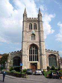
| Reading Minster | Reading | Church | Norman | 22 March 1957 | SU7141173318 51°27′16″N 0°58′25″W / 51.454349°N 0.973647°W |
1113573 | _(cropped).jpg) |
| Greyfriars Church | Friar Street | Church | In use 18th Century | 22 March 1957 | SU7121073589 51°27′25″N 0°58′35″W / 51.456811°N 0.976485°W |
1321952 |  |
| Large barn to south-east of Chazey Court farmhouse | Caversham | Barn | Late C17/early 18th century | 24 October 1951 | SU6915775161 51°28′16″N 1°00′21″W / 51.471197°N 1.005721°W |
1113603 | _(cropped).jpg) |
| Reading Abbey Ruins | Forbury Gardens | Abbey | Now ruined | 22 March 1957 | SU7200273549 51°27′23″N 0°57′54″W / 51.456351°N 0.965096°W |
1113477 | 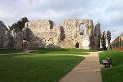 |
Slough
| Name | Location | Type | Completed [note 1] | Date designated | Grid ref.[note 2] Geo-coordinates |
Entry number [note 3] | Image |
|---|---|---|---|---|---|---|---|
| Baylis House, including forecourt walls and pavilions adjoining to North East | Stoke Poges Lane | House | c. 1695 | 29 September 1950 | SU9694780868 51°31′06″N 0°36′15″W / 51.518423°N 0.604165°W |
1113389 | 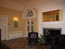 |
| Church of St Laurence | Upton Court Road, Upton-cum-Chalvey | Church | Early 12th century | 29 September 1950 | SU9807479094 51°30′08″N 0°35′18″W / 51.502283°N 0.58842°W |
1251379 | 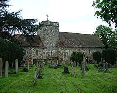 |
| Church of St Mary, Langley | St Mary's Road | Church | 1623 | 29 September 1950 | TQ0048379533 51°30′21″N 0°33′13″W / 51.505806°N 0.5536°W |
1135750 |  |
| Former Service Block Adjoining Baylis House to North East | Stoke Poges Lane | Training College | 1984 | 29 September 1950 | SU9697280892 51°31′07″N 0°36′14″W / 51.518635°N 0.603798°W |
1251374 |  |
| Stable approximately 40 Metres to North of Baylis House | Godolphin Court, Stoke Poges Lane | Stable | Mid to Late 18th century | 29 September 1950 | SU9697280918 51°31′08″N 0°36′14″W / 51.518868°N 0.603791°W |
1313126 | |
West Berkshire


_(geograph_2285756).jpg)
_(geograph_2285762).jpg)
_(geograph_2285778).jpg)
.jpg)
_(geograph_2285849).jpg)

.jpg)


_(14783846173).jpg)
.jpg)
.jpg)

.jpg)

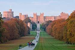
Windsor and Maidenhead
_%26_Sailing_School_(geograph_4408413).jpg)

.jpg)


Wokingham
| Name | Location | Type | Completed [note 1] | Date designated | Grid ref.[note 2] Geo-coordinates |
Entry number [note 3] | Image |
|---|---|---|---|---|---|---|---|
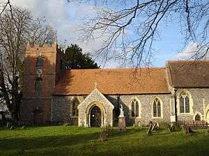
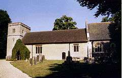
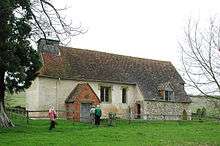
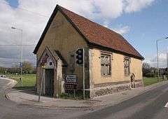
| Church of St James | Church Lane, Finchampstead | Parish Church | From 12th century | 26 January 1967 | SU7928263810 51°22′04″N 0°51′45″W / 51.367828°N 0.862513°W |
1118084 | 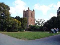 |
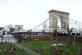
| Henley Bridge | Hart Street, Remenham | Bridge | 18th century | 23 December 1983 | SU7637582642 51°32′15″N 0°54′01″W / 51.537523°N 0.900204°W |
1117419 | 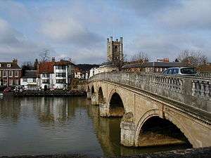 |
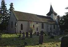
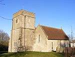
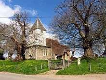
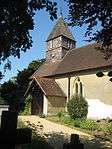
| Church of St James | Church Lane, Ruscombe | Parish Church | 12th century | 26 January 1967 | SU7980676295 51°28′48″N 0°51′08″W / 51.479992°N 0.85218°W |
1154605 | 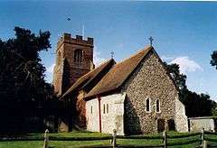 |
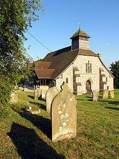
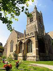
| Church of St Mary the Virgin | Church Lane, Shinfield | Parish Church | Late 12th century | 26 January 1967 | SU7297368198 51°24′29″N 0°57′08″W / 51.408121°N 0.952224°W |
1118131 |  |
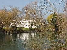
| The Deanery | Thames Street, Sonning | Courtyard House | 1901 | 1 August 1952 | SU7570575617 51°28′28″N 0°54′41″W / 51.47446°N 0.911368°W |
1319459 |  |
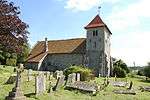
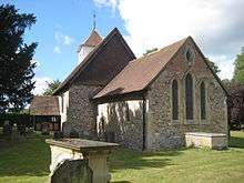
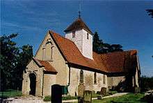
| Church of St Nicholas | Church Hill, Hurst | Parish Church | Early 13th century | 26 January 1967 | SU7948672972 51°27′01″N 0°51′27″W / 51.450164°N 0.857533°W |
1117400 |  |
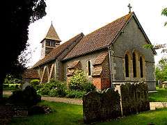
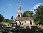
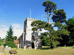
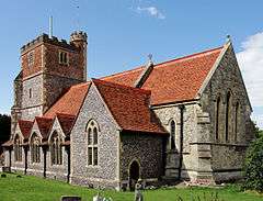
| Church of All Saints | Church Road, Swallowfield | Church | 19th century | 26 January 1967 | SU7317464788 51°22′39″N 0°57′00″W / 51.377439°N 0.950036°W |
1118061 |  |
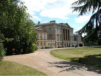
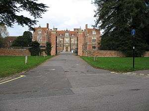
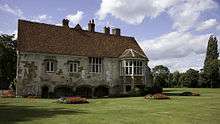
| Farley Hall | Farley Hill Road, Swallowfield | Country House | c. 1730 | 1 August 1952 | SU7501464627 51°22′33″N 0°55′25″W / 51.375752°N 0.923638°W |
1118066 | .jpg) |
| Henry Lucas Hospital and attached water pumps | Chapel Green, Wokingham | Hospital | 1663-1665 | 12 November 1951 | SU8125167394 51°23′59″N 0°50′00″W / 51.399769°N 0.833416°W |
1303641 | .jpg) |
See also
Notes
- 1 2 3 4 5 6 The date given is the date used by Historic England as significant for the initial building or that of an important part in the structure's description.
- 1 2 3 4 5 6 Sometimes known as OSGB36, the grid reference is based on the British national grid reference system used by the Ordnance Survey.
- 1 2 3 4 5 6 The "List Entry Number" is a unique number assigned to each listed building and scheduled monument by Historic England.
References
- ↑ "Listed Buildings". English Heritage. 2010. Archived from the original on 24 January 2013. Retrieved 23 August 2011.
External links
![]()
Berkshire Portal | |
| Unitary authorities | |
| Major settlements | |
| Topics | |
This article is issued from
Wikipedia.
The text is licensed under Creative Commons - Attribution - Sharealike.
Additional terms may apply for the media files.