Gragg, North Carolina
| Gragg | |
|---|---|
| Unincorporated community | |
 Gragg, NC | |
 Gragg Location within the state of North Carolina | |
| Coordinates: 36°04′23″N 81°46′14″W / 36.07306°N 81.77056°WCoordinates: 36°04′23″N 81°46′14″W / 36.07306°N 81.77056°W | |
| Country | United States |
| State | North Carolina |
| County | Avery County |
| Elevation | 2,664 ft (812 m) |
| Time zone | UTC-5 (Eastern (EST)) |
| • Summer (DST) | UTC-4 (EDT) |
| ZIP code | 28645 |
| Area code(s) | 828 |
| GNIS feature ID | 1020484[1] |
Gragg is an unincorporated community in Avery County, North Carolina; spanning approximately one-half mile in radius from the intersection of Edgemont Road and Globe Road.[2] Gragg can be accessed from US 221 via mile marker #305 on the Blue Ridge Parkway. The area was originally known as "'Carey's Flat'".
Photo gallery
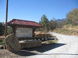
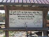 Welcome to Gragg, NC
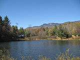 Coffey Trout Lake
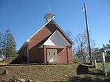 New Hopewell Baptist Church
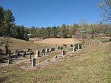 New Hopewell Baptist Church Cemetery
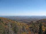 View overlooking Gragg, NC from the Stack Rock Creek Bridge on the Blue Ridge Parkway (mile marker 304.5)
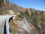 Stack Rock Creek Bridge at Blue Ridge Parkway mile marker 304.5
See also
External links
References
Municipalities and communities of Avery County, North Carolina, United States | ||
|---|---|---|
| Towns |  | |
| Villages | ||
| Unincorporated communities | ||
| Footnotes | ‡This populated place also has portions in an adjacent county or counties | |
This article is issued from
Wikipedia.
The text is licensed under Creative Commons - Attribution - Sharealike.
Additional terms may apply for the media files.