Limasawa
| Limasawa | |
|---|---|
| Municipality | |
| Municipality of Limasawa | |
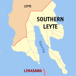 Map of Southern Leyte with Limasawa highlighted | |
.svg.png) Limasawa Location within the Philippines | |
| Coordinates: 9°53′37″N 125°31′18″E / 9.89361°N 125.52167°ECoordinates: 9°53′37″N 125°31′18″E / 9.89361°N 125.52167°E | |
| Country |
|
| Region | Eastern Visayas (Region VIII) |
| Province | Southern Leyte |
| District | Lone District |
| Barangays | 6 (see Barangays) |
| Government [1] | |
| • Type | Sangguniang Bayan |
| • Mayor | Melchor Palero Petracorta |
| • Vice Mayor | Sim Balane Olojan |
| • Electorate | 4,071 voters (2016) |
| Area [2] | |
| • Total | 6.98 km2 (2.69 sq mi) |
| Population (2015 census)[3] | |
| • Total | 6,061 |
| • Density | 870/km2 (2,200/sq mi) |
| Time zone | UTC+8 (PST) |
| ZIP code | 6605 |
| PSGC | 086419000 |
| IDD : area code | +63 (0)53 |
| Climate type | Tropical rainforest climate |
| Income class | 6th municipal income class |
| Revenue (₱) | 34,514,380.48 (2016) |
| Native languages |
Boholano dialect Cebuano Tagalog |
Limasawa, officially the Municipality of Limasawa, is a 6th class municipality in the province of Southern Leyte, Philippines. According to the 2015 census, it has a population of 6,061 people.[3]
It is the smallest municipality in the province, in both area and population. Located at an island of the same name, it lies south of Leyte, in the Mindanao or Bohol Sea. The island, also known as Sarangani Island, is about 10 kilometres (6.2 mi) long from north to south.
Limasawa is famous as it is believed to be the site of the first mass in Philippine soil[4], officiated on Easter Sunday of March 31, 1521 by Father Pedro de Valderrama under the fleet of Ferdinand Magellan. The island is one of the early Pacific contact sites between the East and the West.
Barangays
Limasawa is politically subdivided into 6 barangays.
- Cabulihan
- Lugsongan
- Magallanes
- San Agustin (Tawid)
- San Bernardo (Tigib)
- Triana
Demographics
| Population census of Limasawa | ||
|---|---|---|
| Year | Pop. | ±% p.a. |
| 1990 | 4,519 | — |
| 1995 | 4,927 | +1.63% |
| 2000 | 5,157 | +0.98% |
| 2007 | 5,831 | +1.71% |
| 2010 | 5,867 | +0.22% |
| 2015 | 6,061 | +0.62% |
| Source: Philippine Statistics Authority [3][5][6][7] | ||
See also
References
- ↑ "Municipality". Quezon City, Philippines: Department of the Interior and Local Government. Retrieved 31 May 2013.
- ↑ "Province: Southern Leyte". PSGC Interactive. Quezon City, Philippines: Philippine Statistics Authority. Retrieved 12 November 2016.
- 1 2 3 Census of Population (2015). "Region VIII (Eastern Visayas)". Total Population by Province, City, Municipality and Barangay. PSA. Retrieved 20 June 2016.
- ↑ referred to in travel accounts of Antonio Pigafetta as "Mazaua"
- ↑ Census of Population and Housing (2010). "Region VIII (Eastern Visayas)". Total Population by Province, City, Municipality and Barangay. NSO. Retrieved 29 June 2016.
- ↑ Censuses of Population (1903–2007). "Region VIII (Eastern Visayas)". Table 1. Population Enumerated in Various Censuses by Province/Highly Urbanized City: 1903 to 2007. NSO.
- ↑ "Province of Southern Leyte". Municipality Population Data. Local Water Utilities Administration Research Division. Retrieved 17 December 2016.
External links
| Wikivoyage has a travel guide for Limasawa. |