Leskovec nad Moravicí
| Leskovec nad Moravicí | |||
|---|---|---|---|
| Municipality and village | |||
| |||
 Leskovec nad Moravicí Location in the Czech Republic | |||
| Coordinates: 49°55′N 17°34′E / 49.917°N 17.567°ECoordinates: 49°55′N 17°34′E / 49.917°N 17.567°E | |||
| Country |
| ||
| Region | Moravian-Silesian Region | ||
| District | Bruntál District | ||
| Area | |||
| • Total | 6.02 sq mi (15.59 km2) | ||
| Elevation | 1,670 ft (510 m) | ||
| Population (2011) | |||
| • Total | 461 | ||
| • Density | 77/sq mi (30/km2) | ||
| Time zone | UTC+1 (CET) | ||
| • Summer (DST) | UTC+2 (CEST) | ||

Leskovec nad Moravicí, previously also Špachov (German: Spachendorf) is a village and municipality in Bruntál District in the Moravian-Silesian Region of the Czech Republic. It lies on the shore of Slezská Harta Dam.
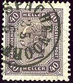
German name used in 1904 in Austrian Silesia province
This article is issued from
Wikipedia.
The text is licensed under Creative Commons - Attribution - Sharealike.
Additional terms may apply for the media files.