Lenora, Kansas
| Lenora, Kansas | |
|---|---|
| City | |
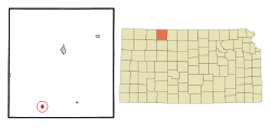 Location within Norton County and Kansas | |
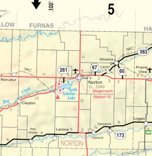 KDOT map of Norton County (legend) | |
| Coordinates: 39°36′40″N 100°0′5″W / 39.61111°N 100.00139°WCoordinates: 39°36′40″N 100°0′5″W / 39.61111°N 100.00139°W | |
| Country | United States |
| State | Kansas |
| County | Norton |
| Area[1] | |
| • Total | 0.51 sq mi (1.32 km2) |
| • Land | 0.51 sq mi (1.32 km2) |
| • Water | 0 sq mi (0 km2) |
| Elevation | 2,267 ft (691 m) |
| Population (2010)[2] | |
| • Total | 250 |
| • Estimate (2016)[3] | 235 |
| • Density | 490/sq mi (190/km2) |
| Time zone | UTC-6 (Central (CST)) |
| • Summer (DST) | UTC-5 (CDT) |
| ZIP code | 67645 |
| Area code(s) | 785 |
| FIPS code | 20-39400 [4] |
| GNIS feature ID | 0471118 [5] |
Lenora is a city in Norton County, Kansas, United States. As of the 2010 census, the city population was 250.[6]
History
Lenora was founded in 1873.[7] It was named for Mrs. Lenora Hauser, a pioneer settler.[8][9]
The first post office in Lenora was established in June 1874.[10]
Geography
Lenora is located at 39°36′40″N 100°0′5″W / 39.61111°N 100.00139°W (39.610975, -100.001391).[11] According to the United States Census Bureau, the city has a total area of 0.51 square miles (1.32 km2), all land.[1]
Demographics
| Historical population | |||
|---|---|---|---|
| Census | Pop. | %± | |
| 1880 | 34 | — | |
| 1890 | 231 | 579.4% | |
| 1900 | 247 | 6.9% | |
| 1910 | 454 | 83.8% | |
| 1920 | 520 | 14.5% | |
| 1930 | 519 | −0.2% | |
| 1940 | 537 | 3.5% | |
| 1950 | 511 | −4.8% | |
| 1960 | 512 | 0.2% | |
| 1970 | 439 | −14.3% | |
| 1980 | 444 | 1.1% | |
| 1990 | 329 | −25.9% | |
| 2000 | 306 | −7.0% | |
| 2010 | 250 | −18.3% | |
| Est. 2016 | 235 | [3] | −6.0% |
| U.S. Decennial Census | |||
2010 census
As of the census[2] of 2010, there were 250 people, 126 households, and 69 families residing in the city. The population density was 490.2 inhabitants per square mile (189.3/km2). There were 182 housing units at an average density of 356.9 per square mile (137.8/km2). The racial makeup of the city was 98.0% White and 2.0% from two or more races. Hispanic or Latino of any race were 2.8% of the population.
There were 126 households of which 18.3% had children under the age of 18 living with them, 48.4% were married couples living together, 4.0% had a female householder with no husband present, 2.4% had a male householder with no wife present, and 45.2% were non-families. 40.5% of all households were made up of individuals and 16.6% had someone living alone who was 65 years of age or older. The average household size was 1.98 and the average family size was 2.59.
The median age in the city was 50.8 years. 16.8% of residents were under the age of 18; 3.6% were between the ages of 18 and 24; 20.8% were from 25 to 44; 30.8% were from 45 to 64; and 28% were 65 years of age or older. The gender makeup of the city was 52.8% male and 47.2% female.
2000 census
As of the census[4] of 2000, there were 306 people, 141 households, and 83 families residing in the city. The population density was 633.8 people per square mile (246.1/km²). There were 196 housing units at an average density of 405.9 per square mile (157.7/km²). The racial makeup of the city was 96.41% White, 0.98% African American, 0.33% Asian, and 2.29% from two or more races. Hispanic or Latino of any race were 1.31% of the population.
There were 141 households out of which 21.3% had children under the age of 18 living with them, 49.6% were married couples living together, 5.7% had a female householder with no husband present, and 41.1% were non-families. 38.3% of all households were made up of individuals and 19.9% had someone living alone who was 65 years of age or older. The average household size was 2.17 and the average family size was 2.88.
In the city, the population was spread out with 21.6% under the age of 18, 6.2% from 18 to 24, 27.5% from 25 to 44, 22.2% from 45 to 64, and 22.5% who were 65 years of age or older. The median age was 42 years. For every 100 females, there were 102.6 males. For every 100 females age 18 and over, there were 106.9 males.
The median income for a household in the city was $32,500, and the median income for a family was $39,250. Males had a median income of $27,361 versus $18,875 for females. The per capita income for the city was $15,426. About 2.2% of families and 7.3% of the population were below the poverty line, including none of those under the age of eighteen and 22.6% of those sixty five or over.
Education
Lenora is served by USD 211 Norton Community Schools.[12]
Lenora schools were closed through school unification. The Lenora High School mascot was Lenora Wildcats.[13]
References
- 1 2 "US Gazetteer files 2010". United States Census Bureau. Archived from the original on 2012-07-14. Retrieved 2012-07-06.
- 1 2 "American FactFinder". United States Census Bureau. Retrieved 2012-07-06.
- 1 2 "Population and Housing Unit Estimates". Retrieved June 9, 2017.
- 1 2 "American FactFinder". United States Census Bureau. Retrieved 2008-01-31.
- ↑ "US Board on Geographic Names". United States Geological Survey. 2007-10-25. Retrieved 2008-01-31.
- ↑ "2010 City Population and Housing Occupancy Status". U.S. Census Bureau. Archived from the original on July 21, 2011. Retrieved September 15, 2011.
- ↑ Blackmar, Frank Wilson (1912). Kansas: A Cyclopedia of State History, Volume 2. Standard Publishing Company. p. 138.
- ↑ Kansas State Historical Society (1916). Biennial Report of the Board of Directors of the Kansas State Historical Society. Kansas State Printing Plant. p. 254.
- ↑ Gannett, Henry (1905). The Origin of Certain Place Names in the United States. U.S. Government Printing Office. p. 185.
- ↑ "Kansas Post Offices, 1828-1961". Kansas Historical Society. Archived from the original on 9 October 2013. Retrieved 10 June 2014.
- ↑ "US Gazetteer files: 2010, 2000, and 1990". United States Census Bureau. 2011-02-12. Retrieved 2011-04-23.
- ↑ "Norton Community Schools". USD 211. Retrieved 7 January 2017.
- ↑ "Lenoras Wildcats Look Super", The Salina Journal, 30 November 1980, p.96.
External links
| Wikimedia Commons has media related to Lenora, Kansas. |
- City
- Schools
- USD 211, local school district
- Maps
- Lenora City Map, KDOT
Municipalities and communities of Norton County, Kansas, United States | ||
|---|---|---|
| Cities | 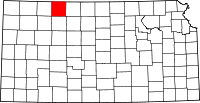 | |
| Unincorporated community | ||
| Ghost towns | ||
| Footnotes | ‡This populated place also has portions in an adjacent county or counties | |