Almena, Kansas
| Almena, Kansas | |
|---|---|
| City | |
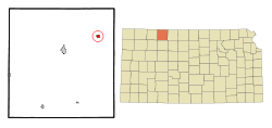 Location within Norton County and Kansas | |
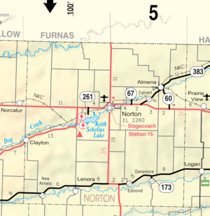 KDOT map of Norton County (legend) | |
| Coordinates: 39°53′30″N 99°42′32″W / 39.89167°N 99.70889°WCoordinates: 39°53′30″N 99°42′32″W / 39.89167°N 99.70889°W | |
| Country | United States |
| State | Kansas |
| County | Norton |
| Area[1] | |
| • Total | 0.61 sq mi (1.58 km2) |
| • Land | 0.61 sq mi (1.58 km2) |
| • Water | 0 sq mi (0 km2) |
| Elevation | 2,152 ft (656 m) |
| Population (2010)[2] | |
| • Total | 408 |
| • Estimate (2016)[3] | 389 |
| • Density | 670/sq mi (260/km2) |
| Time zone | UTC-6 (Central (CST)) |
| • Summer (DST) | UTC-5 (CDT) |
| ZIP code | 67622 |
| Area code(s) | 785 |
| FIPS code | 20-01425 [4] |
| GNIS feature ID | 0471748 [5] |
Almena is a city in Norton County, Kansas, United States. As of the 2010 census, the city population was 408.[6]
History
Almena was a shipping point located at the junction of two railroads.[7] It was named by Margaret Brown Coleman, an early settler and first postmistress,[8] for Almena, Michigan,[9] her hometown.
The first post office in Almena was established in June 1872.[10]
Geography
Almena is located at 39°53′30″N 99°42′32″W / 39.89167°N 99.70889°W (39.891535, -99.708865).[11] According to the United States Census Bureau, the city has a total area of 0.61 square miles (1.58 km2), all land.[1]
Demographics
| Historical population | |||
|---|---|---|---|
| Census | Pop. | %± | |
| 1890 | 366 | — | |
| 1900 | 491 | 34.2% | |
| 1910 | 702 | 43.0% | |
| 1920 | 674 | −4.0% | |
| 1930 | 703 | 4.3% | |
| 1940 | 543 | −22.8% | |
| 1950 | 616 | 13.4% | |
| 1960 | 555 | −9.9% | |
| 1970 | 489 | −11.9% | |
| 1980 | 517 | 5.7% | |
| 1990 | 423 | −18.2% | |
| 2000 | 469 | 10.9% | |
| 2010 | 408 | −13.0% | |
| Est. 2016 | 389 | [3] | −4.7% |
| U.S. Decennial Census | |||
2010 census
As of the census[2] of 2010, there were 408 people, 180 households, and 102 families residing in the city. The population density was 668.9 inhabitants per square mile (258.3/km2). There were 217 housing units at an average density of 355.7 per square mile (137.3/km2). The racial makeup of the city was 97.5% White, 0.5% African American, 0.2% Native American, 1.5% from other races, and 0.2% from two or more races. Hispanic or Latino of any race were 2.7% of the population.
There were 180 households of which 28.9% had children under the age of 18 living with them, 42.8% were married couples living together, 7.8% had a female householder with no husband present, 6.1% had a male householder with no wife present, and 43.3% were non-families. 38.9% of all households were made up of individuals and 21.1% had someone living alone who was 65 years of age or older. The average household size was 2.27 and the average family size was 3.06.
The median age in the city was 41.2 years. 27.5% of residents were under the age of 18; 7.2% were between the ages of 18 and 24; 21.4% were from 25 to 44; 25.8% were from 45 to 64; and 18.1% were 65 years of age or older. The gender makeup of the city was 51.7% male and 48.3% female.
2000 census
As of the census[4] of 2000, there were 469 people, 197 households, and 125 families residing in the city. The population density was 777.9 people per square mile (301.8/km²). There were 229 housing units at an average density of 379.8 per square mile (147.4/km²). The racial makeup of the city was 98.72% White, 0.21% African American, and 1.07% from two or more races. Hispanic or Latino of any race were 0.64% of the population.
There were 197 households out of which 30.5% had children under the age of 18 living with them, 53.8% were married couples living together, 7.1% had a female householder with no husband present, and 36.5% were non-families. 33.0% of all households were made up of individuals and 20.3% had someone living alone who was 65 years of age or older. The average household size was 2.38 and the average family size was 3.06.
In the city, the population was spread out with 27.7% under the age of 18, 6.8% from 18 to 24, 24.3% from 25 to 44, 22.4% from 45 to 64, and 18.8% who were 65 years of age or older. The median age was 38 years. For every 100 females, there were 93.0 males. For every 100 females age 18 and over, there were 85.2 males.
The median income for a household in the city was $27,083, and the median income for a family was $33,958. Males had a median income of $22,237 versus $15,714 for females. The per capita income for the city was $14,433. About 10.4% of families and 15.3% of the population were below the poverty line, including 20.1% of those under age 18 and 11.3% of those age 65 or over.
Education
Almena is served by USD 212 Northern Valley Schools. The Northern Valley High School mascot is Huskies.[12]
Prior to school unification, the Almena High School mascot was also Huskies.
References
- 1 2 "US Gazetteer files 2010". United States Census Bureau. Archived from the original on 2012-01-24. Retrieved 2012-07-06.
- 1 2 "American FactFinder". United States Census Bureau. Retrieved 2012-07-06.
- 1 2 "Population and Housing Unit Estimates". Retrieved June 9, 2017.
- 1 2 "American FactFinder". United States Census Bureau. Archived from the original on 2013-09-11. Retrieved 2008-01-31.
- ↑ "US Board on Geographic Names". United States Geological Survey. 2007-10-25. Retrieved 2008-01-31.
- ↑ "2010 City Population and Housing Occupancy Status". U.S. Census Bureau. Archived from the original on July 21, 2011. Retrieved September 15, 2011.
- ↑ Blackmar, Frank Wilson (1912). Kansas: A Cyclopedia of State History, Embracing Events, Institutions, Industries, Counties, Cities, Towns, Prominent Persons, Etc. Standard Publishing Company. p. 65.
- ↑ The Coleman Saga, by Charles Myron Coleman
- ↑ "Profile for Almena, Kansas". ePodunk. Retrieved 21 June 2014.
- ↑ "Kansas Post Offices, 1828-1961". Kansas Historical Society. Archived from the original on October 9, 2013. Retrieved 10 June 2014.
- ↑ "US Gazetteer files: 2010, 2000, and 1990". United States Census Bureau. 2011-02-12. Retrieved 2011-04-23.
- ↑ "Northern Valley Schools". USD 212. Retrieved 7 January 2017.
External links
- City
- Schools
- USD 212, local school district
- Maps
- Almena City Map, KDOT
Municipalities and communities of Norton County, Kansas, United States | ||
|---|---|---|
| Cities | 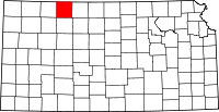 | |
| Unincorporated community | ||
| Ghost towns | ||
| Footnotes | ‡This populated place also has portions in an adjacent county or counties | |