Lem Ferreira
| Lem Ferreira | |
|---|---|
| Neighbourhood | |
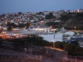 Early morning view of Lem Ferreira from the Platô | |
| Coordinates: 14°55′17″N 23°30′06″W / 14.9215°N 23.5016°WCoordinates: 14°55′17″N 23°30′06″W / 14.9215°N 23.5016°W | |
| Country | Cape Verde |
| Island | Santiago Island |
| City | Praia |
| Population (2010) | 1,456 |
| Postal code | 7600 |
| Website | www.cmpraia.cv |
Lem Ferreira is a subdivision of the city of Praia in the island of Santiago, Cape Verde. Its population was 1,456 at the 2010 census.[1] It is situated directly east of the city centre (Platô), on the east bank of Ribeira da Trindade. Bordering neighborhoods include Agua Funda to the northeast, Achada Grande Frente to the east and the south and Platô and Praia Negra to the west.

Colorful houses of Lem Ferreira west of Achada Grande
.jpg)
View of Lem Ferreira from Platô
References
- ↑ "2010 Census results Santiago". Instituto Nacional de Estatística Cabo Verde (in Portuguese). 24 November 2016.
| Wikimedia Commons has media related to Lem Ferreira. |
| Neighbourhoods |  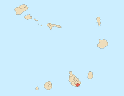 | |
|---|---|---|
| Geographical features | ||
| Education | ||
| Landmarks | ||
| Culture | ||
| Sports | ||
| Transportation | ||
| Media | ||
| History | ||
This article is issued from
Wikipedia.
The text is licensed under Creative Commons - Attribution - Sharealike.
Additional terms may apply for the media files.