Achada Santo António
| Achada Santo António | |
|---|---|
| Neighbourhood | |
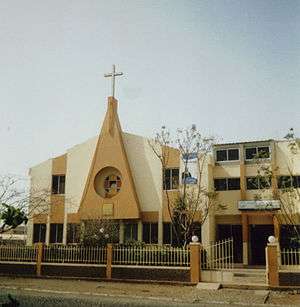
 Chapel of Santo António | |
| Coordinates: 14°54′33″N 23°31′02″W / 14.9093°N 23.5171°WCoordinates: 14°54′33″N 23°31′02″W / 14.9093°N 23.5171°W | |
| Country | Cape Verde |
| Island | Santiago Island |
| City | Praia |
| Population (2010) | 12,965 |
| Postal code | 7603 |
| Website | www.cmpraia.cv |
Achada Santo António is a subdivision of the city of Praia in the island of Santiago, Cape Verde. Its population was 12,965 at the 2010 census.[1] It is situated near the Atlantic coast, southwest of the city centre.
The Protestant church
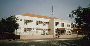
Health Center
Adjacent neighbourhoods are Várzea to the north, Gamboa or Chã das Areias to the northeast, the beach area of Prainha to the east and also where much of the embassies are located, Quebra Canela to the south, Tira Chapéu to the west and Terra Branca to the north.
Landmarks and points of interest
- Chapel of Santo António (Saint Anthony)
- Protestant Church
- École Internationale Les Alizés, a French school
- Institute of Paedagogics
References
- ↑ "2010 Census results Santiago". Instituto Nacional de Estatística Cabo Verde (in Portuguese). 24 November 2016.
| Neighbourhoods |  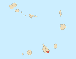 | |
|---|---|---|
| Geographical features | ||
| Education | ||
| Landmarks | ||
| Culture | ||
| Sports | ||
| Transportation | ||
| Media | ||
| History | ||
This article is issued from
Wikipedia.
The text is licensed under Creative Commons - Attribution - Sharealike.
Additional terms may apply for the media files.