Leedstown
| Leedstown | |
|---|---|
 Leedstown Leedstown shown within Cornwall | |
| OS grid reference | SW604343 |
| Civil parish |
|
| Unitary authority | |
| Ceremonial county | |
| Region | |
| Country | England |
| Sovereign state | United Kingdom |
| Post town | HAYLE |
| Postcode district | TR27 |
| Police | Devon and Cornwall |
| Fire | Cornwall |
| Ambulance | South Western |
| EU Parliament | South West England |
| UK Parliament | |
Leedstown is a village on the B3280 road between Helston and Hayle in the civil parish of Crowan (where the 2011 census population is included.), Cornwall, England.[1] It lies 5.5 miles (8.9 km) north-west of Helston and 3 miles (4.8 km) south-east of Hayle at 310 feet (94 m) above sea level.[1] Halfway between the north and south coasts, Leedstown is ideally situated for visiting all of West Cornwall's beautiful beaches.
Leedstown got its name from the Duke of Leeds, who married the daughter of the St Aubyn family. The village has a primary school, post office/stores a pub and a garage.
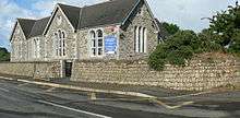
The first school, described as ″a large boys school″ was funded by John St Aubyn in, or around 1813 and a girls school was built in the 1840s. A board school was opened June 1879. Designed by Mr W Carah of Crowan the school had two large classrooms[2]
Remains of the former Crenver and Wheal Abraham mines may be seen along the road to Crenver Grove. The former Godolphin Mine is in the woods near Godolphin Hall; copper was mined here before the 17th century.[3] Leedstown is situated in the Cornwall and West Devon Mining Landscape which was designated as a World Heritage Site in 2006.
References
- 1 2 "Magic Map Application". Defra. Retrieved 10 January 2016.
- ↑ "Education at Crowan". The Cornishman (49). 19 June 1879. p. 6.
- ↑ Todd, A. C. & Laws, Peter (1972) The Industrial Archaeology of Cornwall. Newton Abbot: David & Charles; p. 231
Cornwall Portal | |
| Unitary authorities | |
| Major settlements |
|
| Rivers | |
| Topics | |