Lecanto, Florida
| Lecanto, Florida | |
|---|---|
| Census-designated place | |
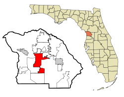 Location in Citrus County and the state of Florida | |
| Coordinates: 28°51′N 82°29′W / 28.850°N 82.483°WCoordinates: 28°51′N 82°29′W / 28.850°N 82.483°W | |
| Country |
|
| State |
|
| County | Citrus |
| Area | |
| • Total | 26.94 sq mi (69.78 km2) |
| • Land | 26.93 sq mi (69.76 km2) |
| • Water | 0.008 sq mi (0.02 km2) |
| Elevation | 46 ft (14 m) |
| Population (2010) | |
| • Total | 5,882 |
| • Density | 218/sq mi (84.3/km2) |
| Time zone | UTC-5 (Eastern (EST)) |
| • Summer (DST) | UTC-4 (EDT) |
| ZIP codes | 34460-34461 |
| Area code(s) | 352 |
| FIPS code | 12-39825[1] |
| GNIS feature ID | 0285422[2] |
Lecanto is an unincorporated community and census-designated place (CDP) in Citrus County, Florida, United States. As of the 2010 census it had a population of 5,882,[3] up from 5,161 in 2000. It is home to several county government facilities such as the Citrus County Sheriff's Office and the Citrus Campus of the College of Central Florida.
Geography
Lecanto is located at the geographic center of Citrus County at 28°51′N 82°29′W / 28.850°N 82.483°W (28.8488, -82.4811).[4] State Road 44 (Gulf to Lake Highway) runs through the center of the CDP, leading west 7 miles (11 km) to Crystal River and east 10 miles (16 km) to Inverness, the county seat.
According to the United States Census Bureau, the CDP has a total area of 26.9 square miles (69.8 km2), of which 0.008 square miles (0.02 km2), or 0.03%, is water.[3]
Demographics
| Historical population | |||
|---|---|---|---|
| Census | Pop. | %± | |
| 1990 | 1,243 | — | |
| 2000 | 5,161 | 315.2% | |
| 2010 | 5,882 | 14.0% | |
| source:[5][3] | |||
As of the census[1] of 2000, there were 5,161 people, 1,861 households, and 1,369 families residing in the CDP. The population density was 190.8 people per square mile (73.7/km²). There were 2,095 housing units at an average density of 77.5/sq mi (29.9/km²). The racial makeup of the CDP was 93.88% White, 2.96% African American, 0.76% Native American, 0.76% Asian, 0.02% Pacific Islander, 0.43% from other races, and 1.20% from two or more races. Hispanic or Latino of any race were 2.71% of the population.
There were 1,861 households out of which 25.8% had children under the age of 18 living with them, 61.8% were married couples living together, 7.9% had a female householder with no husband present, and 26.4% were non-families. 22.0% of all households were made up of individuals and 11.7% had someone living alone who was 65 years of age or older. The average household size was 2.43 and the average family size was 2.81.
In the CDP, the population was spread out with 20.5% under the age of 18, 6.3% from 18 to 24, 23.4% from 25 to 44, 27.1% from 45 to 64, and 22.6% who were 65 years of age or older. The median age was 45 years. For every 100 females, there were 105.6 males. For every 100 females age 18 and over, there were 101.4 males.
The median income for a household in the CDP was $40,826, and the median income for a family was $46,987. Males had a median income of $30,625 versus $27,296 for females. The per capita income for the CDP was $20,625. About 5.3% of families and 9.1% of the population were below the poverty line, including 13.8% of those under age 18 and 4.8% of those age 65 or over.
Lecanto is the site of the privately operated Citrus County Detention Facility, which holds a maximum of 760 prisoners of the county, of the federal government, and prisoners from the Virgin Islands.[6]
Education
The CDP is served by Citrus County Schools.[7] Elementary schools serving sections of the CDP include Lecanto, Forest Ridge, Rock Crusher, and Hernando.[8] Lecanto Middle School,[9] and Lecanto High School serve the CDP.[10]
College of Central Florida is in Lecanto.
Public transportation
Citrus County Transit has its headquarters in Lecanto, and runs one flex-route service in the area.[11]
References
- 1 2 "American FactFinder". United States Census Bureau. Retrieved 2008-01-31.
- ↑ "US Board on Geographic Names". United States Geological Survey. 2007-10-25. Retrieved 2008-01-31.
- 1 2 3 "Geographic Identifiers: 2010 Demographic Profile Data (G001): Lecanto CDP, Florida". U.S. Census Bureau, American Factfinder. Retrieved June 26, 2014.
- ↑ "US Gazetteer files: 2010, 2000, and 1990". United States Census Bureau. 2011-02-12. Retrieved 2011-04-23.
- ↑ "CENSUS OF POPULATION AND HOUSING (1790-2000)". U.S. Census Bureau. Retrieved 2010-07-30.
- ↑ "Citrus County Detention Facility". Corrections Corporation of America. Retrieved 11 September 2016.
- ↑ "2010 CENSUS - CENSUS BLOCK MAP (INDEX): Lecanto CDP, FL." U.S. Census Bureau. Retrieved on February 3, 2017. See map pages. Compare this map to the attendance boundary maps of the school district.
- ↑ "Citrus County Elementary School Attendance Boundaries." Citrus County Schools. Retrieved on February 2, 2017.
- ↑ "Citrus County Middle School Attendance Boundaries." Citrus County Schools. Retrieved on February 2, 2017.
- ↑ "Citrus County High School Attendance Boundaries." Citrus County Schools. Retrieved on February 2, 2017.
- ↑ http://www.bocc.citrus.fl.us/commserv/trans/transportation.htm
Municipalities and communities of Citrus County, Florida, United States | ||
|---|---|---|
| Cities | 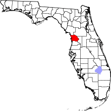 | |
| CDPs | ||
| Unincorporated communities |
| |
| Ghost town | ||