Beverly Hills, Florida
| Beverly Hills, Florida | |
|---|---|
| Census-designated place | |
 Location in Citrus County and the state of Florida | |
| Coordinates: 28°55′3″N 82°27′22″W / 28.91750°N 82.45611°WCoordinates: 28°55′3″N 82°27′22″W / 28.91750°N 82.45611°W | |
| Country |
|
| State |
|
| County | Citrus |
| Area | |
| • Total | 3.0 sq mi (7.7 km2) |
| • Land | 3.0 sq mi (7.7 km2) |
| • Water | 0 sq mi (0 km2) |
| Elevation | 102 ft (31 m) |
| Population (2010) | |
| • Total | 8,445 |
| • Density | 2,853/sq mi (1,101.7/km2) |
| Time zone | UTC-5 (Eastern (EST)) |
| • Summer (DST) | UTC-4 (EDT) |
| ZIP codes | 34464-34465 |
| Area code(s) | 352 |
| FIPS code | 12-06125[1] |
| GNIS feature ID | 0304633[2] |
Beverly Hills is an unincorporated community and census-designated place in Citrus County, Florida, United States. The population was 8,445 at the 2010 census.[3]
Geography
Beverly Hills is located in north-central Citrus County at 28°55′03″N 82°27′22″W / 28.917466°N 82.456167°W.[4] It is nearly surrounded by the community of Pine Ridge, except for a small area on the west where it is bordered by Black Diamond. County Road 491 (North Lecanto Highway) forms the northwestern edge of the Beverly Hills CDP, leading northeast 4 miles (6 km) to U.S. Route 41 and southwest 5 miles (8 km) to State Road 44 in Lecanto.
According to the United States Census Bureau, the CDP has a total area of 3.0 square miles (7.7 km2), all land.[3]
Demographics
As of the census[1] of 2000, there were 8,317 people, 4,401 households, and 2,583 families residing in the CDP. The population density was 2,922.0 people per square mile (1,126.7/km²). There were 4,925 housing units at an average density of 1,730.3/sq mi (667.2/km²). The racial makeup of the CDP was 95.90% White, 1.71% African American, 0.19% Native American, 0.60% Asian, 0.01% Pacific Islander, 0.38% from other races, and 1.20% from two or more races. Hispanic or Latino of any race were 3.97% of the population.
There were 4,401 households out of which 10.9% had children under the age of 18 living with them, 50.4% were married couples living together, 6.5% had a female householder with no husband present, and 41.3% were non-families. 36.9% of all households were made up of individuals and 28.5% had someone living alone who was 65 years of age or older. The average household size was 1.87 and the average family size was 2.35.
In the CDP, the population was spread out with 10.8% under the age of 18, 3.4% from 18 to 24, 13.2% from 25 to 44, 17.6% from 45 to 64, and 54.9% who were 65 years of age or older. The median age was 68 years. For every 100 females, there were 80.6 males. For every 100 females age 18 and over, there were 78.2 males.
The median income for a household in the CDP was $24,875, and the median income for a family was $31,505. Males had a median income of $27,500 versus $16,857 for females. The per capita income for the CDP was $17,014. About 8.4% of families and 12.4% of the population were below the poverty line, including 20.3% of those under age 18 and 9.0% of those age 65 or over.
Public transportation
Citrus County Transit's Orange route serves Beverly Hills.[5]
Education
The CDP is served by Citrus County Schools.[6] Residents are divided between Forest Ridge Elementary School and Central Ridge Elementary School.[7] Residents are divided between Citrus Springs Middle and Lecanto Middle.[8] All residents are zoned to Lecanto High School.[9]
The Central Ridge Library of Citrus Libraries is in Beverly Hills.[10]
References
- 1 2 "American FactFinder". United States Census Bureau. Archived from the original on 2013-09-11. Retrieved 2008-01-31.
- ↑ "US Board on Geographic Names". United States Geological Survey. 2007-10-25. Retrieved 2008-01-31.
- 1 2 "Geographic Identifiers: 2010 Demographic Profile Data (G001): Beverly Hills CDP, Florida". U.S. Census Bureau, American Factfinder. Retrieved June 25, 2014.
- ↑ "US Gazetteer files: 2010, 2000, and 1990". United States Census Bureau. 2011-02-12. Retrieved 2011-04-23.
- ↑ http://www.bocc.citrus.fl.us/commserv/trans/transportation.htm
- ↑ "2010 CENSUS - CENSUS BLOCK MAP (INDEX): Beverly Hills CDP, FL." U.S. Census Bureau. Retrieved on February 3, 2017. Compare this map to the attendance boundary maps of the school district.
- ↑ "Citrus County Elementary School Attendance Boundaries Archived 2015-02-26 at the Wayback Machine.." Citrus County Schools. Retrieved on February 2, 2017.
- ↑ "Citrus County Middle School Attendance Boundaries Archived 2015-02-26 at the Wayback Machine.." Citrus County Schools. Retrieved on February 2, 2017.
- ↑ "Citrus County High School Attendance Boundaries Archived 2015-02-26 at the Wayback Machine.." Citrus County Schools. Retrieved on February 2, 2017.
- ↑ "Locations & Hours." Citrus Libraries. Retrieved on February 4, 2017. "CENTRAL RIDGE PUBLIC LIBRARY 425 W. Roosevelt Blvd. Beverly Hills, FL 34465"
External links
Municipalities and communities of Citrus County, Florida, United States | ||
|---|---|---|
| Cities | 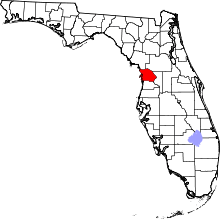 | |
| CDPs | ||
| Unincorporated communities |
| |
| Ghost town | ||