Leakesville, Mississippi
| Leakesville, Mississippi | |
|---|---|
| Town | |
 Location of Leakesville, Mississippi | |
 Leakesville, Mississippi Location in the United States | |
| Coordinates: 31°9′14″N 88°33′21″W / 31.15389°N 88.55583°WCoordinates: 31°9′14″N 88°33′21″W / 31.15389°N 88.55583°W | |
| Country | United States |
| State | Mississippi |
| County | Greene |
| Area | |
| • Total | 1.59 sq mi (4.11 km2) |
| • Land | 1.58 sq mi (4.10 km2) |
| • Water | 0.004 sq mi (0.01 km2) |
| Elevation | 108 ft (33 m) |
| Population (2010) | |
| • Total | 898 |
| • Estimate (2016)[1] | 921 |
| • Density | 570/sq mi (220/km2) |
| Time zone | UTC-6 (Central (CST)) |
| • Summer (DST) | UTC-5 (CDT) |
| ZIP code | 39451 |
| Area code(s) | 601 |
| FIPS code | 28-39840 |
| GNIS feature ID | 0672343 |
Leakesville is a town located along the Chickasawhay River in Greene County, Mississippi, United States, around the junction of Mississippi routes 57 and 63.[2] As of the 2010 census, the town population was 898,[3] down from 1,026 at the 2000 census. It is the county seat of Greene County.[4]
History
A post office called Leakesville has been in operation since 1829.[5] The town was named for Walter Leake, third governor of Mississippi.[6]
Geography
Leakesville is in southeastern Greene County, on the west side of the Chickasawhay River, a south-flowing tributary of the Pascagoula River. Via Mississippi Highway 63, it is 20 miles (32 km) south to Lucedale and 19 miles (31 km) northwest to Sand Hill, and via Highway 57 it is 24 miles (39 km) north to State Line and 17 miles (27 km) west to McLain.
According to the United States Census Bureau, Leakesville has a total area of 1.6 square miles (4.1 km2), of which 0.0039 square miles (0.01 km2), or 0.31%, is water.[3]
Demographics
| Historical population | |||
|---|---|---|---|
| Census | Pop. | %± | |
| 1910 | 466 | — | |
| 1920 | 555 | 19.1% | |
| 1930 | 562 | 1.3% | |
| 1940 | 834 | 48.4% | |
| 1950 | 893 | 7.1% | |
| 1960 | 1,014 | 13.5% | |
| 1970 | 1,090 | 7.5% | |
| 1980 | 1,120 | 2.8% | |
| 1990 | 1,129 | 0.8% | |
| 2000 | 1,026 | −9.1% | |
| 2010 | 898 | −12.5% | |
| Est. 2016 | 921 | [1] | 2.6% |
| U.S. Decennial Census[7] | |||
As of the 2010 United States Census, There were 898 people residing in the town. 78.0% were White, 20.0% African American, 0.1% Asian, 0.3% of some other race and 1.2% of two or more races. 2.3% were Hispanic or Latino of any race.
As of the census[8] of 2000, there were 1,026 people, 390 households, and 262 families residing in the town. The population density was 647.9 people per square mile (250.7/km²). There were 463 housing units at an average density of 292.4 per square mile (113.1/km²). The racial makeup of the town was 79.92% White, 19.40% African American, 0.10% Native American, 0.10% Asian, 0.49% from other races. Hispanic or Latino people of any race were 1.07% of the population.
There were 390 households out of which 27.2% had children under the age of 18 living with them, 51.0% were married couples living together, 14.9% had a female householder with no husband present, and 32.6% were non-families. 29.7% of all households were made up of individuals and 14.9% had someone living alone who was 65 years of age or older. The average household size was 2.34 and the average family size was 2.92.
In the town, the population was spread out with 21.5% under the age of 18, 8.1% from 18 to 24, 19.6% from 25 to 44, 23.5% from 45 to 64, and 27.3% who were 65 years of age or older. The median age was 46 years. For every 100 females, there were 71.6 males. For every 100 females age 18 and over, there were 66.0 males.
The median income for a household in the town was $26,731, and the median income for a family was $33,618. Males had a median income of $30,208 versus $19,167 for females. The per capita income for the town was $14,674. About 17.0% of families and 21.5% of the population were below the poverty line, including 38.0% of those under age 18 and 12.3% of those age 65 or over.
Government and infrastructure

The Mississippi Department of Corrections South Mississippi Correctional Institution is located in unincorporated Greene County, near Leakesville.[9][10]
Education
Leakesville is served by the Greene County School District. Schools include Greene County High School, Leakesville Junior High School, and Leakesville Elementary School.
Notable people
- Don Churchwell, NFL player
- Kermit Davis, Head Coach at Ole Miss
- Bill Hicks, comedian, buried in Magnolia Cemetery
- Wilmer Mizell, MLB pitcher and congressman
- Walter Packer, NFL player
References
- 1 2 "Population and Housing Unit Estimates". Retrieved June 9, 2017.
- ↑ American Map 2009 road atlas
- 1 2 "Geographic Identifiers: 2010 Demographic Profile Data (G001): Leakesville town, Mississippi". American Factfinder. U.S. Census Bureau. Retrieved December 20, 2016.
- ↑ "Find a County". National Association of Counties. Retrieved 2011-06-07.
- ↑ "Greene County". Jim Forte Postal History. Retrieved 14 June 2015.
- ↑ Gannett, Henry (1905). The Origin of Certain Place Names in the United States. U.S. Government Printing Office. p. 183.
- ↑ "Census of Population and Housing". Census.gov. Retrieved June 4, 2015.
- ↑ "American FactFinder". United States Census Bureau. Retrieved 2008-01-31.
- ↑ "State Prisons Archived 2002-12-06 at the Wayback Machine.." Mississippi Department of Corrections. Retrieved on May 21, 2010.
- ↑ "MDOC QUICK REFERENCE." Mississippi Department of Corrections. Retrieved on May 21, 2010.
Municipalities and communities of Greene County, Mississippi, United States | ||
|---|---|---|
| Cities | 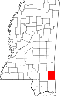 | |
| Unincorporated communities | ||
| Footnotes | ‡This populated place also has portions in an adjacent county or counties | |