Lawrence Brook
| Lawrence Brook | |
|---|---|
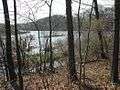
 One of the few undammed sections of Lawrence Brook (below Davidsons Mill Pond) | |
| Country | United States |
| Physical characteristics | |
| Main source | 40°22′33″N 74°32′32″W / 40.37583°N 74.54222°W[1] |
| River mouth |
3 ft (0.91 m) 40°29′5″N 74°23′34″W / 40.48472°N 74.39278°WCoordinates: 40°29′5″N 74°23′34″W / 40.48472°N 74.39278°W[1] |
| Basin features | |
| Progression | Raritan River, Atlantic Ocean |
| River system | Raritan River system |
| Basin size | 40 sq mi (100 km2) |
| Tributaries |
|

Lawrence Brook is a tributary of the Raritan River in Middlesex County, New Jersey in the United States.[2]
Course
Originally a 10-mile (16 km) stream, its course now includes man-made lakes created by dams built in the 19th and 20th centuries: Deans Pond (South Brunswick), Davidsons Mill Pond (South Brunswick), Farrington Lake (South Brunswick, North Brunswick and East Brunswick), Mill Pond (Milltown), and Westons Mill Pond (Milltown, East Brunswick, North Brunswick and New Brunswick). Its lowest section, near the Raritan River, is tidal; it hosts marine wildlife and is regarded as a coastal area.
Its drainage basin, the Lawrence Brook watershed, is a 40-square-mile (100 km2) area, identified by the USGS code HUC 02030105130.
At the stretch at Weston's Mill Pond, Lawrence Brook crosses Rutgers University's Cook Campus, along the vegetable research Farm, the Equine Research farm, Rutgers Gardens and Helyar forest.
Though not obvious from the roadways, Lawrence Brook is a wildlife corridor, a bird migration area and a highly sensitive body of water. Power boats, except with an electric motor, are not permitted on the brook.
History
- This stream was called Piscopeek by the Unami Lenni Lenape Indians. Its current name comes from Mr.Thomas Lawrence, a New York City baker, who acquired its surrounding land in the 17th century.[3] Some historical maps show the spelling Lawrence's Brook.
- In the late 19th and early 20th centuries, Farrington Lake area served as a resort area, with a trolley line running from New Brunswick through Milltown then turning south to eventually end at the State Fair Grounds in Trenton. The lake (named for a mayor of New Brunswick who died during WWI) was formed by a dam built above a lower working dam that powered a snuff mill built in the mid 19th century.
Pictures
 Lawrence Brook-East Brunswick N.J.
 Lawrence Brook-East Brunswick N.J.
 Lawrence Brook-East Brunswick N.J.
 Lawrence Brook-East Brunswick N.J.
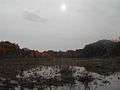 Lawrence Brook-East Brunswick N.J.
 Lawrence Brook-Milltown N.J.
 Lawrence Brook-Milltown N.J.
Succession of ponds, lakes and reservoirs
(Upstream)
- Deans Pond (South Brunswick)
- Davidsons Mill Pond (South Brunswick)
- Farrington Lake (South Brunswick, North Brunswick, East Brunswick)
- Mill Pond (Milltown)
- Westons Mill Pond (Milltown, East Brunswick, North Brunswick, New Brunswick)
(Downstream)
Parks along Lawrence Brook
- Davidsons Mill Pond County Park (South Brunswick)
- Ireland Brook County Park (South Brunswick and East Brunswick)
- Bicentennial Park (East Brunswick)
- North Brunswick Memorial Park (North Brunswick)
- Brook Park (Milltown)
- Mill Pond Park (Milltown)
- Rutgers Gardens and Helyar Woods (Rutgers, the State University of New Jersey)
Main tributaries
- Brook from the beaver pond to Davidsons Mill Pond
- Ireland Brook
- Oakeys Brook
- Cow Yard Brook, a branch of the Oakeys Brook
- Beaverdam Brook
- Sucker Brook
- Sawmill Brook
- Brook in Rutgers Gardens (along the bamboo forest), sometimes called Doc Brook
- Brook in Rutgers' Helyar Woods (with a small waterfall), sometimes called Helyar Brook
- Terhune Run
- Great Ditch