Lavender Federation Trail
| Lavender Federation Trail | |
|---|---|
| Length | 212 km (132 mi) |
| Location | Mount Lofty Ranges, South Australia |
| Established | 2000 |
| Trailheads | |
| Use | Hiking |
| Hiking details | |
| Season | avoid summer |
| Waymark |
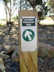 Trail marker at Dutton |
| Sights | |
| Hazards | washouts, bushfire |
| Surface | mainly natural |
| Website | http://lavenderfederationtrail.org.au/ |
The Lavender Federation Trail is a long distance walking trail in the eastern Mount Lofty Ranges in South Australia. It extends 212 kilometres (132 mi) from Murray Bridge to Eudunda.[1][2] It is named after Terry Lavender OAM[3] and development started in 1999.[3] The ultimate goal is to extend it to a total of 350 kilometres (220 mi) to Clare.[3]
Route
The trail starts at Sturt Reserve by the Murray River in Murray Bridge. It climbs out of Murray Bridge through Rocky Gully and passes Monarto Zoo. The trail crosses the ridge with views over the Bremer River valley, and up to the summit of Mount Beevor (503m). The trail continues north along the eastern Mount Lofty Ranges through the Eden Valley wine region to Truro.[4] The next section continues north to Eudunda, South Australia. It now has been extended to Manoora in 2017. By April 2018 the trail will be completed to Clare.
There are several loops off of the main trail,[5] including:
- Tungkillo Loop Trail
- Eden Valley Loop Trail
- Springton Loop Trail – 17km
- Moculta Loop Trail
Geology and biology
The trail passes through wetlands near the Murray River, rocky gullies up the eastern slopes of the ranges, past the ruins of former farmhouses and copper mines. There are native plants, grain crops, and grape vines then more crops and grazing land.
History
The first section of the trail from Murray Bridge to Monarto opened in 2000. The trail has been progressively extended to Mount Beevor near Harrogate northwards through Tungkillo, Springton, Eden Valley, Keyneton, Moculta, Truro, Dutton, Eudunda, Waterloo to Manoora.
Future
The development team are currently working on the section through Mintaro, Watervale and Penwortham to Clare.
See also
References
- ↑ "First Full Length Trail Walk". Lavender Federation Walking Trail. Retrieved 12 February 2015.
- ↑ "Lavender Federation Walking Trail". SA Recreation Trails Incorporated. Retrieved 9 February 2015.
- 1 2 3 "History". SA Recreation Trails Incorporated. Retrieved 3 September 2014.
- ↑ "Trail Description". Lavender Federation Walking Trail. Retrieved 12 February 2015.
- ↑ "Maps". SA Recreation Trails Incorporated. Retrieved 3 September 2014.