Latrobe, West Virginia
| Latrobe, West Virginia | |
|---|---|
| Unincorporated community | |
 Latrobe, West Virginia  Latrobe, West Virginia | |
| Coordinates: 37°47′26″N 81°46′07″W / 37.79056°N 81.76861°WCoordinates: 37°47′26″N 81°46′07″W / 37.79056°N 81.76861°W | |
| Country | United States |
| State | West Virginia |
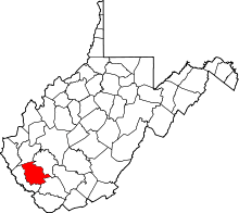
| County | Logan |
| Elevation | 1,010 ft (310 m) |
| Time zone | UTC-5 (Eastern (EST)) |
| • Summer (DST) | UTC-4 (EDT) |
| Area code(s) | 304 & 681 |
| GNIS feature ID | 1554914[1] |
Latrobe is an unincorporated community and coal town in Logan County, West Virginia, United States. Latrobe is located on County Route 16 and Buffalo Creek 6.9 miles (11.1 km) east-northeast of Man.[2]
References
- ↑ U.S. Geological Survey Geographic Names Information System: Latrobe, West Virginia
- ↑ Logan County, West Virginia General Highway Map (PDF) (Map). West Virginia Department of Transportation. 2011. p. 2. Archived from the original (PDF) on February 6, 2012. Retrieved October 17, 2011.
This article is issued from
Wikipedia.
The text is licensed under Creative Commons - Attribution - Sharealike.
Additional terms may apply for the media files.