Laranja da Terra
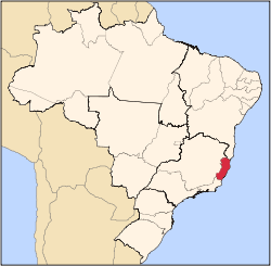
Coordinates: 19°53′56″S 41°03′25″W / 19.89889°S 41.05694°W Laranja da Terra is a municipality located in the Brazilian state of Espírito Santo. Its population was 11,121 (2005) and its area is 457 km².[1]
References
- ↑ IBGE - "Archived copy". Archived from the original on 2007-01-09. Retrieved 2007-01-09.
Capital: Vitória | ||||||||||
| Mesoregion Central |
|  | ||||||||
| Mesoregion Litoral Norte |
| |||||||||
| Mesoregion Noroeste |
| |||||||||
| Mesoregion Sul |
| |||||||||
This article is issued from
Wikipedia.
The text is licensed under Creative Commons - Attribution - Sharealike.
Additional terms may apply for the media files.