Laram Pukara
| Laram Pukara | |
|---|---|
 Laram Pukara Location in Bolivia | |
| Highest point | |
| Elevation | 5,292 m (17,362 ft) [1] |
| Coordinates | 18°53′59″S 68°49′10″W / 18.89972°S 68.81944°WCoordinates: 18°53′59″S 68°49′10″W / 18.89972°S 68.81944°W |
| Geography | |
| Location | Bolivia, Oruro Department, Mejillones Province |
| Parent range | Andes, Cordillera Occidental |
Laram Pukara (Aymara larama blue, pukara fortress / mountain of protection,[2][3] "blue fortress" or "blue mountain of protection", Hispanicized spelling Laram Pucara,[4] labeled Larani Pacara[1] in the BIGM map) is a 5,292-metre-high (17,362 ft) mountain in the Cordillera Occidental in the Andes of Bolivia. It is located in the Oruro Department, Mejillones Province, La Rivera Municipality. Laram Pukara lies south-east of the mountain Kimsa Chata and north-east of the mountain Taypi Qullu.[4]
References
- 1 2 BIGM map 1:50,000 Cerro Capitan Hoja 5837-III
- ↑ Radio San Gabriel, "Instituto Radiofonico de Promoción Aymara" (IRPA) 1993, Republicado por Instituto de las Lenguas y Literaturas Andinas-Amazónicas (ILLLA-A) 2011, Transcripción del Vocabulario de la Lengua Aymara, P. Ludovico Bertonio 1612 (Spanish-Aymara-Aymara-Spanish dictionary)
- ↑ portal.perueduca.edu.pe Archived 2013-07-28 at the Wayback Machine. Yatiqirinaka Aru Pirwa (Aymara-Spanish Dictionary)
- 1 2 "La Rivera". Archived from the original on August 13, 2014. Retrieved August 13, 2014.
Capital: Oruro | ||
| Provinces | 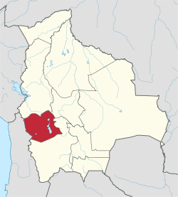 | |
| Municipalities (and seats) |
| |
This article is issued from
Wikipedia.
The text is licensed under Creative Commons - Attribution - Sharealike.
Additional terms may apply for the media files.