Laniel, Quebec
| Laniel | |
|---|---|
| Unorganized territory | |
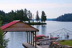 Boathouse on Lake Kipawa at Laniel | |
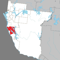 Location within Témiscamingue RCM. | |
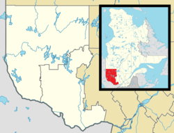 Laniel Location in western Quebec. | |
| Coordinates: 47°03′N 79°16′W / 47.050°N 79.267°WCoordinates: 47°03′N 79°16′W / 47.050°N 79.267°W[1] | |
| Country |
|
| Province |
|
| Region | Abitibi-Témiscamingue |
| RCM | Témiscamingue |
| Constituted | October 31, 2005 |
| Government[2] | |
| • Federal riding | Abitibi—Témiscamingue |
| • Prov. riding | Rouyn-Noranda–Témiscamingue |
| Area[2][3] | |
| • Total | 540.00 km2 (208.50 sq mi) |
| • Land | 412.27 km2 (159.18 sq mi) |
| Population (2011)[3] | |
| • Total | 69 |
| • Density | 0.2/km2 (0.5/sq mi) |
| • Pop (2006–11) |
|
| • Dwellings | 155 |
| Time zone | UTC−5 (EST) |
| • Summer (DST) | UTC−4 (EDT) |
Laniel is an unorganized territory in the Témiscamingue Regional County Municipality, Abitibi-Témiscamingue region, Quebec, Canada. It surrounds the northern portion of Lake Kipawa.
Laniel is also a hamlet located within this territory at the outflow of Lake Kipawa where Route 101 crosses the Kipawa River. It was named in honour of priest Armand Laniel (1866-1928).[1]
Until 2005, Laniel and Lacs-du-Témiscamingue unorganized territories were part of the Rivière-Kipawa unorganized territory.[4]
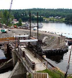
New dam of Lake Kipawa under construction at Laniel
Demographics
Population:[3]
- Population in 2011: 69
- Population in 2006: 150
- Population in 2001: 85 (adjusted for boundary changes)
See also
References
- 1 2 Reference number 390262 of the Commission de toponymie du Québec (in French)
- 1 2 Geographic code 85905 in the official Répertoire des municipalités (in French)
- 1 2 3 "(Code 2485905) Census Profile". 2011 census. Statistics Canada. 2012.
- ↑ http://www.stat.gouv.qc.ca/publications/referenc/pdf2005/Modif_oct05.pdf%5Bpermanent+dead+link%5D
Adjacent Municipal Subdivisions | |
|---|---|
| Cities | |
|---|---|
| Municipalities | |
| Townships |
|
| Parishes | |
| Villages | |
| Unorganized territories | |
| |
This article is issued from
Wikipedia.
The text is licensed under Creative Commons - Attribution - Sharealike.
Additional terms may apply for the media files.