Lancaster Township, Huntington County, Indiana
| Lancaster Township | |
|---|---|
| Township | |
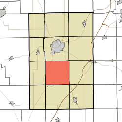 Location in Huntington County | |
| Coordinates: 40°46′36″N 85°30′18″W / 40.77667°N 85.50500°WCoordinates: 40°46′36″N 85°30′18″W / 40.77667°N 85.50500°W | |
| Country | United States |
| State | Indiana |
| County | Huntington |
| Government | |
| • Type | Indiana township |
| Area | |
| • Total | 35.89 sq mi (93.0 km2) |
| • Land | 35.63 sq mi (92.3 km2) |
| • Water | 0.27 sq mi (0.7 km2) 0.75% |
| Elevation | 801 ft (244 m) |
| Population (2010) | |
| • Total | 1,150 |
| • Density | 32.3/sq mi (12.5/km2) |
| GNIS feature ID | 0453538 |
Lancaster Township is one of twelve townships in Huntington County, Indiana, United States. As of the 2010 census, its population was 1,150 and it contained 472 housing units.[1]
History
Lancaster Township was founded in 1837.[2]
Geography
According to the 2010 census, the township has a total area of 35.89 square miles (93.0 km2), of which 35.63 square miles (92.3 km2) (or 99.28%) is land and 0.27 square miles (0.70 km2) (or 0.75%) is water.[1]
Cities and towns
- Mount Etna (northeast half)
Unincorporated towns
Extinct towns
- River
Adjacent townships
- Huntington Township (north)
- Union Township (northeast)
- Rock Creek Township (east)
- Salamonie Township (southeast)
- Jefferson Township (south)
- Wayne Township (southwest)
- Polk Township (west)
- Dallas Township (northwest)
Cemeteries
The township contains three cemeteries: German Settlement, Loon Creek and Rees.
Major highways
References
- "Lancaster Township, Huntington County, Indiana". Geographic Names Information System. United States Geological Survey. Retrieved 2009-09-24.
- United States Census Bureau cartographic boundary files
- 1 2 "Population, Housing Units, Area, and Density: 2010 - County -- County Subdivision and Place -- 2010 Census Summary File 1". United States Census. Retrieved 2013-05-10.
- ↑ History of Huntington County, Indiana: From the Earliest Time to the Present. Brant & Fuller. 1887. p. 690.
External links
Municipalities and communities of Huntington County, Indiana, United States | ||
|---|---|---|
| City | ||
| Towns | ||
| Townships | ||
| Unincorporated communities | ||
| Footnotes | ‡This populated place also has portions in an adjacent county or counties | |
This article is issued from
Wikipedia.
The text is licensed under Creative Commons - Attribution - Sharealike.
Additional terms may apply for the media files.