Lali, Iran
| Lali لالي | |
|---|---|
| City | |
 Lali | |
| Coordinates: 32°19′44″N 49°05′37″E / 32.32889°N 49.09361°ECoordinates: 32°19′44″N 49°05′37″E / 32.32889°N 49.09361°E | |
| Country |
|
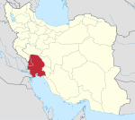
| Province | Khuzestan |
| County | Lali |
| Bakhsh | Central |
| Population (2016 Census) | |
| • Total | 18,473 [1] |
| Time zone | UTC+3:30 (IRST) |
| • Summer (DST) | UTC+4:30 (IRDT) |
Lali (Persian: لالي; also Romanized as Lālī; also known as Dasht-e Lālī and Lālī Pelāyen)[2] is a city and capital of Lali County, Khuzestan Province, Iran. At the 2006 census, its population was 16,213, in 3,041 families.[3]
Climate
| Climate data for Lali | |||||||||||||
|---|---|---|---|---|---|---|---|---|---|---|---|---|---|
| Month | Jan | Feb | Mar | Apr | May | Jun | Jul | Aug | Sep | Oct | Nov | Dec | Year |
| Average high °C (°F) | 16.7 (62.1) |
18.1 (64.6) |
23.3 (73.9) |
29.9 (85.8) |
36.8 (98.2) |
42.7 (108.9) |
45.5 (113.9) |
44.6 (112.3) |
42.3 (108.1) |
35.8 (96.4) |
26.4 (79.5) |
19.3 (66.7) |
31.8 (89.2) |
| Average low °C (°F) | 5.1 (41.2) |
6.0 (42.8) |
10.5 (50.9) |
15.8 (60.4) |
20.3 (68.5) |
23.6 (74.5) |
27.1 (80.8) |
25.9 (78.6) |
22.8 (73) |
18.3 (64.9) |
12.9 (55.2) |
7.2 (45) |
16.3 (61.3) |
| Average precipitation mm (inches) | 95 (3.74) |
72 (2.83) |
62 (2.44) |
46 (1.81) |
12 (0.47) |
0 (0) |
0 (0) |
0 (0) |
0 (0) |
3 (0.12) |
52 (2.05) |
82 (3.23) |
424 (16.69) |
| Source: Climate-data.org | |||||||||||||
References
- ↑ https://www.amar.org.ir/english
- ↑ Lali, Iran can be found at GEOnet Names Server, at this link, by opening the Advanced Search box, entering "-3072833" in the "Unique Feature Id" form, and clicking on "Search Database".
- ↑ "Census of the Islamic Republic of Iran, 1385 (2006)". Islamic Republic of Iran. Archived from the original (Excel) on 2011-11-11.
| Capital | |||||||||||||||||||||
|---|---|---|---|---|---|---|---|---|---|---|---|---|---|---|---|---|---|---|---|---|---|
| Districts |
| ||||||||||||||||||||
This article is issued from
Wikipedia.
The text is licensed under Creative Commons - Attribution - Sharealike.
Additional terms may apply for the media files.