Lal-lo, Cagayan
| Lal-lo | ||
|---|---|---|
| Municipality | ||
| Municipality of Lal-Lo | ||
 Nueva Segovia Church | ||
| ||
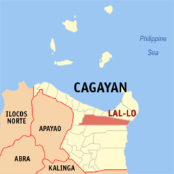 Map of Cagayan with Lal-lo highlighted | ||
.svg.png) Lal-lo Location within the Philippines | ||
| Coordinates: 18°12′N 121°40′E / 18.2°N 121.67°ECoordinates: 18°12′N 121°40′E / 18.2°N 121.67°E | ||
| Country |
| |
| Region | Cagayan Valley (Region II) | |
| Province | Cagayan | |
| District | 1st District | |
| Barangays | 35 (see Barangays) | |
| Government [1] | ||
| • Type | Sangguniang Bayan | |
| • Mayor | Florante 'Anteng' C. Pascual | |
| • Electorate | 24,950 voters (2016) | |
| Area [2] | ||
| • Total | 702.80 km2 (271.35 sq mi) | |
| Population (2015 census)[3] | ||
| • Total | 44,506 | |
| • Density | 63/km2 (160/sq mi) | |
| Time zone | UTC+8 (PST) | |
| ZIP code | 3509 | |
| PSGC | 021516000 | |
| IDD : area code | +63 (0)78 | |
| Climate type | Tropical monsoon climate | |
| Income class | 1st municipal income class | |
| Revenue (₱) | 182,466,322.96 (2016) | |
| Native languages |
Ilocano Ibanag Cagayan Agta language Tagalog | |

Lal-lo, officially the Municipality of Lal-Lo, is a 1st class municipality in the province of Cagayan, Philippines. According to the 2015 census, it has a population of 44,506 people.[3]
During the Spanish colonial period, Lal-lo was known as the City of Nueva Segovia and was the seat of the Diocese of Nueva Segovia before it was moved to Vigan in Ilocos Sur. There is a recent move in the Philippine Congress to rename Lal-lo back to its former name and reclassify the municipality again as a component city.
The current mayor of Lal-lo is Florante 'Anteng' Pascual, spouse of former Mayor Olivia Pascual, now a board member of the 1st district of Cagayan.
Recently,the provincial government of Cagayan thru the leadership of Governor Mamba have a planned to make Lallo become the provincial capital of Cagayan again.
An international airport is currently being built in the southern part of Lal-lo. The Northern Cagayan International Airport is constructed to support the Cagayan Special Economic Zone in northern Cagayan and will also serve the seaborne traffic through Port Irene. The airport project involves the construction of a 2,200-meter runway, with a width of 45 meters, following the standards of the International Civil Aviation Organization. Once completed, the international airport can accommodate large aircraft such as the Airbus A319-100 and Boeing regional jets of comparable size.
Barangays
Lal-lo is politically subdivided into 35 barangays.
- Abagao
- Alaguia
- Bagumbayan
- Bangag
- Bical
- Bicud
- Binag
- Cabayabasan (Capacuan)
- Cagoran
- Cambong
- Catayauan
- Catugan
- Centro (Poblacion)
- Cullit
- Dagupan
- Dalaya
- Fabrica
- Fusina
- Jurisdiction
- Lalafugan
- Logac
- Magallungon (Sta. Teresa)
- Magapit
- Malanao
- Maxingal
- Naguilian
- Paranum
- Rosario
- San Antonio (Lafu)
- San Jose
- San Juan
- San Lorenzo
- San Mariano
- Santa Maria
- Tucalana
Etymology
Lal-lo means "twisting two strands to make a rope", or may also refer to the strong river current as it is located along Cagayan River, the longest and largest river in the Philippines.
History
Classical Era
In the classical era, Lal-lo used to be the home of hunter-gatherers who specialized in hunting mollusks. These hunter-gatherers have stockpiled their leftover mollusk shells in numerous sites in Lal-lo and neighboring Gattaran, until eventually, the shells formed into largest stock of shell-midden sites in the entire Philippines.
Spanish Era
The first European to set foot on what is now the town of Lal-lo is Juan de Salcedo, the Spanish conquistador and grandson of Miguel Lopez de Legazpi, in 1572. Don Juan Pablo Carrion established it as a pueblo (municipality) in 1581 and named it Nueva Segovia. The reason is currently unknown, as the hometown of this Spanish soldier was Carrión de los Condes (Palencia, Spain), as his last name, Carrión, suggests. This is mentioned by Juan Aguilera and Ángel Miranda in their book "Espadas del Fin del Mundo" (2016).
Diocese of Nueva Segovia
In 1595, Pope Clement VIII created the Diocese of Nueva Segovia and in 1596, the Dominicans accepted it as an ecclesiastical mission. Nueva Segovia had three churches: the cathedral that was under the secular clergy, and the parishes of Bagumbayan and Tocolona under the supervision of the Dominicans. But because of its distance from Manila and the constant threat of the Cagayan River’s rampaging waters, the Diocese of Nueva Segovia was transferred to Vigan in Ilocos Sur province in 1758. The diocese’s name went along with the transfer to Vigan and to avoid confusion, Bishop Miguel Garcia requested that Nueva Segovia and its suburbs renamed back to Lal-lo. The seat of the Diocese of Nueva Segovia remains in Vigan till today where is now elevated as the Archdiocese of Nueva Segovia.
The transfer affected the closure of the cathedral and the merging of the three churches into the single parish of Bagumbayan. The two other churches were abandoned and eventually destroyed because of neglect while the church of Bagumbayan, dedicated to Sto. Domingo de Guzman (Saint Dominic) became what is now the church of Lal-lo. The remains of three bishops are interred in the church: Bishop Miguel de Benavides who was Nueva Segovia’s first bishop and later of Manila where he founded the University of Santo Tomas, Bishop Diego de Soria who was the second bishop of the diocese, and Bishop Diego Aduarte who was the sixth.
Provincial capital
Lal-lo used to be the capital of Cagayan province until 1839 when the provincial seat of power was relocated to Tuguegarao. The decline of Lal-lo is the transformation of Tuguegarao as the most important town in Cagayan. It was accepted as an ecclesiastical mission by the Dominicans in 1604, 23 years after the foundation of Lal-lo.
Cityhood
Researchers have found a Spanish document which declared this municipality as a city during the Spanish regime, according to board member Maria Olivia Pascual. Pascual said a bill, which clamors for the restoration of the former Ciudad Nueva Segovia now called Lal-lo filed by 1SR Congressional District Representative Juan Ponce Enrile Jr., will be re-filed.
During the first term of Mayor Florante Pascual, he resolved that the cityhood be restored through an earlier bill. However, even after sending a research delegation to Madrid to retrieve the historical document originally signed by King Philip, the team failed to locate it. The document is a basic requirement in the bid of this town for cityhood.
Under the local government code, municipalities who want to elevate themselves into cities must satisfy requirements on population, land area and income. For municipalities who were earlier declared as Spanish cities, only decrees which declared them as such is the basic requirement. Earlier, the towns of Naga (Nueva Caceres) and Vigan (Ciudad Fernandina) were elevated to cityhood status after both towns applied for their historical rights in the early 1990s. Academics clarified that there is a big difference between restoration and conversion of cities under Philippine laws.
Under the Diocese of Nueva Segovia, Lal-lo enjoyed lavish gifts from Spain and was the capital of the entire Cagayan Valley region until its transfer to Tuguegarao City in 1839.
Modern Era
In 2006, the shell-midden sites of Lalo-lo and Gattaran were included in the UNESCO Tentative List for World Heritage Site inclusion, a step closer to becoming a world heritage site. The shell-midden sites are currently being conserved by the local government from looting to preserve its outstanding universal value.
Demographics
| Population census of Lal-Lo | ||
|---|---|---|
| Year | Pop. | ±% p.a. |
| 1903 | 7,309 | — |
| 1918 | 9,385 | +1.68% |
| 1939 | 12,921 | +1.53% |
| 1948 | 10,730 | −2.04% |
| 1960 | 16,834 | +3.82% |
| 1970 | 21,400 | +2.43% |
| 1975 | 24,866 | +3.06% |
| 1980 | 26,947 | +1.62% |
| 1990 | 31,373 | +1.53% |
| 1995 | 32,156 | +0.46% |
| 2000 | 36,529 | +2.77% |
| 2007 | 39,607 | +1.12% |
| 2010 | 41,388 | +1.61% |
| 2015 | 44,506 | +1.39% |
| Source: Philippine Statistics Authority[3][4][5][6] | ||
In the 2015 census, the population of Lal-lo, Cagayan, was 44,506 people,[3] with a density of 63 inhabitants per square kilometre or 160 inhabitants per square mile.
Education
- Lal-lo National High School
- Cagayan State University Lal-lo
- Lyceum of Lal-lo
- Lal-lo National High School - Cabayabasan Annex
- Logac National High School
- Magapit National High School
References
- ↑ "Municipality". Quezon City, Philippines: Department of the Interior and Local Government. Retrieved 31 May 2013.
- ↑ "Province: Cagayan". PSGC Interactive. Quezon City, Philippines: Philippine Statistics Authority. Retrieved 12 November 2016.
- 1 2 3 4 Census of Population (2015). "Region II (Cagayan Valley)". Total Population by Province, City, Municipality and Barangay. PSA. Retrieved 20 June 2016.
- ↑ Census of Population and Housing (2010). "Region II (Cagayan Valley)". Total Population by Province, City, Municipality and Barangay. NSO. Retrieved 29 June 2016.
- ↑ Censuses of Population (1903–2007). "Region II (Cagayan Valley)". Table 1. Population Enumerated in Various Censuses by Province/Highly Urbanized City: 1903 to 2007. NSO.
- ↑ "Province of Cagayan". Municipality Population Data. Local Water Utilities Administration Research Division. Retrieved 17 December 2016.
External links
Places adjacent to Lal-lo, Cagayan | |
|---|---|
Tuguegarao (capital) | |
| Municipalities | |
| Component city | |
| Barangays | |