Lake Nagambie
| Lake Nagambie | |
|---|---|
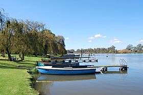 Boats on Lake Nagambie | |
| Location | Goldfields region, Victoria |
| Coordinates | 36°47′0″S 145°8′30″E / 36.78333°S 145.14167°ECoordinates: 36°47′0″S 145°8′30″E / 36.78333°S 145.14167°E |
| Type | Reservoir |
| Primary inflows | Goulburn River |
| Primary outflows | Goulburn River |
| Basin countries | Australia |
| Surface area | 170 ha (420 acres) |
| Settlements | Nagambie |
Lake Nagambie is a 170-hectare (420-acre) man–made reservoir located in the Goldfields region of Victoria, Australia. The lake was formed by the damming of the Goulburn River by the Goulburn Weir. The town of Nagambie is on its shores.[1][2]
See also
References
- ↑ "Map of Lake Nagambie, VIC". Bonzle Digital Atlas of Australia. Retrieved 27 October 2014.
- ↑ "ROWING NOTES. By OUTRIGGER". The Leader (1934). Melbourne. 4 February 1893. p. 16. Retrieved 7 March 2017 – via National Library of Australia. , ...The first regatta on Lake Nagambie was held on Thursday, the 26th January (Foundation day)...The lake...is; of comparatively recent formation, having been created by the construction of the Goulburn Weir...
| |||||||||||||||||
| |||||||||||||||||
| |||||||||||||||||
This article is issued from
Wikipedia.
The text is licensed under Creative Commons - Attribution - Sharealike.
Additional terms may apply for the media files.