Lake Mainit
| Lake Mainit | |
|---|---|
 | |
.svg.png) Lake Mainit Location within the Philippines | |
| Location | Mindanao |
| Coordinates | 9°25′57″N 125°31′22″E / 9.43250°N 125.52278°ECoordinates: 9°25′57″N 125°31′22″E / 9.43250°N 125.52278°E |
| Type | Oligotrophic Freshwater lake |
| Primary inflows | 28 creeks and rivers |
| Primary outflows | Calinawan River |
| Catchment area | 87,072 ha (870.72 km2) |
| Basin countries | Philippines |
| Max. length | 29.10 km (18.08 mi) |
| Surface area | 17,340 ha (173.40 km2) |
| Average depth | 128 m (419.95 ft) |
| Max. depth | 223 m (731.63 ft) |
| Water volume | 18.00 km3 (4.32 cu mi) |
| Shore length1 | 62.10 km (38.59 mi) |
| Surface elevation | 42 m (137.80 ft) |
| Settlements | |
| References | [1][2] |
| 1 Shore length is not a well-defined measure. | |
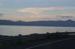
Lake Mainit looking south from the northern shore
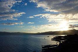
Lake Mainit is the fourth largest lake in the Philippines, having a surface area of 173.40 square kilometres (66.95 sq mi).[2][3][4] The lake is also the deepest lake in the country with maximum depth reaching 223 metres (732 ft).[2][5] It is located in the northeastern section of Mindanao and shared between the provinces of Surigao del Norte and Agusan del Norte.
Etymology
The name of the lake is a Visayan word mainit, which means "hot".[6]
Flora and fauna
Plants
- Fire orchid (Vanda hookeriana)
- Narra tree (Pterocarpus indicus)
- Molave tree (Vitex parviflora)
- Philippine rosewood or "toog"
- Kamagong
- Mancono
- Malabayabas (Eucalyptus spp.)
- Indian lotus (Nelumbo nucifera)
Animals
- Animals
- Mindanao scops owl
- Mindanao savanna nightjar
- Mindanao Himalayan swiftlet
- Mindanao forest kingfisher
- White-breasted sea eagle (Haliaeetus leucogaster)
- Monkeys
- Wild pigs
- Fishes
- "Casili" (Anguilla spp.)
- Mudfish, "hayuan" or "halwan" (Channa striata)
- Gurami (Gourami belontiidae)
- "Bolinao" (Neosthethus thessa)
List
Municipalities bordering the lake
Municipalities within Lake Mainit's watershed
References
- ↑ "Philippine Lakes - Lake Look to Lake Pandin". Retrieved 17 October 2008.
- 1 2 3 "Physical Features of Lake Mainit". Lake Mainit Development Alliance (LMDA). 8 February 2008. Retrieved 17 October 2008.
- ↑ "Lake Mainit". ASEAN Regional Centre for Biodiversity Conservation (ARCBC). Retrieved 17 October 2008.
- ↑ "Lake Mainit". Encyclopædia Britannica. Retrieved 17 October 2008.
- ↑ "Lake Mainit". BIMP-EAGA. Archived from the original on 30 October 2008. Retrieved 17 October 2008.
- ↑ "How Mainit got its name?".
- ↑ "Municipality of Alegria". Municipality of Alegria.
Further reading
- A Directory of Philippine Wetlands. Vol I, compiled by Davies, J. et al. (Asian Wetland Bureau Philippines Foundation, Inc, 1991)
- Webpage on Lake Minit (cited part available online)
External links

- Lake Mainit Updates
- Lake Mainit Development Alliance
- LMDA Updates
This article is issued from
Wikipedia.
The text is licensed under Creative Commons - Attribution - Sharealike.
Additional terms may apply for the media files.