Hulun Lake
| Hulun Lake | |
|---|---|
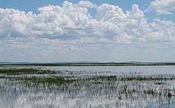 Panorama of lake with reed beds. | |
| Location | Inner Mongolia (China) |
| Coordinates | 48°58′23″N 117°26′08″E / 48.97306°N 117.43556°ECoordinates: 48°58′23″N 117°26′08″E / 48.97306°N 117.43556°E |
| Primary inflows | Kherlen River, Orshuun Gol |
| Primary outflows | Mutnaya Protoka (temporal Argun River−Amur Basin tributary) |
| Catchment area | 33,469 km2 (12,922 sq mi)[1] |
| Basin countries | China, Mongolia |
| Max. length | 90 km (56 mi)[2] |
| Max. width | 27 km (17 mi)[2] |
| Surface area | 2,339 km2 (903 sq mi) |
| Average depth | 5.7 m (19 ft)[1] |
| Surface elevation | 539 m (1,768 ft) |
| Official name | Dalai Lake National Nature Reserve, Inner Mongolia |
| Designated | 11 January 2002 |
| Reference no. | 1146[3] |
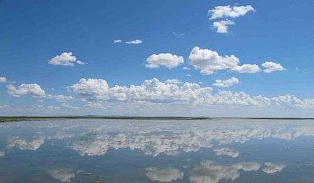
Hulun Lake (simplified Chinese: 呼伦湖; traditional Chinese: 呼倫湖; pinyin: Hūlún Hú; Mongolian: hölön nuur Хөлөн нуур, lit. foot lake) or Dalai Lake (Mongolian: Dalai nuur Далай нуур, lit. ocean lake), is a large lake in the Inner Mongolia region of northern China.
Geography
It is one of the five largest freshwater lakes in all of China, covering approximately 2,339 km².
The lake is not far from Manzhouli, which is on a major passenger rail-line. Although there are several villages nearby, and Manzhouli is the nearest city of notable size.
- Amur Basin
In years with high precipitation, the normally exit−less endorheic lake may overflow at its northern shore, and the water will meet the Argun River (Ergune) after about 30 kilometres (19 mi). The Amur Basin of the Kherlen River−Argun/Ergune River−Amur River system has a total length of 5,052 kilometres (3,139 mi) to its river mouth on the Sea of Japan.
Economy
As in 1995 annual fish production was about 7,000 tons, 100 tons of shrimp, 4 kilograms of pearls, 1.5 million crayfish.
Hulun Lake is also one of the key reed production areas in China.[1]
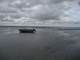
- Recreation
The lake and lakeshore is a tourist destination during the summer. During the other seasons there are few visitors. Hulun Lake and its wetlands are a Biosphere reserve of China.
See also
- Amur River basin
- Endorheic lakes of Asia
References
- 1 2 3 LakeNet - Hulun Hu (Hulun Nur) Lake Profile
- 1 2 measured using Google Earth
- ↑ "Dalai Lake National Nature Reserve, Inner Mongolia". Ramsar Sites Information Service. Retrieved 25 April 2018.
External links
![]()
| Five Great Lakes | ||
|---|---|---|
| Notable freshwater lakes |
| |
| Notable salt lakes | ||
| National Parks |
| |
| Protected wetlands | ||
| Nature Reserves | ||
| Major urban lakes | ||
| Reservoirs |
| |