Laird, Colorado
| Laird, Colorado | |
|---|---|
| CDP | |
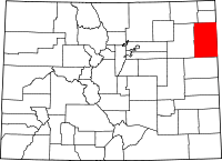
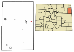 Location of Laird in Yuma County, Colorado. | |
| Coordinates: 40°04′58″N 102°06′21″W / 40.08278°N 102.10583°WCoordinates: 40°04′58″N 102°06′21″W / 40.08278°N 102.10583°W | |
| Country |
|
| State |
|
| County | Yuma[1] |
| Elevation[1] | 3,406 ft (1,038 m) |
| 47 | |
| Time zone | UTC-7 (MST) |
| • Summer (DST) | UTC-6 (MDT) |
| ZIP code[2] | 80758 (Wray) |
| GNIS feature ID | 0183040 |
Laird is a census-designated place in Yuma County, Colorado, United States. The population as of the 2010 Census was 47.[3] The U.S. Post Office at Wray (ZIP Code 80758) now serves Laird postal addresses.[2]
A post office called Laird has been in operation since 1887.[4] The community has the name of James Laird, a Nebraska legislator.[5]
Geography
Laird is located at 40°04′58″N 102°06′21″W / 40.08278°N 102.10583°W (40.082800,-102.105732).
Demographics
| Historical population | |||
|---|---|---|---|
| Census | Pop. | %± | |
| U.S. Decennial Census[6] | |||
See also
References
- 1 2 "US Board on Geographic Names". United States Geological Survey. 2007-10-25. Retrieved 2008-01-31.
- 1 2 "ZIP Code Lookup". United States Postal Service. January 3, 2007. Archived from the original (JavaScript/HTML) on November 23, 2010. Retrieved January 3, 2007.
- ↑ Colorado Trend Report 2: State and Complete Places (Sub-state 2010 Census Data). Missouri Census Data Center. Accessed 2011-02-25.
- ↑ "Post offices". Jim Forte Postal History. Retrieved 29 June 2016.
- ↑ Dawson, John Frank. Place names in Colorado: why 700 communities were so named, 150 of Spanish or Indian origin. Denver, CO: The J. Frank Dawson Publishing Co. p. 30.
- ↑ "Census of Population and Housing". Census.gov. Retrieved June 4, 2016.
This article is issued from
Wikipedia.
The text is licensed under Creative Commons - Attribution - Sharealike.
Additional terms may apply for the media files.