La Pêche, Quebec
| La Pêche | |
|---|---|
| Municipality | |
 | |
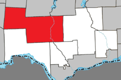 Location within Les Collines-de-l'Outaouais RCM. | |
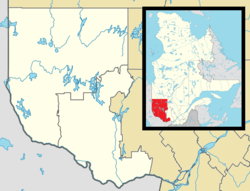 La Pêche Location in western Quebec. | |
| Coordinates: 45°41′N 75°59′W / 45.683°N 75.983°WCoordinates: 45°41′N 75°59′W / 45.683°N 75.983°W[1] | |
| Country |
|
| Province |
|
| Region | Outaouais |
| RCM | Les Collines-de-l'Outaouais |
| Constituted | January 1, 1975 |
| Government[2] | |
| • Mayor | Guillaume Lamoureux |
| • Federal riding | Pontiac |
| • Prov. riding | Gatineau |
| Area[2][3] | |
| • Total | 616.50 km2 (238.03 sq mi) |
| • Land | 584.65 km2 (225.73 sq mi) |
| Population (2011)[3] | |
| • Total | 7,619 |
| • Density | 13.0/km2 (34/sq mi) |
| • Pop 2006-2011 |
|
| • Dwellings | 4,490 |
| Time zone | UTC−5 (EST) |
| • Summer (DST) | UTC−4 (EDT) |
| Postal code(s) | J0X 2W0 |
| Area code(s) | 819 |
| Highways |
|
| Website |
www |
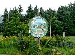
La Pêche (French pronunciation: [la pɛːʃ], Quebec French pronunciation: [la paɪ̯ʃ]) is a municipality along both sides of the Gatineau River in Les Collines-de-l'Outaouais Regional County Municipality in the Outaouais region of Quebec, Canada, about 30 kilometres (19 mi) north of downtown Gatineau. It comprises the following villages and communities:
- Duclos
- East-Aldfield
- Edelweiss
- Farrellton
- Lac-des-Loups (Wolf Lake)
- Lascelles, Rupert and Alcove
- Sainte-Cécile-de-Masham
- Saint-François-de-Masham
- Saint-Louis-de-Masham
- Wakefield
Bordering on the north side of the Gatineau Park, La Pêche provides multiple access points to this park.
La Pêche was declared Quebec's first and Canada's second fair trade town on November 9, 2007.
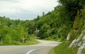
Highway 105 at Alcove.
References
External links
- Wakefield Quebec Community Website
- http://www.villelapeche.qc.ca/index.php/en/la-peche/history
- http://www.mrcdescollinesdeloutaouais.qc.ca/
- http://sp.mrcdescollinesdeloutaouais.qc.ca/
Adjacent Municipal Subdivisions | |
|---|---|
| Municipalities | |
|---|---|
| |
This article is issued from
Wikipedia.
The text is licensed under Creative Commons - Attribution - Sharealike.
Additional terms may apply for the media files.