La Concordia, Chiapas
| La Concordia | |
|---|---|
| Municipality | |
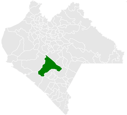 Municipality of La Concordia in Chiapas | |
|
La Concordia Location in Mexico | |
| Coordinates: 16°07′N 92°41′W / 16.117°N 92.683°WCoordinates: 16°07′N 92°41′W / 16.117°N 92.683°W | |
| Country |
|
| State | Chiapas |
| Area | |
| • Total | 1,112.9 km2 (429.7 sq mi) |
| Elevation | 1,933 m (6,342 ft) |
| Population (2010) | |
| • Total | 44,082 |
| • Density | 40/km2 (100/sq mi) |
| Website |
www |
La Concordia is a town and one of the 119 Municipalities of Chiapas, in southern Mexico.
As of 2010, the municipality had a total population of 44,082,[1] up from 39,770 as of 2005.[2] It covers an area of 1112.9 km².
As of 2010, the town of La Concordia had a population of 7,641.[1] Other than the town of La Concordia, the municipality had 800 localities, the largest of which (with 2010 populations in parentheses) were: Benito Juárez (2,715), El Ámbar (El Ámbar de Echeverría) (2,592), classified as urban, and La Tigrilla (2,346), Diamante de Echeverría (2,157), Dolores Jaltenango (2,090), Independencia (1,953), Plan de Agua Prieta (1,752), Rizo de Oro (1,434), Reforma (1,148), Ignacio Zaragoza (1,127), El Ramal (Porvenir) (1,054), and Nueva Libertad (1,005), classified as rural.[1]
References
- 1 2 3 "La Concordia". Catálogo de Localidades. Secretaría de Desarrollo Social (SEDESOL). Retrieved 23 April 2014.
- ↑ "La Concordia". Enciclopedia de los Municipios de México. Instituto Nacional para el Federalismo y el Desarrollo Municipal Gobierno del Estado de Chiapas. Archived from the original on May 17, 2011. Retrieved July 25, 2008.