Cacahoatán
| Cacahoatán | |
|---|---|
| Municipality | |
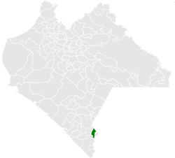 Municipality of Cacahoatán in Chiapas | |
|
Cacahoatán Location in Mexico | |
| Coordinates: 17°10′N 92°10′W / 17.167°N 92.167°WCoordinates: 17°10′N 92°10′W / 17.167°N 92.167°W | |
| Country |
|
| State | Chiapas |
| Area | |
| • Total | 67.1 sq mi (173.9 km2) |
| Population (2010) | |
| • Total | 43,811 |
| Climate | Aw |
Cacahoatán is a city and one of the 122 Municipalities of Chiapas, in southern Mexico. It covers an area of 173.9 km².
As of 2010, the municipality had a total population of 43,811,[1] up from 39,033 as of 2005.[2]
As of 2010, the city of Cacahoatán had a population of 16,572.[1] Other than the city of Cacahoatán, the municipality had 112 localities, the largest of which (with 2010 populations in parentheses) were: Salvador Urbina (2,555), classified as urban, and Faja de Oro (2,356), Agustín de Iturbide (2,211), Unión Roja (1,829), Ahuacatlán (1,583), Mixcum (1,502), Benito Juárez (1,473), and El Águila (1,274), classified as rural.[1]
References
- 1 2 3 "Cacahoatán". Catálogo de Localidades. Secretaría de Desarrollo Social (SEDESOL). Retrieved 23 April 2014.
- ↑ "Cacahoatán". Enciclopedia de los Municipios de México. Instituto Nacional para el Federalismo y el Desarrollo Municipal Gobierno del Estado de Chiapas. Retrieved July 25, 2008.

This article is issued from
Wikipedia.
The text is licensed under Creative Commons - Attribution - Sharealike.
Additional terms may apply for the media files.