La Coma i la Pedra
| La Coma i la Pedra | |||
|---|---|---|---|
| Municipality | |||
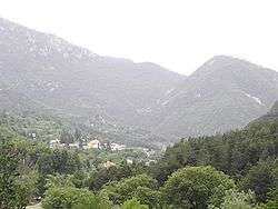 The two villages | |||
| |||
 La Coma i la Pedra Location in Catalonia | |||
| Coordinates: 42°10′40″N 1°35′27″E / 42.17778°N 1.59083°ECoordinates: 42°10′40″N 1°35′27″E / 42.17778°N 1.59083°E | |||
| Country |
| ||
| Community |
| ||
| Province | Lleida | ||
| Comarca | Solsonès | ||
| Government | |||
| • Mayor | Jaume Oriol Grau (2015)[1] | ||
| Area[2] | |||
| • Total | 60.6 km2 (23.4 sq mi) | ||
| Elevation | 1,004 m (3,294 ft) | ||
| Population (2014)[1] | |||
| • Total | 269 | ||
| • Density | 4.4/km2 (11/sq mi) | ||
| Demonym(s) | Comardí, comardina | ||
| Website |
comapedra | ||


La Coma i la Pedra is a municipality in the comarca of the Solsonès in Catalonia, Spain. It is situated in the Lord valley in the north of the comarca. The Cardener river has its source in the territory of the municipality. The local economy is traditionally based on livestock raising, although there is also a ski resort in the pyrenean massif of Port del Comte and a power station at Gafa. Local roads link the municipality with Sant Llorenç de Morunys and Josa i Tuixén.
Subdivisions
The municipality of La Coma i la Pedra is formed by three villages. Populations are given as of 2005:
- La Coma (137)
- La Pedra (64), at the foot of the Pratformiu range
- El Port del Comte (69)
Demography
| 1900 | 1930 | 1950 | 1970 | 1986 | 2007 |
|---|---|---|---|---|---|
| 487 | 482 | 437 | 427 | 254 | 252 |
References
- 1 2 "Ajuntament de la Coma i la Pedra". Generalitat of Catalonia. Retrieved 2015-11-13.
- ↑ "El municipi en xifres: La Coma i la Pedra". Statistical Institute of Catalonia. Retrieved 2015-11-23.
External links
- Official website (in Catalan)
- Government data pages (in Catalan)
Places adjacent to La Coma i la Pedra | ||||||||||
|---|---|---|---|---|---|---|---|---|---|---|
| ||||||||||
Municipalities of Solsonès | ||
|---|---|---|
This article is issued from
Wikipedia.
The text is licensed under Creative Commons - Attribution - Sharealike.
Additional terms may apply for the media files.