L'Erable, Illinois
| L'Erable, Illinois | |
|---|---|
| Unincorporated community | |
 Iroquois County's location in Illinois | |
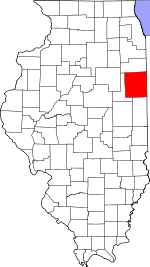
 L'Erable L'Erable's location in Iroquois County | |
| Coordinates: 40°54′12″N 87°50′49″W / 40.90333°N 87.84694°WCoordinates: 40°54′12″N 87°50′49″W / 40.90333°N 87.84694°W | |
| Country |
|
| State |
|
| County | Iroquois County |
| Township | Ashkum Township |
| Elevation | 627 ft (191 m) |
| Time zone | UTC-6 (Central (CST)) |
| • Summer (DST) | UTC-5 (CDT) |
| ZIP code | 60927 |
| GNIS feature ID | 0411634[1] |
L'Erable is an unincorporated community in Ashkum Township, Iroquois County, Illinois, United States.
Geography
L'Erable is located at 40°54′12″N 87°50′49″W / 40.90333°N 87.84694°W at an elevation of 627 feet.
Cemeteries
L'Erable Catholic Cemetery.
References
- ↑ "L'Erable". Geographic Names Information System. United States Geological Survey. Retrieved 2010-10-15.
Municipalities and communities of Iroquois County, Illinois, United States | ||
|---|---|---|
| Cities | ||
| Villages | ||
| Townships | ||
| Unincorporated communities | ||
| Footnotes | ‡This populated place also has portions in an adjacent county or counties | |
This article is issued from
Wikipedia.
The text is licensed under Creative Commons - Attribution - Sharealike.
Additional terms may apply for the media files.