Löwenberger Land
| Löwenberger Land | ||
|---|---|---|
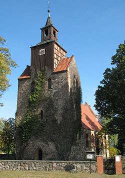 Church in Falkenthal | ||
| ||
 Löwenberger Land Location of Löwenberger Land within Oberhavel district 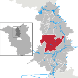 | ||
| Coordinates: 52°53′N 13°09′E / 52.883°N 13.150°ECoordinates: 52°53′N 13°09′E / 52.883°N 13.150°E | ||
| Country | Germany | |
| State | Brandenburg | |
| District | Oberhavel | |
| Government | ||
| • Mayor | Bernd-Christian Schneck (SPD) | |
| Area | ||
| • Total | 244.83 km2 (94.53 sq mi) | |
| Elevation | 51 m (167 ft) | |
| Population (2017-12-31)[1] | ||
| • Total | 8,157 | |
| • Density | 33/km2 (86/sq mi) | |
| Time zone | CET/CEST (UTC+1/+2) | |
| Postal codes | 16775 | |
| Vehicle registration | OHV | |
| Website | loewenberger-land.de | |

Löwenberger Land is a municipality in the Oberhavel district, in the German state of Brandenburg, about 50 km north of Berlin.
Overview
Established on December 31, 1997 it consists of 15 villages:
|
|
|
Löwenberg was first mentioned in a 1269 deed, when it was acquired by the Bishopric of Brandenburg from the Brandenburg Margraves. A Gothic fieldstone church was erected in the 13th century. The church and large parts of the village were devastated by a fire in 1808. In 1877 Löwenberg gained access to the new Prussian Nordbahn railway line from Berlin to Neubrandenburg.
The municipality is known for Liebenberg Castle (Schloss Liebenberg) built in 1745, the former residence of Prince Philip of Eulenburg (1847–1921) who from 1886 on held a homophile political salon - the Liebenberg Circle - here. Members included the Berlin military commander Kuno von Moltke, the later Chancellor Bernhard von Bülow and Emperor Wilhelm II. The circle broke up in 1907 with the Harden-Eulenburg Affair.
Transportation
Löwenberg is situated at the junction of the Bundesstraßen 96 and 167. The Löwenberg railway station is served by the Nordbahn line from Berlin to Stralsund. In east-west direction train connections are also available toward Prenzlau and Rheinsberg. Further Nordbahn railway stations are also in the villages of Grüneberg and Nassenheide.
Notable people
- Libertas Schulze-Boysen, Resistance fighter, born November 20, 1913 in Paris, died December 22, 1942 in Berlin Plötzensee Prison, granddaughter of Philip von Eulenburg, spent her childhood at Liebenberg Castle.
Some historical sites
- Some buildings and scenes from the region
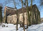 Church in Löwenberg
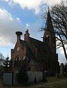 Church in Glambeck
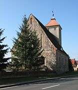 Church in Grieben
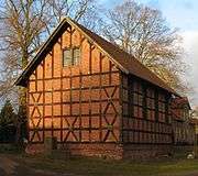 Church in Linde
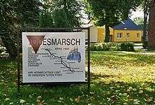 Sachsenhausen Todesmarsch (death march) route marker
 Church in Gutengermendorf
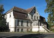 Building in Löwenberg
 Former tavern in Gutengermendorf
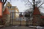 Liebenberg Castle
 Alcove house in Liebenberg
 Former schoolhouse in Klevesche Häuser
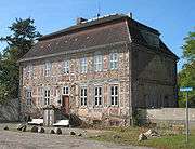 Manor
Manor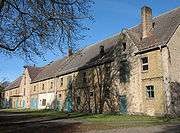 Estate
Demography
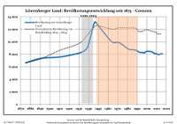 Development of Population since 1875 within the Current Boundaries (Blue Line: Population; Dotted Line: Comparison to Population Development of Brandenburg state; Grey background: Time of nazi rule -- Red background: Time of communist rule)
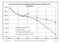 Recent Population Development (Blue Line) and Forecasts
| Löwenberger Land: Population development within the current boundaries (2013)[2] | ||||||||||||||||||||||||||||||||||||||||||||||||||||||||||||||||||||||||||||||||||||||||||||||||||||||||||||||||||||||||||||||||||||||
|---|---|---|---|---|---|---|---|---|---|---|---|---|---|---|---|---|---|---|---|---|---|---|---|---|---|---|---|---|---|---|---|---|---|---|---|---|---|---|---|---|---|---|---|---|---|---|---|---|---|---|---|---|---|---|---|---|---|---|---|---|---|---|---|---|---|---|---|---|---|---|---|---|---|---|---|---|---|---|---|---|---|---|---|---|---|---|---|---|---|---|---|---|---|---|---|---|---|---|---|---|---|---|---|---|---|---|---|---|---|---|---|---|---|---|---|---|---|---|---|---|---|---|---|---|---|---|---|---|---|---|---|---|---|---|
|
|
| ||||||||||||||||||||||||||||||||||||||||||||||||||||||||||||||||||||||||||||||||||||||||||||||||||||||||||||||||||||||||||||||||||||
References
- ↑ "Bevölkerung im Land Brandenburg nach amtsfreien Gemeinden, Ämtern und Gemeinden 31. Dezember 2017 (Fortgeschriebene amtliche Einwohnerzahlen auf Grundlage des Zensus 2011)". Amt für Statistik Berlin-Brandenburg (in German). 2018.
- ↑ Detailed data sources are to be found in the Wikimedia Commons.Population Projection Brandenburg at Wikimedia Commons
External links
| Wikimedia Commons has media related to Löwenberger Land. |
- Liebenberg Castle (in German)
Towns and municipalities in Oberhavel | ||
|---|---|---|