Kyll
| Kyll | |
|---|---|
 | |
| Country | Germany, Belgium |
| Physical characteristics | |
| Main source |
Hautes Fagnes ±600 m (2,000 ft) |
| River mouth |
Moselle 49°48′12″N 6°42′6″E / 49.80333°N 6.70167°ECoordinates: 49°48′12″N 6°42′6″E / 49.80333°N 6.70167°E |
| Length | 127.6 km (79.3 mi) [1] |
| Basin features | |
| Progression | Moselle→ Rhine→ North Sea |
| Basin size | 849 km2 (328 sq mi) [1] |
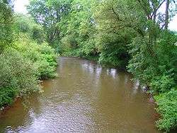
The Kyll (German pronunciation: [ˈkɪl]), noted by the Roman poet Ausonius as Celbis,[2] is a 128 km long river in western Germany (North Rhine-Westphalia and Rhineland-Palatinate), left tributary of the Moselle. It rises in the Eifel mountains, near the border with Belgium and flows generally south through the towns Stadtkyll, Gerolstein, Kyllburg and east of Bitburg. It flows into the Moselle in Ehrang, a suburb of Trier.
References
Tributaries of the river Moselle | ||
|---|---|---|
| From the left | ||
| From the right | ||
This article is issued from
Wikipedia.
The text is licensed under Creative Commons - Attribution - Sharealike.
Additional terms may apply for the media files.