Kyanika
| Kyanika | |
|---|---|
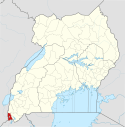
 Kyanika Map of Uganda showing the location of Kyanika | |
| Coordinates: 01°20′20″S 29°44′20″E / 1.33889°S 29.73889°E | |
| Elevation | 1,360 m (4,460 ft) |
| Time zone | UTC+3 (EAT) |
Kyanika is a settlement in Kisoro District in the Western Region of Uganda.
Location
Kyanika is in Kisoro District, Kigezi sub-region. The town is at Uganda's border with Rwanda and is only 11 kilometres (6.8 mi) southeast of Bunagana at Uganda's border with the Democratic Republic of the Congo.[1] It is approximately 485 kilometres (301 mi), by road, southwest of Kampala, Uganda's capital and largest city.[2] This is approximately 6.4 kilometres (4.0 mi), by road, south of Kisoro, the administrative center and the largest town in the district.[1] The coordinates of Kyanika, Uganda are 1°20'20.0"S, 29°44'20.0"E (Latitude:-1.338889; Longitude:29.738889).[3]
Overview
Immediately south of Kyanika, across the Rwandan border, is the town of Cyanika. The Kyanika-Cyanika border crossing is an important transit point between the countries the others being the Katuna-Gatuna and the Mirama Hills-Kagitumba border crossings.[4]
Points of interest
The following additional points of interest lie within the town limits or close to the edges of the town:
- offices of Kyanika Town Council
- Kyanika central market
- Kabale–Kisoro–Bunagana Road - The 6.3 kilometres (4 mi) southern spur of this road, from Kisoro to Kyanika, ends here.[5]
See also
References
- 1 2 UNRA (18 July 2015). "Kabale–Kisoro–Bunagana Road (100Km): Project Profile". Uganda National Roads Authority (UNRA). Retrieved 18 July 2015.
- ↑ GFC (18 July 2015). "Map Showing Kyanika And Kampala With Route Marker". Globefeed.com (GFC). Retrieved 18 July 2015.
- ↑ Google (18 July 2015). "Location of Kyanika at Google Maps" (Map). Google Maps. Google. Retrieved 18 July 2015.
- ↑ Candia, Steven (22 May 2012). "Uganda, Rwanda tighten border security". New Vision. Kampala. Retrieved 25 July 2015.
- ↑ Muhumuza, Robert (26 July 2013). "New Kabale-Kisoro road spurs growth". Daily Monitor. Kampala. Retrieved 25 July 2015.
External links
Capital: Kisoro | ||
| Parishes |
|  |
| Towns and villages | ||
| Economy | ||
| Transport | ||
| Notable landmarks | ||
| Health | ||
| Education |
| |
| Notable people | ||