Kuujjuarapik Airport
| Kuujjuarapik Airport | |||||||||||
|---|---|---|---|---|---|---|---|---|---|---|---|
 | |||||||||||
| Summary | |||||||||||
| Airport type | Public | ||||||||||
| Operator | Administration régionale Kativik | ||||||||||
| Serves | Kuujjuarapik, Whapmagoostui | ||||||||||
| Location | Kuujjuarapik | ||||||||||
| Time zone | EST (UTC−05:00) | ||||||||||
| • Summer (DST) | EDT (UTC−04:00) | ||||||||||
| Elevation AMSL | 40 ft / 12 m | ||||||||||
| Coordinates | 55°16′55″N 077°45′55″W / 55.28194°N 77.76528°WCoordinates: 55°16′55″N 077°45′55″W / 55.28194°N 77.76528°W | ||||||||||
| Map | |||||||||||
 CYGW Location in Quebec | |||||||||||
| Runways | |||||||||||
| |||||||||||
| Statistics (2010) | |||||||||||
| |||||||||||
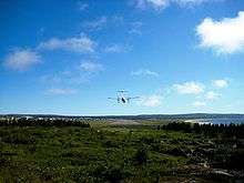
Kuujjuarapik Airport, (IATA: YGW, ICAO: CYGW), is located adjacent to the Inuit community of Kuujjuarapik, Quebec, Canada. It also serves the nearby Cree community of Whapmagoostui.
Airlines and destinations
| Airlines | Destinations |
|---|---|
| Air Creebec | Chisasibi, Eastmain, Montreal-Trudeau, Waskaganish, Wemindji |
| Air Inuit | Akulivik, Inukjuak, Ivujivik, Kuujjuaq, Montreal-Trudeau, La Grande, Puvirnituq, Salluit, Sanikiluaq, Umiujaq |
References
- ↑ Canada Flight Supplement. Effective 0901Z 19 July 2018 to 0901Z 13 September 2018.
- ↑ Total aircraft movements by class of operation
External links
- Past three hours METARs, SPECI and current TAFs for Kuujjuarapik Airport from Nav Canada as available.
| By name | |
|---|---|
| By location indicator | |
| By province/territory | |
| By area | |
| National Airports System | |
| Related | |
| |
This article is issued from
Wikipedia.
The text is licensed under Creative Commons - Attribution - Sharealike.
Additional terms may apply for the media files.