Kugluktuk Airport
| Kugluktuk Airport | |||||||||||
|---|---|---|---|---|---|---|---|---|---|---|---|
 | |||||||||||
| Summary | |||||||||||
| Airport type | Public | ||||||||||
| Operator | Government of Nunavut | ||||||||||
| Location | Kugluktuk, Nunavut | ||||||||||
| Time zone | MST (UTC−07:00) | ||||||||||
| • Summer (DST) | MDT (UTC−06:00) | ||||||||||
| Elevation AMSL | 74 ft / 23 m | ||||||||||
| Coordinates | 67°49′00″N 115°08′38″W / 67.81667°N 115.14389°WCoordinates: 67°49′00″N 115°08′38″W / 67.81667°N 115.14389°W | ||||||||||
| Map | |||||||||||
 CYCO Location in Nunavut | |||||||||||
| Runways | |||||||||||
| |||||||||||
| Statistics (2010) | |||||||||||
| |||||||||||
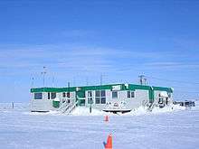
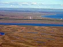
Kugluktuk Airport (IATA: YCO, ICAO: CYCO) is located at Kugluktuk, Nunavut, Canada, and is operated by the Government of Nunavut.
Airlines and destinations
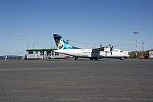
Regular scheduled flights daily by First Air
| Airlines | Destinations |
|---|---|
| Canadian North | Cambridge Bay, Gjoa Haven, Taloyoak, Yellowknife[4] |
| First Air | Cambridge Bay, Ulukhaktok, Yellowknife[5] |
Cargo
| Airlines | Destinations |
|---|---|
| Buffalo Airways | Yellowknife |
References
- ↑ Canada Flight Supplement. Effective 0901Z 19 July 2018 to 0901Z 13 September 2018.
- ↑ Synoptic/Metstat Station Information Archived 2013-06-28 at the Wayback Machine.
- ↑ Total aircraft movements by class of operation
- ↑ Flight Schedule and Route Map Archived 2011-07-08 at the Wayback Machine..
- ↑ First Air Flight Schedule
GPS Approach Runway 30 True
External links
- Past three hours METARs, SPECI and current TAFs for Kugluktuk Airport from Nav Canada as available.
| By name | |
|---|---|
| By location indicator | |
| By province/territory | |
| By area | |
| National Airports System | |
| Related | |
| |
This article is issued from
Wikipedia.
The text is licensed under Creative Commons - Attribution - Sharealike.
Additional terms may apply for the media files.