Kremenchuk Reservoir
| Kremenchuk Reservoir | |
|---|---|
 | |
| Location | Poltava, Cherkasy, and Kirovohrad Oblasts, Ukraine |
| Coordinates | 49°16′N 32°38′E / 49.267°N 32.633°ECoordinates: 49°16′N 32°38′E / 49.267°N 32.633°E |
| Type | Hydroelectric reservoir |
| Primary inflows | Dnieper River |
| Primary outflows | Dnieper River |
| Basin countries | Russia, Belarus, Ukraine |
| Max. length | 149 km (93 mi) |
| Max. width | 28 km (17 mi) |
| Surface area | 2,250 km2 (870 sq mi) |
| Water volume | 13.5 km3 (10,900,000 acre⋅ft) |
| Surface elevation | 77 m (253 ft) |
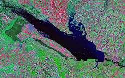
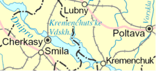
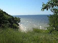
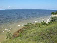
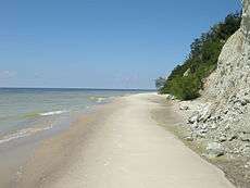
The Kremenchuk Reservoir (Ukrainian: Кременчуцьке водосховище, Kremenchuts’ke Vodoskhovyshche) is the largest water reservoir located on the Dnieper River. Named for the city of Kremenchuk, it covers a total area of 2,250 square kilometres in the territories of the Poltava, Cherkasy, and Kirovohrad Oblasts in central Ukraine.
The reservoir is 149 km long, 28 km wide, and has an average depth of six meters. The total water volume is 13.5 km³. It is mainly used for irrigation, flood control, fishing, and transport within the area. The main ports located on the reservoir are Cherkasy, and Svitlovodsk (originally Khrushchev). The Sula River flows into the reservoir, forming a delta with numerous islands.
The reservoir was created in 1959 when the Kremenchuk Hydroelectric Power Plant was built. The body of water flooded the whole Novoheorhivsk Raion with 23 populated places ending up submerged including such historical places like Kryliv, Novoheorhivsk and others.[1]
See also
References
- ↑ Orel, S. Kremenchuk Sea of Ukrainian tragedy (Кременчугское море украинского горя). Argument (from Mirror Weekly). 28 January 2018
External links
| Tributaries1 | 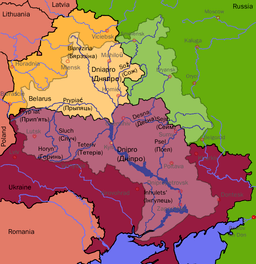 | |
|---|---|---|
| Reservoirs | ||
| Hydroelectric stations | ||
| Canals |
| |
| Cities | ||
| Crossings | ||
| ||