Kaniv Reservoir
| Kaniv Reservoir | |
|---|---|
 | |
| Location | Kaniv (to the south), Cherkasy and Kiev Oblasts, Ukraine |
| Coordinates | 49°55′34″N 31°28′46″E / 49.92611°N 31.47944°ECoordinates: 49°55′34″N 31°28′46″E / 49.92611°N 31.47944°E |
| Type | Hydroelectric reservoir |
| Primary inflows | Dnieper River |
| Primary outflows | Dnieper River |
| Basin countries | Russia, Belarus, Ukraine |
| Max. length | 162 km (101 mi) |
| Max. width | 5 km (3.1 mi) |
| Surface area | 675 km2 (261 sq mi) |
| Average depth | 5.5 m (18 ft) |
| Water volume | 2.6 km3 (2,100,000 acre⋅ft) |
| Surface elevation | 87 m (285 ft) |
The Kaniv Reservoir (Ukrainian: Канівське водосховище, Kanivs'ke vodoskhovyshche) is a water reservoir located on the Dnieper River in Ukraine. Named after the city of Kaniv, it covers a total area of 675 square kilometres within the Cherkasy and Kiev Oblasts.[1] It was created in 1972 following construction of the dams of the Kaniv Hydroelectric Power Plant on the Dnieper River.
The reservoir is 162 km long, up to 5 km wide, and has an average depth of 5.5 meters. The total water volume is 2.6 km³.[1]
References
- 1 2 "Kaniv Reservoir". Encyclopedia of Ukraine. Retrieved 2008-01-24.
| Tributaries1 | 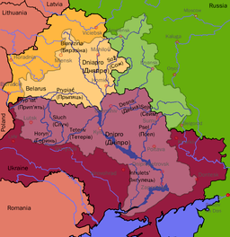 | |
|---|---|---|
| Reservoirs | ||
| Hydroelectric stations | ||
| Canals |
| |
| Cities | ||
| Crossings | ||
| ||
This article is issued from
Wikipedia.
The text is licensed under Creative Commons - Attribution - Sharealike.
Additional terms may apply for the media files.