Krāslava
| Krāslava | ||
|---|---|---|
| Town | ||
.jpg) Krāslava town centre | ||
| ||
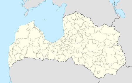 Krāslava Location in Latvia | ||
| Coordinates: 55°53′N 27°10′E / 55.883°N 27.167°ECoordinates: 55°53′N 27°10′E / 55.883°N 27.167°E | ||
| Country |
| |
| Municipality | Krāslava Municipality | |
| Town rights | 1923 | |
| Area | ||
| • Total | 8.6 km2 (3.3 sq mi) | |
| Population (2015) | ||
| • Total | 8,300[1] | |
| • Density | 965/km2 (2,500/sq mi) | |
| Time zone | UTC+2 (EET) | |
| • Summer (DST) | UTC+3 (EEST) | |
| Postal code | LV-560(1–3) | |
| Calling code | +371 656 | |
Krāslava (![]()
History
- Krāslava was an important hillfort on the waterway from the Varangians to the Byzantine Empire since early Middle Ages, part of the orthodox Principality of Jersika in the 13th century.
- In 1558 was mentioned for the first time in written sources of Livonian Order as Kreslau (in German).
- In 1676 the church was built by Jesuit Order and Krāslava became the most northern located center of the Jesuit movement on the border with the areas dominated by Protestant and Orthodox churches.
- In 1729 Count Ludvig Plater bought Krāslava. For nearly two centuries the Plater family determined Kraslava economical and cultural life.
- Craftmen from Poland and Germany in co-operation with local people organized the production of carpets, velvet, silk and cotton material, weapons, jewellery and other goods. The goods were in demand at the four Kraslava fairs and also exported to Courland, Poland and Germany.
- Between 1757 and 1842 Krāslava was home for a Roman Catholic seminary, one of the first educational institutions in Latgale region.
Prominent residents
- writer Kazimierz Bujnicki
- Sculptor Naoum Aronson (1872-1943)
- Signatorie to the Act of Independence of Lithuania Donatas Malinauskas
- Philosopher Nikolai Lossky
- Writer and philosopher Konstantin Raudive
- Monsignor Konstantin Budkevich – Roman Catholic priest executed in the Lubyanka Prison on Easter Sunday 1923.
- athlete Ineta Radēviča
- athlete Valentīna Gotovska
- Basketball player Jānis Timma
- Opera Singer and Professor Katrina Krumpane
- Siarhiej Sacharaŭ (1880-1954), Belarusian folklorist, ethnographer, pedagogue.
- Mocieĺ Blinčykaŭ (1896-1935), leader of the revolutionary movement in Western Belarus.
Gallery
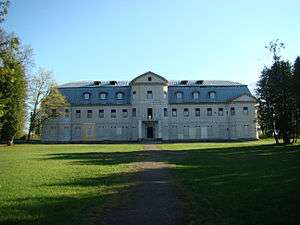 Krāslava Palace (under restoration)
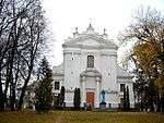 Krāslava Catholic Church
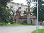
See also
References
External links

- Krāslava Municipality website
This article is issued from
Wikipedia.
The text is licensed under Creative Commons - Attribution - Sharealike.
Additional terms may apply for the media files.