Staicele
| Staicele | |||
|---|---|---|---|
| Town | |||
 Street in the Staicele | |||
| |||
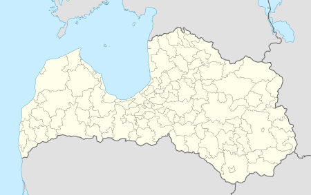 Staicele Location in Latvia | |||
| Coordinates: 57°50′N 24°44′E / 57.833°N 24.733°ECoordinates: 57°50′N 24°44′E / 57.833°N 24.733°E | |||
| Country |
| ||
| District | Aloja Municipality | ||
| Town rights | 1992 | ||
| Area | |||
| • Total | 258.23 km2 (99.70 sq mi) | ||
| Population | |||
| • Total | 1,192 | ||
| • Density | 9/km2 (20/sq mi) | ||
| Time zone | UTC+2 (EET) | ||
| • Summer (DST) | UTC+3 (EEST) | ||
| Postal code | LV-4043 | ||
| Calling code | +371 640 | ||


Staicele (![]()
The area of Staicele has been inhabited only since the 19th century when a tavern and ferryman's house on the banks of Salaca river are mentioned. In 1887 the owners of Rozēni and Ungura manors built a bridge over Salaca in that place. In 1897 a paper mill was built and a larger settlament started to grow around it. In 1913 a narrow gauge railway line was built to the factory.
After the First World War Staicele became the centre of the Rozēni parish. It received village status in 1925.
In Latvian SSR Staicele became an Urban-type settlement in 1950. It received town rights in 1992 and since 2009 Staicele town is part of the Aloja Municipality.
See also
This article is issued from
Wikipedia.
The text is licensed under Creative Commons - Attribution - Sharealike.
Additional terms may apply for the media files.