Kotovo, Volgograd Oblast
| Kotovo Котово (Russian) | |
|---|---|
| - Town[1] - | |
.svg.png) Location of Volgograd Oblast in Russia | |
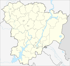 Kotovo | |
_(1994).png) |
.png) |
Coat of arms |
Flag |
| Administrative status (as of 2012) | |
| Country | Russia |
| Federal subject | Volgograd Oblast[1] |
| Administrative district | Kotovsky District[1] |
| Town of district significance | Kotovo[2] |
| Administrative center of | Kotovsky District,[1] town of district significance of Kotovo[2] |
| Municipal status (as of December 2004) | |
| Municipal district | Kotovsky Municipal District[3] |
| Urban settlement | Kotovo Urban Settlement[3] |
| Administrative center of | Kotovsky Municipal District,[3] Kotovo Urban Settlement[3] |
| Statistics | |
| Population (2010 Census) | 24,115 inhabitants[4] |
| Time zone | MSK (UTC+03:00)[5] |
| Founded | 1710s |
| Town status since | 1966 |
| Kotovo on Wikimedia Commons | |
Kotovo (Russian: Ко́тово) is a town and the administrative center of Kotovsky District in Volgograd Oblast, Russia, located on the Kazanka River (Don's tributary), 229 kilometers (142 mi) north of Volgograd, the administrative center of the oblast. Population: 24,115 (2010 Census);[4] 26,763 (2002 Census);[6] 25,360 (1989 Census).[7]
History
It was founded in the 1710s and was granted town status in 1966.
Administrative and municipal status
Within the framework of administrative divisions, Kotovo serves as the administrative center of Kotovsky District.[1] As an administrative division, it is incorporated within Kotovsky District as the town of district significance of Kotovo.[2] As a municipal division, the town of district significance of Kotovo is incorporated within Kotovsky Municipal District as Kotovo Urban Settlement.[3]
References
Notes
- 1 2 3 4 5 Государственный комитет Российской Федерации по статистике. Комитет Российской Федерации по стандартизации, метрологии и сертификации. №ОК 019-95 1 января 1997 г. «Общероссийский классификатор объектов административно-территориального деления. Код 18 226», в ред. изменения №278/2015 от 1 января 2016 г.. (State Statistics Committee of the Russian Federation. Committee of the Russian Federation on Standardization, Metrology, and Certification. #OK 019-95 January 1, 1997 Russian Classification of Objects of Administrative Division . Code 18 226, as amended by the Amendment #278/2015 of January 1, 2016. ).
- 1 2 3 Государственный комитет Российской Федерации по статистике. Комитет Российской Федерации по стандартизации, метрологии и сертификации. №ОК 019-95 1 января 1997 г. «Общероссийский классификатор объектов административно-территориального деления. Код 18 226 501», в ред. изменения №278/2015 от 1 января 2016 г.. (State Statistics Committee of the Russian Federation. Committee of the Russian Federation on Standardization, Metrology, and Certification. #OK 019-95 January 1, 1997 Russian Classification of Objects of Administrative Division . Code 18 226 501, as amended by the Amendment #278/2015 of January 1, 2016. ).
- 1 2 3 4 5 Law #974-OD
- 1 2 Russian Federal State Statistics Service (2011). "Всероссийская перепись населения 2010 года. Том 1" [2010 All-Russian Population Census, vol. 1]. Всероссийская перепись населения 2010 года (2010 All-Russia Population Census) (in Russian). Federal State Statistics Service. Retrieved June 29, 2012.
- ↑ Правительство Российской Федерации. Федеральный закон №107-ФЗ от 3 июня 2011 г. «Об исчислении времени», в ред. Федерального закона №271-ФЗ от 03 июля 2016 г. «О внесении изменений в Федеральный закон "Об исчислении времени"». Вступил в силу по истечении шестидесяти дней после дня официального опубликования (6 августа 2011 г.). Опубликован: "Российская газета", №120, 6 июня 2011 г. (Government of the Russian Federation. Federal Law #107-FZ of June 31, 2011 On Calculating Time, as amended by the Federal Law #271-FZ of July 03, 2016 On Amending Federal Law "On Calculating Time". Effective as of after sixty days following the day of the official publication.).
- ↑ Russian Federal State Statistics Service (May 21, 2004). "Численность населения России, субъектов Российской Федерации в составе федеральных округов, районов, городских поселений, сельских населённых пунктов – районных центров и сельских населённых пунктов с населением 3 тысячи и более человек" [Population of Russia, Its Federal Districts, Federal Subjects, Districts, Urban Localities, Rural Localities—Administrative Centers, and Rural Localities with Population of Over 3,000] (XLS). Всероссийская перепись населения 2002 года [All-Russia Population Census of 2002] (in Russian). Retrieved August 9, 2014.
- ↑ Demoscope Weekly (1989). "Всесоюзная перепись населения 1989 г. Численность наличного населения союзных и автономных республик, автономных областей и округов, краёв, областей, районов, городских поселений и сёл-райцентров" [All Union Population Census of 1989: Present Population of Union and Autonomous Republics, Autonomous Oblasts and Okrugs, Krais, Oblasts, Districts, Urban Settlements, and Villages Serving as District Administrative Centers]. Всесоюзная перепись населения 1989 года [All-Union Population Census of 1989] (in Russian). Институт демографии Национального исследовательского университета: Высшая школа экономики [Institute of Demography at the National Research University: Higher School of Economics]. Retrieved August 9, 2014.
Sources
- Волгоградская областная Дума. Закон №974-ОД от 22 декабря 2004 г. «Об установлении границ и наделении статусом Котовского района и муниципальных образований в его составе». Вступил в силу со дня официального опубликования. Опубликован: "Волгоградская правда", №2, 11 января 2005 г. (Volgograd Oblast Duma. Law #974-OD of December 22, 2004 On Establishing the Borders and Granting the Status to Kotovsky District and the Municipal Formations Comprising It. Effective as of the day of the official publication.).
| Administrative districts |
| ||
|---|---|---|---|
| Cities and towns | |||
| Urban-type settlements |
| ||