Kotelnikovsky District
| Kotelnikovsky District Котельниковский район (Russian) | |
|---|---|
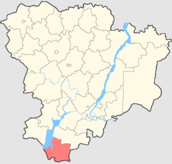 Location of Kotelnikovsky District in Volgograd Oblast | |
| Coordinates: 47°38′N 43°08′E / 47.633°N 43.133°ECoordinates: 47°38′N 43°08′E / 47.633°N 43.133°E | |
.png) |
.png) |
|
| |
| Location | |
| Country | Russia |
| Federal subject | Volgograd Oblast[1] |
| Administrative structure (as of 2011) | |
| Administrative center | town of Kotelnikovo[2] |
| Administrative divisions: | |
| Towns of district significance | 1 |
| Selsoviets | 15 |
| Inhabited localities: | |
| Cities/towns | 1 |
| Rural localities | 33 |
| Municipal structure (as of March 2005) | |
| Municipally incorporated as | Kotelnikovsky Municipal District[3] |
| Municipal divisions:[3] | |
| Urban settlements | 1 |
| Rural settlements | 15 |
| Statistics | |
| Area | 3,471 km2 (1,340 sq mi)[4] |
| Population (2010 Census) | 37,584 inhabitants[5] |
| • Urban | 54.4% |
| • Rural | 45.6% |
| Density | 10.83/km2 (28.0/sq mi)[6] |
| Time zone | MSK (UTC+03:00)[7] |
| Official website | |
| Kotelnikovsky District on WikiCommons | |
Kotelnikovsky District (Russian: Коте́льниковский райо́н) is an administrative[1] district (raion), one of the thirty-three in Volgograd Oblast, Russia. As a municipal division, it is incorporated as Kotelnikovsky Municipal District.[3] It is located in the south of the oblast. The area of the district is 3,471 square kilometers (1,340 sq mi).[4] Its administrative center is the town of Kotelnikovo.[2] Population: 37,584 (2010 Census);[5] 36,856 (2002 Census);[8] 38,660 (1989 Census).[9] The population of Kotelnikovo accounts for 54.4% of the district's total population.[5]
References
Notes
- 1 2 Law #139-OD
- 1 2 Государственный комитет Российской Федерации по статистике. Комитет Российской Федерации по стандартизации, метрологии и сертификации. №ОК 019-95 1 января 1997 г. «Общероссийский классификатор объектов административно-территориального деления. Код 18 224», в ред. изменения №278/2015 от 1 января 2016 г.. (State Statistics Committee of the Russian Federation. Committee of the Russian Federation on Standardization, Metrology, and Certification. #OK 019-95 January 1, 1997 Russian Classification of Objects of Administrative Division . Code 18 224, as amended by the Amendment #278/2015 of January 1, 2016. ).
- 1 2 3 Law #1028-OD
- 1 2 "General Information" (in Russian). Kotelnikovsky District. Retrieved May 15, 2018.
- 1 2 3 Russian Federal State Statistics Service (2011). "Всероссийская перепись населения 2010 года. Том 1" [2010 All-Russian Population Census, vol. 1]. Всероссийская перепись населения 2010 года (2010 All-Russia Population Census) (in Russian). Federal State Statistics Service. Retrieved June 29, 2012.
- ↑ The value of density was calculated automatically by dividing the 2010 Census population by the area specified in the infobox. Please note that this value is only approximate as the area specified in the infobox does not necessarily correspond to the area of the entity proper or is reported for the same year as the population.
- ↑ Правительство Российской Федерации. Федеральный закон №107-ФЗ от 3 июня 2011 г. «Об исчислении времени», в ред. Федерального закона №271-ФЗ от 03 июля 2016 г. «О внесении изменений в Федеральный закон "Об исчислении времени"». Вступил в силу по истечении шестидесяти дней после дня официального опубликования (6 августа 2011 г.). Опубликован: "Российская газета", №120, 6 июня 2011 г. (Government of the Russian Federation. Federal Law #107-FZ of June 31, 2011 On Calculating Time, as amended by the Federal Law #271-FZ of July 03, 2016 On Amending Federal Law "On Calculating Time". Effective as of after sixty days following the day of the official publication.).
- ↑ Russian Federal State Statistics Service (May 21, 2004). "Численность населения России, субъектов Российской Федерации в составе федеральных округов, районов, городских поселений, сельских населённых пунктов – районных центров и сельских населённых пунктов с населением 3 тысячи и более человек" [Population of Russia, Its Federal Districts, Federal Subjects, Districts, Urban Localities, Rural Localities—Administrative Centers, and Rural Localities with Population of Over 3,000] (XLS). Всероссийская перепись населения 2002 года [All-Russia Population Census of 2002] (in Russian). Retrieved August 9, 2014.
- ↑ Demoscope Weekly (1989). "Всесоюзная перепись населения 1989 г. Численность наличного населения союзных и автономных республик, автономных областей и округов, краёв, областей, районов, городских поселений и сёл-райцентров" [All Union Population Census of 1989: Present Population of Union and Autonomous Republics, Autonomous Oblasts and Okrugs, Krais, Oblasts, Districts, Urban Settlements, and Villages Serving as District Administrative Centers]. Всесоюзная перепись населения 1989 года [All-Union Population Census of 1989] (in Russian). Институт демографии Национального исследовательского университета: Высшая школа экономики [Institute of Demography at the National Research University: Higher School of Economics]. Retrieved August 9, 2014.
Sources
- Волгоградская областная Дума. Закон №139-ОД от 7 октября 1997 г. «Об административно-территориальном устройстве Волгоградской области», в ред. Закона №107-ОД от 10 июля 2015 г. «О внесении изменений в отдельные законодательные акты Волгоградской области в связи с приведением их в соответствие с Уставом Волгоградской области». Вступил в силу со дня официального опубликования. Опубликован: "Волгоградская правда", №207, 1 ноября 1997 г. (Volgograd Oblast Duma. Law #139-OD of October 7, 1997 On the Administrative-Territorial Structure of Volgograd Oblast, as amended by the Law #107-OD of July 10, 2015 On Amending Various Legislative Acts of Volgograd Oblast to Ensure Compliance with the Charter of Volgograd Oblast. Effective as of the day of the official publication.).
- Волгоградская областная Дума. Закон №1028-ОД от 14 марта 2005 г. «Об установлении границ и наделении статусом Котельниковского района и муниципальных образований в его составе». Вступил в силу со дня официального опубликования. Опубликован: "Волгоградская правда", №50, 23 марта 2005 г. (Volgograd Oblast Duma. Law #1028-OD of March 14, 2005 On Establishing the Borders and Granting the Status to Kotelnikovsky District and the Municipal Formations Comprising It. Effective as of the day of the official publication.).
| Administrative districts |
| ||
|---|---|---|---|
| Cities and towns | |||
| Urban-type settlements |
| ||
This article is issued from
Wikipedia.
The text is licensed under Creative Commons - Attribution - Sharealike.
Additional terms may apply for the media files.