Kohabara
| Kohabara कोहवरा | |
|---|---|
| Village development committee | |
 Kohabara Location in Nepal | |
| Coordinates: 26°31′N 87°40′E / 26.51°N 87.66°ECoordinates: 26°31′N 87°40′E / 26.51°N 87.66°E | |
| Country |
|
| Zone | Mechi Zone |
| District | Jhapa District |
| Population (2011[1]) | |
| • Total | 10,326 |
| • Major Ethnicities | Brahmin and Chhetri |
| Time zone | UTC+5:45 (Nepal Time) |
| Area code(s) | 023 |
Kohabara [2] is a village development committee in Jhapa District in the Mechi Zone of south-eastern Nepal. RamChandre Khola,a stream, separates it from Khajurgachhi VDC.
Population
Major ethnicities includes Brahmin and Chhetri and Nepali is a major language spoken by the people here. At the time of the 2011 Nepal census it had a population of 10,326 people.[1][3] Baniyatol is one of the village in this VDC which is quite developed in comparison to other villages here.[4]
References
- 1 2 National Population and Housing Census 2011 Archived 2013-09-27 at the Wayback Machine., p. 6
- ↑ Central Bureau of Statistics of Nepal: Major Highlights. Archived 2013-07-17 at the Wayback Machine.
- ↑ "Nepal Census 2001". Nepal's Village Development Committees. Digital Himalaya. Archived from the original on 12 October 2008. Retrieved 24 November 2008.
- ↑ Baniyatol
Headquarter: Damak | ||
| Rural Municipalities | 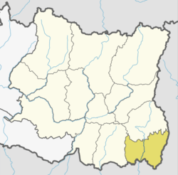 | |
| Municipalities | ||
This article is issued from
Wikipedia.
The text is licensed under Creative Commons - Attribution - Sharealike.
Additional terms may apply for the media files.